- Eagle, Michigan
Infobox Settlement
official_name = Eagle, Michigan
settlement_type = Village
nickname =
motto =
imagesize =
image_caption =
image_
imagesize =
image_caption =
image_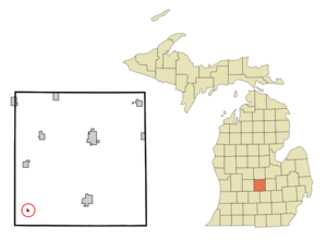
mapsize = 250px
map_caption = Location of Eagle, Michigan
mapsize1 =
map_caption1 =subdivision_type = Country
subdivision_name =United States
subdivision_type1 = State
subdivision_name1 =Michigan
subdivision_type2 = County
subdivision_name2 = Clintongovernment_footnotes =
government_type =
leader_title =
leader_name =
leader_title1 =
leader_name1 =
established_title =
established_date =area_footnotes =
area_magnitude =
area_total_km2 = 0.3
area_land_km2 = 0.3
area_water_km2 = 0.0
area_total_sq_mi = 0.1
area_land_sq_mi = 0.1
area_water_sq_mi = 0.0population_as_of = 2000
population_footnotes =
population_total = 130
population_density_km2 = 409.7
population_density_sq_mi = 1061.2timezone = Eastern (EST)
utc_offset = -5
timezone_DST = EDT
utc_offset_DST = -4
elevation_footnotes =
elevation_m = 254
elevation_ft = 833
latd = 42 |latm = 48 |lats = 32 |latNS = N
longd = 84 |longm = 47 |longs = 26 |longEW = Wpostal_code_type =
ZIP code
postal_code = 48822
area_code = 517
blank_name = FIPS code
blank_info = 26-23560GR|2
blank1_name = GNIS feature ID
blank1_info = 0625069GR|3
website =
footnotes =Eagle is a village in Clinton County in the
U.S. state ofMichigan . The population was 130 at the 2000 census.The village is within Eagle Township in the southwest corner of the county. It is near
Interstate 96 about 15 miles northwest of Lansing.Geography
According to the
United States Census Bureau , the village has a total area of 0.1square mile s (0.3km² ), all land.Demographics
As of the
census GR|2 of 2000, there were 130 people, 46 households, and 35 families residing in the village. Thepopulation density was 1,061.2 per square mile (418.3/km²). There were 47 housing units at an average density of 383.7/sq mi (151.2/km²). The racial makeup of the village was 99.23% White, 0.77% from other races. Hispanic or Latino of any race were 3.85% of the population.There were 46 households out of which 37.0% had children under the age of 18 living with them, 71.7% were married couples living together, and 23.9% were non-families. 15.2% of all households were made up of individuals and 8.7% had someone living alone who was 65 years of age or older. The average household size was 2.83 and the average family size was 3.26.
In the village the population was spread out with 29.2% under the age of 18, 3.1% from 18 to 24, 33.8% from 25 to 44, 22.3% from 45 to 64, and 11.5% who were 65 years of age or older. The median age was 38 years. For every 100 females there were 109.7 males. For every 100 females age 18 and over, there were 114.0 males.
The median income for a household in the village was $41,667, and the median income for a family was $45,625. Males had a median income of $41,667 versus $28,750 for females. The
per capita income for the village was $19,332. There were no families and 2.0% of the population living below thepoverty line , including no under eighteens and none of those over 64.References
External links
* [http://www.gdledgehistsoc.org/history-eagle.html Eagle Area History]
Wikimedia Foundation. 2010.