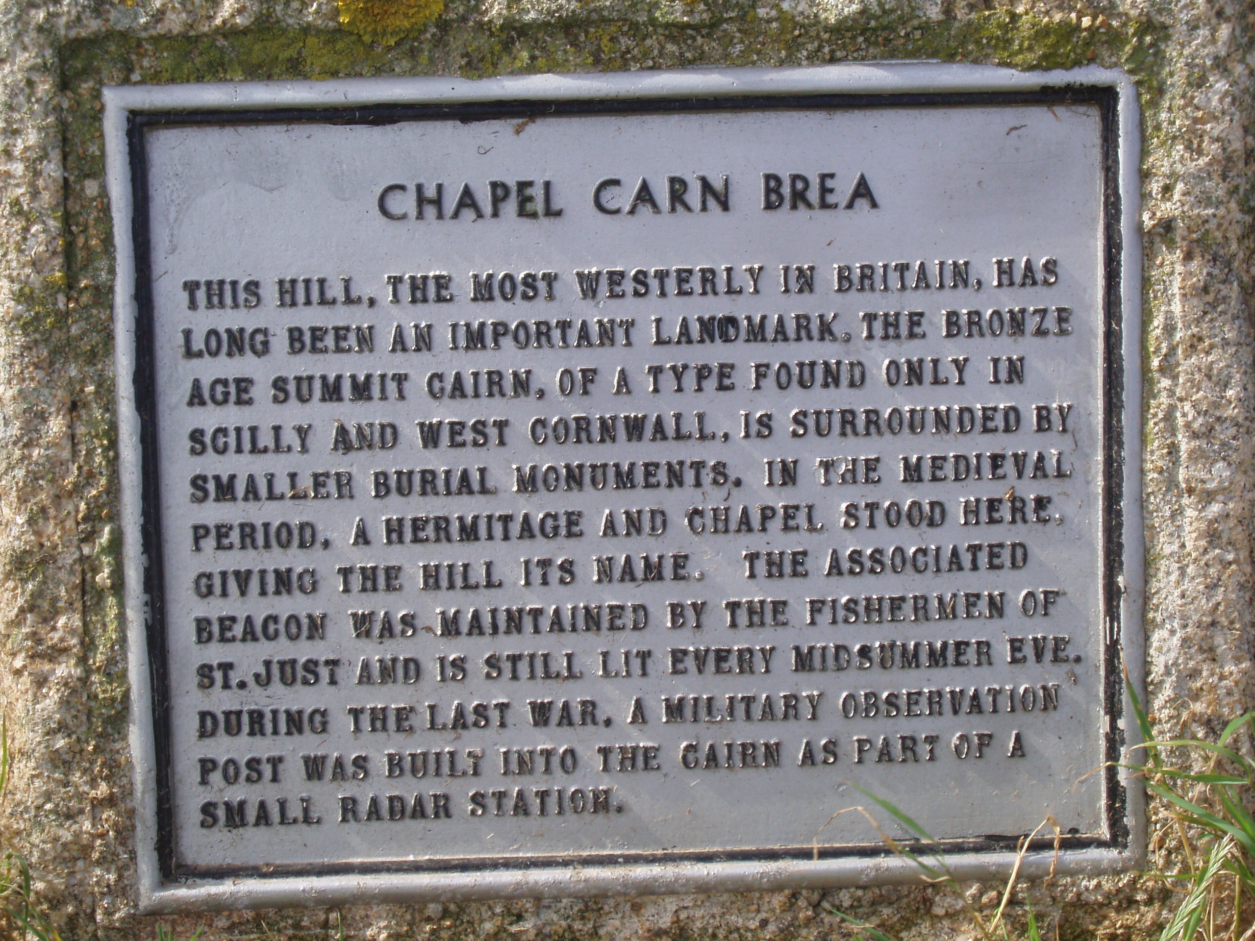
Chapel Carn Brea

Chapel Carn Brea

Coordinates: 50°05′38″N 5°39′25″W / 50.094°N 5.657°W / 50.094; -5.657

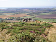
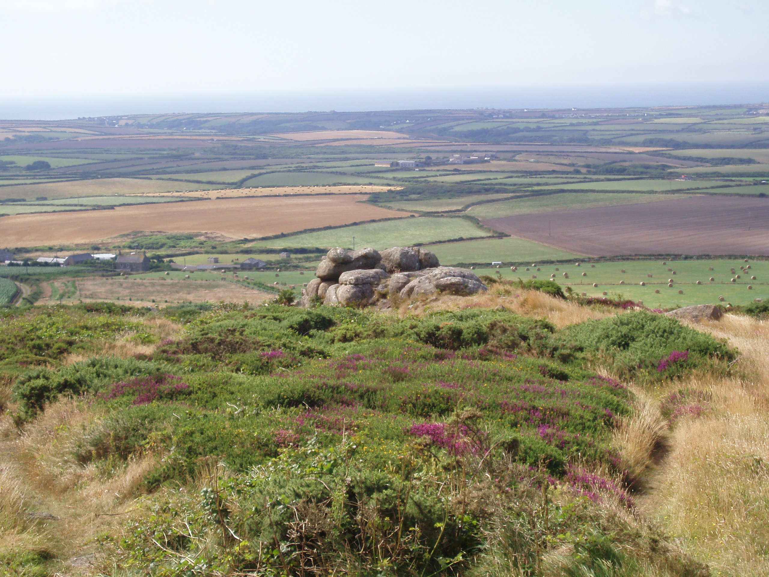
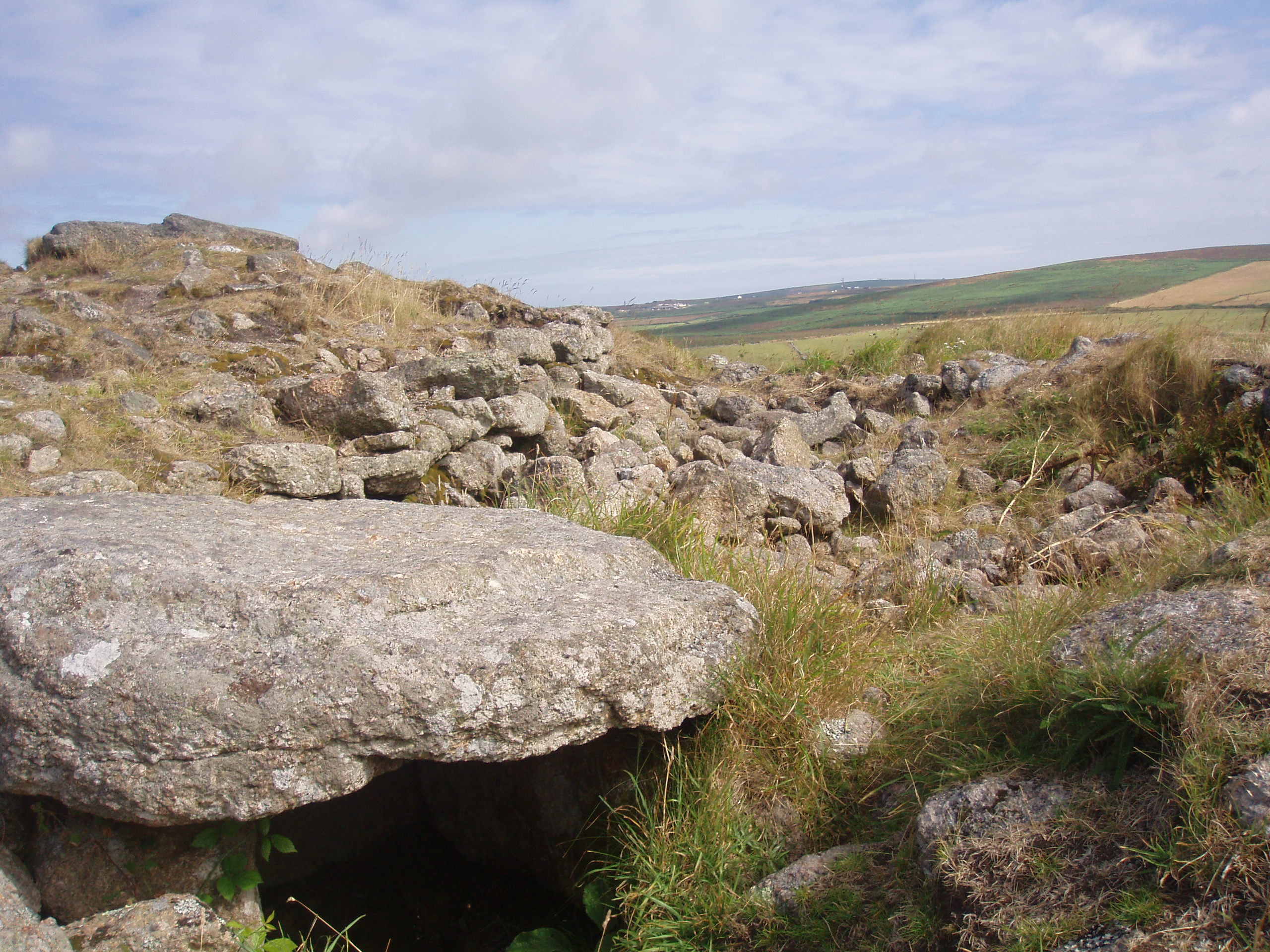
Chapel Carn Brea is an elevated granite outcrop at the northern edge of the civil parish of St Buryan, Cornwall, United Kingdom. It is three miles (5 km) south of St Just and two miles (3.5 km) east of Sennen Cove. It should not be confused with Carn Brea hill overlooking the Camborne-Redruth area

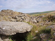
Chapel Carn Brea is often described as the first hill in Cornwall (from a westerly perspective) and rises 657 feet/200 Metres above sea level. The hill is an important historical site showing evidence of neolithic activity, as well as the remains of the chapel from which it is named.

Plaque at Chapel Carn Brea, the highest point in St Buryan parish
View from Chapel Carn Brea towards St Levan
Neolithic remains at the summit of Chapel Carn brea

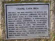
During the second world war the summit housed a Royal Air Force radar, a plaque is dedicated at the bottom of the hill near the carpark to those that served there.

References


Wikimedia Foundation. 2010.

Игры ⚽ Поможем решить контрольную работу

Look at other dictionaries:

  • Carn Brea — ( kw. Karnbre) is a civil parish and hilltop site near Redruth in Cornwall, England, UK, famous for its long history of human occupation. Neolithic settlement The earliest Neolithic settlement at Carn Brea was a tor enclosure occupied between… …   Wikipedia

  • Carn Euny — is an archaeological site near Sancreed, on the Penwith peninsula in Cornwall, United Kingdom with considerable evidence of both Iron Age and post Iron Age settlement. Excavations on this site have shown that there was activity at Carn Euny as… …   Wikipedia

  • St Buryan — infobox UK place country = England latitude= 50.075 longitude= 5.620833 official name= St Buryan cornish name= Eglosborrie population = 1,215 (2001 Census) shire district= Penwith region= South West England shire county= Cornwall constituency… …   Wikipedia

  • Eglosborrie — 50.075 5.62083333333337Koordinaten: 50° 5′ N, 5° 37′ W St Buryan …   Deutsch Wikipedia

  • St Buryan — 50.075 5.6208333333333 Koordinaten: 50° 5′ N, 5° 37′ W St Buryan …   Deutsch Wikipedia

  • Redruth — infobox UK place static static image caption= Redruth s Fore Street country = England map type= Cornwall official name= Redruth cornish name=Rysrudh latitude= 50.2330 longitude= 5.2248 civil parish= Redruth population = 12,352 (Census 2001) shire …   Wikipedia

  • List of places in Cornwall — This is a list of all the towns and villages of Cornwall, United Kingdom. This also includes places in the Isles of Scilly. See List of places in England for lists of settlements in other counties. Top 15 places by population Alphabetical list A… …   Wikipedia

  • John Harris (poet) — John Harris (1820 1884) was a Cornish poet.Harris was born and raised in a two bedroom cottage on the slopes of Bolenowe Carn, a small Cornish village, near Camborne.At age twelve, he was sent to work at the Dolcoath mine, an immense maze… …   Wikipedia

  • Civil parishes in Cornwall — A map of Cornwall (Cornish: Kernow); the Isles of Scilly (Cornish: Enesek Syllan) are in the extreme bottom left. A civil parish is a subnational entity, forming the lowest unit of local government in Engla …   Wikipedia

  • United Kingdom — a kingdom in NW Europe, consisting of Great Britain and Northern Ireland: formerly comprising Great Britain and Ireland 1801 1922. 58,610,182; 94,242 sq. mi. (244,100 sq. km). Cap.: London. Abbr.: U.K. Official name, United Kingdom of Great… …   Universalium

Share the article and excerpts

Direct link
Do a right-click on the link above
and select “Copy Link”