- Kidwelly
-
Coordinates: 51°44′11″N 4°18′26″W / 51.73634°N 4.30714°W
Cydweli / Kidwelly 
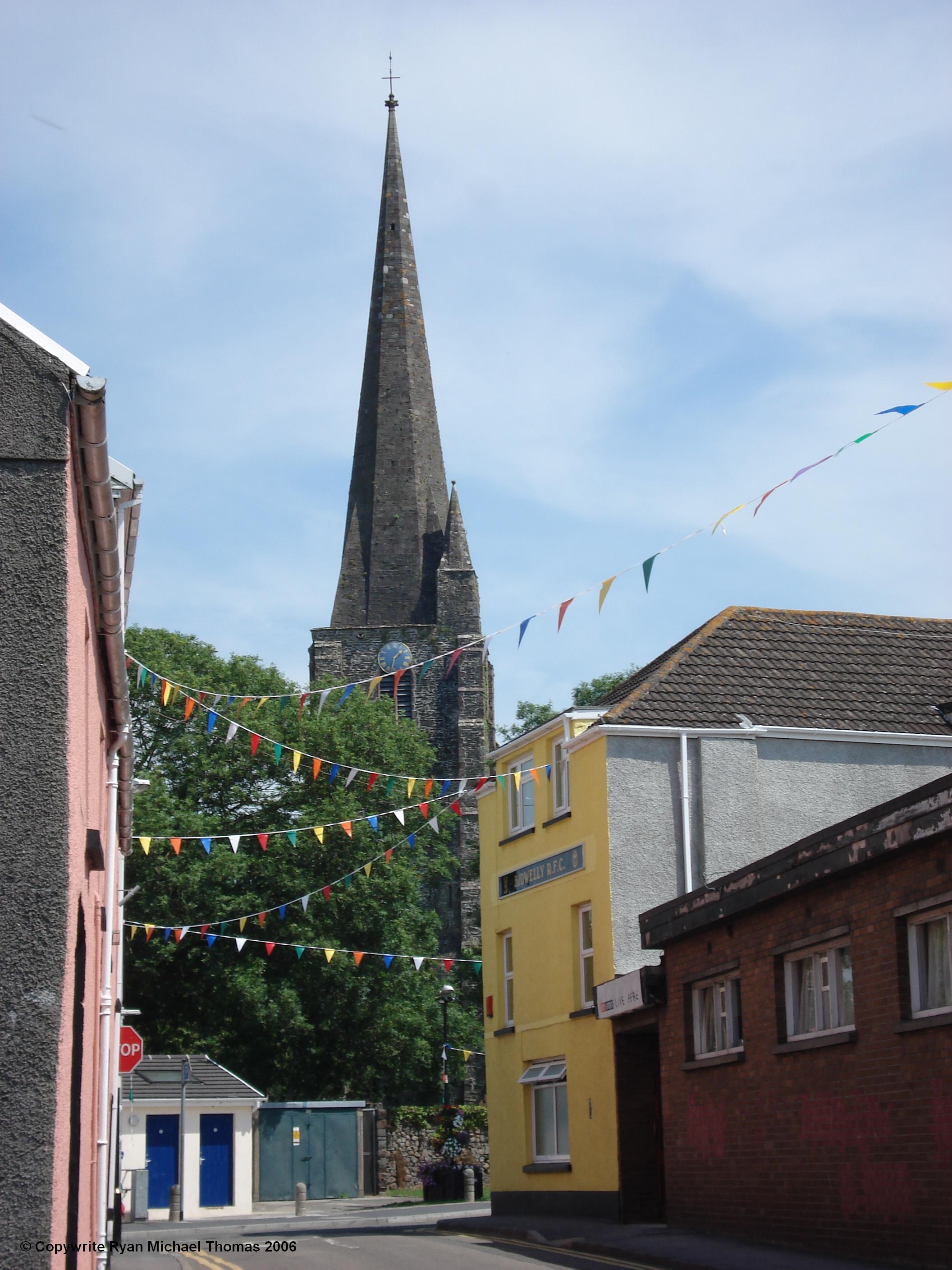
Kidwelly Town Centre and Parish Church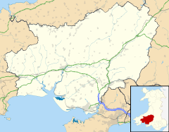
 Cydweli / Kidwelly
Cydweli / Kidwelly shown within CarmarthenshirePopulation 3,000 approx. OS grid reference SN407067 Community Kidwelly Town Council Principal area Carmarthenshire Ceremonial county Dyfed Country Wales Sovereign state United Kingdom Post town KIDWELLY Postcode district SA17 Dialling code 01554 Police Dyfed-Powys Fire Mid and West Wales Ambulance Welsh EU Parliament Wales UK Parliament Llanelli Welsh Assembly Llanelli Website kidwelly.gov.uk List of places: UK • Wales • Carmarthenshire Kidwelly (Welsh: Cydweli) is a town in Carmarthenshire, west Wales, approximately 10 miles (16 km) north-west of the main town of Llanelli.
It lies on the River Gwendraeth Fach above Carmarthen Bay. The town is twinned with French village St Jacut de la Mer.
Contents
History
The original name 'Cedweli' is very old: the earliest form of the name, 'Cetgueli', is recorded by the monk, Nennius, writing in the 9th century. The name means the land of Cadwal, or the 'kingdom' of Cadwal. Thus the name originally applied to a territory. The town and castle of the same name were established by the invading Normans in 1106.
A field in the neighbouring forest of Kingswood, Maes Gwenllian is known as the location of a battle in 1136, in which Princess Gwenllian, sister of Owain Gwynedd, led her husband's troops into battle against a Norman army during his absence. She is believed to have been killed either during the battle or shortly afterwards, historians debate whether her death was at Maes Gwenllian or if she was marched back to Kidwelly Castle to be beheaded there.
Although being an ancient town, Kidwelly grew significantly during the industrial revolution, as did many other towns in South Wales. The town was home to a large brickworks and tinworks. Little evidence now exists of such activities since the closure of the industrial works, with the exception of Kidwelly Industrial Museum.
An atmospheric quotation from a despondent vicar in the nineteenth century provides a fascinating insight to times gone by;
Kidwelly Parish Church records, 1851 "Remarks: [MS torn] . . . Lords day in this Town is but very little regarded as a day for spiritual worship [pub] lick houses are allowed to be open, and frequented during Divine Service. Publick [hou]ses are very numerous in this place, and even the Town Clerk keeps a . . . publick house. Often times on the Lord's day we are not only hear cursing and . . . once swearing in our streets, but frequently we see most brutal fighting, and . . . [n]otice taken thereof by the authority of the Town. This is the cause why places [of wor]ship are so little frequented and religion so little appreciated and professed at Kidwelly." Thomas Griffiths, Vicar[1]
Tourism
Local attractions include Kidwelly Castle, founded in 1106; a fourteenth century bridge and gate; the former quay (now a nature reserve); a Norman parish church, and an industrial museum.
Kidwelly Carnival is an annual event held on the second Saturday of July each year. Previous carnivals have featured aerial displays.[1]
Transport
Road - Kidwelly is connected to Llanelli and Carmarthen by the A484 road.
Bus/Coach - There are regular local buses running through Kidwelly, linking the town with Llanelli and Carmarthen, with a main stop in the town centre. There is also a Coach Park located in the town centre.
Rail - Kidwelly railway station is on the West Wales Line. Westbound services from Kidwelly terminate at Carmarthen or Pembroke Dock, with less frequent direct services to Fishguard and Milford Haven. Eastbound services terminate at Swansea railway station or Cardiff Central, with less frequent direct services to Manchester Piccadilly and London Paddington.[2][3]
Cycling - Kidwelly is connected to the National Cycle Network along the coast from the east and west by NCR 4.[4] The cycle path runs directly through the town centre.
Air - Pembrey Airport is approximately 3 miles (4.8 km) east of Kidwelly, and is connected to the town by regular bus services. The nearest airport with domestic and international scheduled flights is Cardiff International Airport.
Walking- There are numerous public footpaths and bridleways in Kidwelly and Mynydd-y- Garreg, including Glan yr Afon, just behind the Wesleyan Chapel on the Bridge and Summer Way (Maes yr Haf) off Water Street. Information and maps are obtainable from the Town Council Offices in Bridge Street.
Government
Kidwelly is governed on a local level by Carmarthenshire County Council and on a community level by Kidwelly Town Council, who appoint a Mayor of Kidwelly and Mynydd-y-garreg.
Sport
The local rugby union team is Kidwelly RFC, a club formed in the 1880s which now plays in the Welsh Rugby Union league they play their home games at Parc Stephen's, Kidwelly. Parc Stephen's is also the home venue of local football, cricket and lawn bowls teams. The football team, Kidwelly Town AFC (nicknamed The Black Cats), currently play in Carmarthenshire League Division 3 in the Welsh football pyramid.
The town also boasts a large number of junior football, rugby union and cricket teams.
See also
- Mynyddygarreg
- Llanelli
References
- ^ Kidwelly Carnival
- ^ National Rail Enquiries
- ^ Route 14 South and Central Wales and Borders
- ^ Sustrans
External links
- Kidwelly Town Council - Includes Visitors` Guide
- Kidwelly Castle Official Website
- Kidwelly Industrial Museum Official site
- Aerial photograph of Kidwelly
- www.geograph.co.uk : photos of Kidwelly and surrounding area
- History of Kidwelly with photos
Communities of Carmarthenshire Abergwili · Abernant · Ammanford · Betws · Bronwydd · Carmarthen · Cenarth · Cilycwm · Cilymaenllwyd · Cwmamman · Dyffryn Cennen · Cynwyl Elfed · Cynwyl Gaeo · Eglwyscummin · Gorslas · Henllanfallteg · Kidwelly · Laugharne Township · Llanarthney · Llanboidy · Llanddarog · Llanddeusant · Llanddowror · Llandeilo · Llandovery · Llandybie · Llandyfaelog · Llanedi · Llanegwad · Llanelli · Llanelli Rural · Llanfair-ar-y-bryn · Llanfihangel Aberbythych · Llanfihangel Rhos-y-Corn · Llanfihangel-ar-Arth · Llanfynydd · Llangadog · Llangain · Llangathen · Llangeler · Llangennech · Llangunnor · Llangyndeyrn · Llangynin · Llangynog · Llanllawddog · Llanllwni · Llannon · Llanpumsaint · Llansadwrn · Llansawel · Llansteffan · Llanwinio · Llanwrda · Llanybydder · Llanycrwys · Manordeilo and Salem · Meidrim · Myddfai · Newcastle Emlyn · Newchurch and Merthyr · Pembrey and Burry Port Town · Pencarreg · Pendine · Pontyberem · Quarter Bach · St Clears · St Ishmael · Talley · Trelech · Trimsaran · Whitland
Categories:- Towns in Carmarthenshire
- Carmarthenshire electoral wards
- Communities of Carmarthenshire
- Llanelli
- Carmarthen Bay


Wikimedia Foundation. 2010.