- McQuire, Virginia
-
McQuire — Unincorporated community — Location within the Commonwealth of Virginia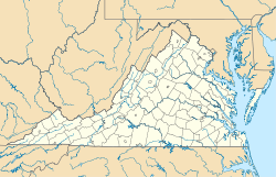
 McQuire
Coordinates: 39°13′18″N 78°16′37″W / 39.22167°N 78.27694°WCoordinates: 39°13′18″N 78°16′37″W / 39.22167°N 78.27694°W Country United States State Virginia County Frederick Time zone Eastern (EST) (UTC-5) – Summer (DST) EDT (UTC-4) ZIP codes FIPS code GNIS feature ID McQuire is an unincorporated community in Frederick County, Virginia, USA. McQuire is located along Hogue Creek at the intersection of the Northwestern Turnpike (U.S. Highway 50) and Back Mountain Road (VA 614).
Municipalities and communities of Frederick County, Virginia Towns 
CDPs Unincorporated
communitiesAlbin | Armel | Bartonsville | Brucetown | Burnt Factory | Canterburg | Cedar Grove | Cedar Hill | Clear Brook | Cross Junction | De Haven | Gainesboro | Gore | Gravel Springs | Green Spring | Grimes | Hayfield | Indian Hollow | Jordan Springs | Kernstown | Klines Mill | Leetown | Marlboro | McQuire | Meadow Mills | Mount Pleasant | Mount Williams | Mountain Falls | Mountain Falls Park | Nain | Opequon | Parkins Mills | Rest | Reynolds Store | Ridings Mill | Rock Enon Springs | Round Hill | Shockeysville | Siler | Star Tannery | Stephenson | Vaucluse | Welltown | Whitacre | White Hall | Wilde Acres
Categories:- Populated places in Frederick County, Virginia
- Unincorporated communities in Virginia
- Northwestern Turnpike
- Shenandoah Valley, Virginia geography stubs


Wikimedia Foundation. 2010.