- Cross Junction, Virginia
-
Cross Junction — Unincorporated community — Location within the Commonwealth of Virginia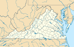
 Cross Junction
Coordinates: 39°19′13″N 78°17′36″W / 39.32028°N 78.29333°WCoordinates: 39°19′13″N 78°17′36″W / 39.32028°N 78.29333°W Country United States State Virginia County Frederick Time zone Eastern (EST) (UTC-5) – Summer (DST) EDT (UTC-4) ZIP codes FIPS code GNIS feature ID Cross Junction is an unincorporated community in northern Frederick County, Virginia, USA. Cross Junction is located on the North Frederick Pike (U.S. Highway 522) at its intersection with Collinsville Road. Cross Junction also encompasses the residential communities at Lake Holiday to the south.
History and terrain
Cross Junction and its environs consist of rain-fed streams and springs. It is the traditional home of the indigenous Shawnee, who had a settlement and court at Shawnee Springs. A few old farms in the area are owned mostly descendants of the founders of the European-American community, which dated from the 18th century. Some date back to the days when George Washington first visited the land and surveyed it.
Cross Junction has rolling farm land which is modestly priced. Of the handful of housing developments. Lake Holiday is the largest. There is no fire or EMS department in Cross Junction. The closest fire departments are those of Gainesboro and Reynolds Store, Virginia, 5–6 miles away. Each of these departments have an ISO rating of 9, so home owners' insurance in this area can be expensive.
Lake Holiday
Previously known as "The Summit", Lake Holiday is a gated community of about 800 homes and more than 1,000 building lots. This is the primary residential area in Cross Junction; it is built around a large, 240-acre (0.97 km2) manmade lake, from which the community derives its name.
Municipalities and communities of Frederick County, Virginia Towns 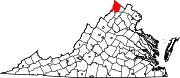
CDPs Unincorporated
communitiesAlbin | Armel | Bartonsville | Brucetown | Burnt Factory | Canterburg | Cedar Grove | Cedar Hill | Clear Brook | Cross Junction | De Haven | Gainesboro | Gore | Gravel Springs | Green Spring | Grimes | Hayfield | Indian Hollow | Jordan Springs | Kernstown | Klines Mill | Leetown | Marlboro | McQuire | Meadow Mills | Mount Pleasant | Mount Williams | Mountain Falls | Mountain Falls Park | Nain | Opequon | Parkins Mills | Rest | Reynolds Store | Ridings Mill | Rock Enon Springs | Round Hill | Shockeysville | Siler | Star Tannery | Stephenson | Vaucluse | Welltown | Whitacre | White Hall | Wilde Acres
Categories:- Populated places in Frederick County, Virginia
- Unincorporated communities in Virginia
- Shenandoah Valley, Virginia geography stubs


Wikimedia Foundation. 2010.