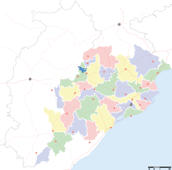
- Champua
-
Champua — city — Coordinates 22°05′N 85°40′E / 22.08°N 85.67°ECoordinates: 22°05′N 85°40′E / 22.08°N 85.67°E Country India State Orissa District(s) Kendujhar district Population 8,310 (2001[update]) Time zone IST (UTC+05:30) Area
• 346 metres (1,135 ft)
Champua is a census town in Kendujhar district in the state of Orissa, India.
Contents
Geography
Champua is located at 22°05′N 85°40′E / 22.08°N 85.67°E.[1] It has an average elevation of 346 metres (1135 feet).
Demographics
As of 2001[update] India census,[2] Champua had a population of 8310. Males constitute 53% of the population and females 47%. Champua has an average literacy rate of 75%, higher than the national average of 59.5%; with male literacy of 81% and female literacy of 68%. 14% of the population is under 6 years of age.
Politics
The current MLA for Champua (GE) Assembly Constituency is Jitu pattnaik of Independent candidate, who won the seat in the State elections of 2009. Previous MLAs from this seat include Dhanurjaya Sidhu who won as MLA in 2005 by getting ticket from congress, Saharai Oram who won as independent candidate in 2000, as JD candidate in 1990, as JNP(SC) candidate in 1980 and as JNP candidate in 1977; and Dhanurjay Laguri of INC who won in 1995 and in 1985.[3]
Champua is part of Keonjhar (Lok Sabha constituency).[4]
References
- ^ Falling Rain Genomics, Inc - Champua
- ^ "Census of India 2001: Data from the 2001 Census, including cities, villages and towns (Provisional)". Census Commission of India. Archived from the original on 2004-06-16. http://web.archive.org/web/20040616075334/http://www.censusindia.net/results/town.php?stad=A&state5=999. Retrieved 2008-11-01.
- ^ "State Elections 2004 - Partywise Comparison for 142 - Champua Constituency of ORISSA". Election Commission of India. http://archive.eci.gov.in/March2004/pollupd/ac/states/s18/Partycomp142.htm. Retrieved 2008-09-27.
- ^ "Assembly Constituencies - Corresponding Districts and Parliamentary Constituencies of Orissa". Election Commission of India. http://archive.eci.gov.in/se2000/background/S18/Orissa_AC_Dist_PC.pdf. Retrieved 2008-09-27.
Cities and towns in Kendujhar district Kendujhar Cities and towns
in other districtsAnugul · Balangir · Balasore · Bargarh · Bhadrak · Boudh · Cuttack · Debagarh · Dhenkanal · Gajapati · Ganjam · Jagatsinghpur · Jajpur · Jharsuguda · Kalahandi · Kandhamal · Kendrapara · Khordha · Koraput · Malkangiri · Mayurbhanj · Nabarangpur · Nayagarh · Nuapada · Puri · Rayagada · Sambalpur · Subarnapur · Sundergarh
Categories:- Cities and towns in Kendujhar district
- Orissa geography stubs
Wikimedia Foundation. 2010.


