Connor Downs

Connor Downs

Coordinates: 50°12′14″N 5°22′27″W / 50.2039°N 5.3741°W / 50.2039; -5.3741

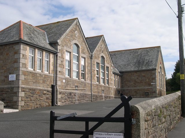
Connor Downs Primary School.
The Turnpike Inn, Connor Downs.

Connor Downs is a village in west Cornwall, United Kingdom. It is situated approximately two miles (3 km) east of Hayle.[1]

The village straddles the old course of the A30 road but has now been bypassed. Facilities include a school (Connor Downs Primary School), a petrol station and a fish-and-chip shop.

  1. ^ Ordnance Survey: Landranger map sheet 203 Land's End ISBN 978-0-319-23148-7

External links

Media related to Connor Downs at Wikimedia Commons


Wikimedia Foundation. 2010.

Игры ⚽ Нужна курсовая?

Look at other dictionaries:

  • Connor — Contents 1 Given name 1.1 Living persons 1.2 Fictional characters …   Wikipedia

  • Brendan O'Connor (journalist) — Infobox Person name = Brendan O Connor small image size = caption = birth name = birth date = birth place = County Cork, Ireland death date = death place = death cause = resting place = resting place coordinates = residence = Dublincite news last …   Wikipedia

  • Greg Downs — For information about the former footballer, see Greg Downs (footballer)Greg Downs (born November 22, 1971) is the author of the Flannery O Connor Award winning short story collection, Spit Baths published in 2006 by the University of Georgia… …   Wikipedia

  • Flannery O'Connor Award for Short Fiction — The Flannery O Connor Award for Short Fiction is an annual prize awarded by the University of Georgia Press named in honor of the American short story writer and novelist Flannery O Connor.Established in 1983 to encourage young writers by… …   Wikipedia

  • List of places in Cornwall — This is a list of all the towns and villages of Cornwall, United Kingdom. This also includes places in the Isles of Scilly. See List of places in England for lists of settlements in other counties. Top 15 places by population Alphabetical list A… …   Wikipedia

  • Hayle — Infobox UK place official name=Hayle country=England region=South West England|map type= Cornwall static static image caption= population=8,317 (2001 Census) os grid reference=SW561371 latitude=50.183 longitude= 5.416 london distance= post… …   Wikipedia

  • Gwinear-Gwithian — 50.216666666667 5.3833333333333 Koordinaten: 50° 13′ N, 5° 23′ W Gwinear Gwithian …   Deutsch Wikipedia

  • List of places in Penwith — This is a full list of all the towns, villages, hamlets and other places of note in the Penwith district of Cornwall, United KingdomA DBattery Rocks, Penzance, Bejouans, Boscaswell, Boscawen Un, Bosporthennis, Bosvennen, Boswednack, Botreah,… …   Wikipedia

  • Gwinear-Gwithian — is a civil parish in the Penwith district of Cornwall, United Kingdom. It includes the villages of Gwinear, Reawla, Rosewarne, Connor Downs, and Gwithian.Gwinear is situated on a hill with impressive views from the northern end of the village… …   Wikipedia

  • George Eustice — MP Member of Parliament for Camborne and Redruth Incumbent Assumed office 6 May 2010 Preceded by Constituency Created Majority …   Wikipedia

Share the article and excerpts

Direct link
Do a right-click on the link above
and select “Copy Link”