- Marks Gate
-
Coordinates: 51°35′35″N 0°08′41″E / 51.593°N 0.1448°E
Marks Gate 
 Marks Gate
Marks Gate shown within Greater LondonOS grid reference TQ485905 London borough Barking & Dagenham Ceremonial county Greater London Region London Country England Sovereign state United Kingdom Post town ROMFORD Postcode district RM6 Dialling code 020 Police Metropolitan Fire London Ambulance London EU Parliament London UK Parliament Dagenham London Assembly City and East List of places: UK • England • London Marks Gate is a place at the northern tip of the London Borough of Barking and Dagenham in northeast London, England.
It is located immediately north of Chadwell Heath and west of Collier Row.
The name refers to an entrance to Hainault Forest, which once occupied the area north of here. 'Marks' is formed from an old manorial name which is derived from the 14th century de Merk family.[1]
Scenes for the 2009 box office hit Harry Brown starring Cockney actor Michael Caine, and soul music singer Plan B, were filmed here.[citation needed] Famous ex-residents include David Essex who lived in Padnall Road.[citation needed]
Nearest stations
References
- ^ Mills, A.D. (2001). Dictionary of London Place Names. Oxford.
London Borough of Barking and Dagenham Districts Barking · Becontree · Becontree Heath · Castle Green · Chadwell Heath · Creekmouth · Dagenham · Dagenham Dock · Marks Gate · Rush Green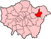
Attractions Barking Abbey · Barking Market · Eastbury Manor House (NT) · Valence House Museum · The Broadway · Victoria RoadParks and open spaces Barking Park · Central Park · Eastbrookend Country Park · Mayesbrook Park · Parsloes Park · Valence ParkConstituencies Tube and rail stations Other topics Categories:- Districts of Barking and Dagenham
- London geography stubs


Wikimedia Foundation. 2010.