- Creekmouth
-
Coordinates: 51°31′01″N 0°05′57″E / 51.5169°N 0.0991°E
Creekmouth 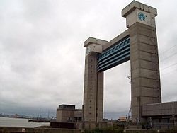
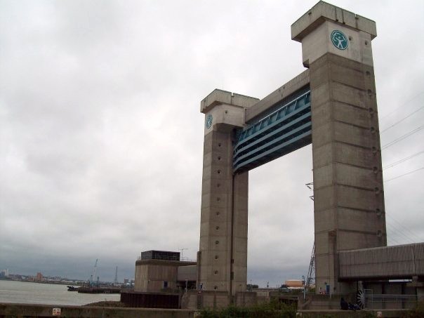
The Barking Creek tidal barrier as seen from the Creekmouth industrial estate
 Creekmouth
Creekmouth shown within Greater LondonOS grid reference TQ457448 London borough Barking & Dagenham Ceremonial county Greater London Region London Country England Sovereign state United Kingdom Post town BARKING Postcode district IG11 Dialling code 020 Police Metropolitan Fire London Ambulance London EU Parliament London UK Parliament Dagenham and Rainham London Assembly City and East List of places: UK • England • London Creekmouth is a suburb in the east London, UK. It is most known by its large industrial estate. The industrial area around River Road and Thames Road is one of the London Borough of Barking and Dagenham's largest employment areas. Creekmouth has a wide range of businesses from small local manufacturers to major multi-national companies.[1]
Contents
History
The Creekmouth Village as it was known, was built just below the Thames riverbank in the 1850s by Mr John Bennett Lawes, primarily for workers at his factory, Lawes Chemical and Fertiliser Company.[2] The village consisted of two rows of small houses, approximately 50 in total and had its own school, Mission Hall, shop and a public house called The Crooked Billet which is mentioned in records going back to 1719. The village community was very isolated. Most people who lived there worked for the chemical factory, or on the river, on the barges or as Lightermen. The area was surrounded by marshes and fields full of grazing cows and horses.[2] For much of the 20th Century Creekmouth was the location of the former Barking Power Station;[3] the current station is further east near Dagenham Dock.
Transport & locale
Transport connections
Creekmouth is not served by the tube, DLR or National Rail, although it is on the route of the proposed DLR extension to Dagenham Dock (see below).
There is one London Bus serving Creekmouth. Bus route 387, running between Little Heath and Barking Reach, which only operates two Monday to Friday morning peak journeys (the route itself operates daily, but is extended to Creekmouth on weekday mornings).
Regeneration project & DLR proposal
The regeneration project, costing £290,000 was started in 2005 and has seen the Environment Agency work in partnership with local charity the Creekmouth Preservation Society to transform disused land at the Barking Barrier into a green space. A station Creekmouth DLR station is proposed on the Dagenham Dock extension of the Docklands Light Railway with a suggested opening date of 2016.
Billy Bragg, poet and musician originally from nearby Barking helped local children from Thames View Junior School plant over 500 wild flower bulbs at the “Creekmouth Open Space” at the Barking Barrier on 28 November 2007.[4]
Location
Neighbouring areas of Creekmouth 
East Ham Barking Dagenham Beckton 
Dagenham Dock  Creekmouth

Gallions Reach Thamesmead (beyond River Thames) Thamesmead North (beyond River Thames) References
- ^ Creekmouth to Castle Green Study
- ^ a b Creekmouth Preservation Society
- ^ "'The borough of Barking',". A History of the County of Essex: Volume 5 (1966), pp. 235-248. Victoria County History. http://www.british-history.ac.uk/report.aspx?compid=42729. Retrieved 2007-12-05.
- ^ Bard of Barking Billy Bragg to join Stone Walk ceremony
External links
London Borough of Barking and Dagenham Districts Barking · Becontree · Becontree Heath · Castle Green · Chadwell Heath · Creekmouth · Dagenham · Dagenham Dock · Marks Gate · Rush Green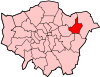
Attractions Barking Abbey · Barking Market · Eastbury Manor House (NT) · Valence House Museum · The Broadway · Victoria RoadParks and open spaces Barking Park · Central Park · Eastbrookend Country Park · Mayesbrook Park · Parsloes Park · Valence ParkConstituencies Tube and rail stations Other topics Categories:- Districts of London
- Districts of Barking and Dagenham
- Districts of London on the River Thames
- Port of London


Wikimedia Foundation. 2010.