- Chalvington with Ripe
-
Coordinates: 50°51′52″N 0°09′33″E / 50.864436°N 0.159125°E
Chalvington with Ripe 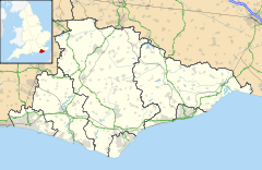
 Chalvington with Ripe
Chalvington with Ripe shown within East SussexArea 11.12 km2 (4.29 sq mi) [1] Population 1,082 (2007)[1] - Density 252 /sq mi (97 /km2) OS grid reference TQ520094 - London 46 miles (74 km) NNW District Wealden Shire county East Sussex Region South East Country England Sovereign state United Kingdom Post town HAILSHAM Postcode district BN27 Dialling code 01323 Police Sussex Fire East Sussex Ambulance South East Coast EU Parliament South East England UK Parliament Lewes Website Chalvington with Ripe List of places: UK • England • East Sussex The civil parish of Chalvington with Ripe, in the Wealden District of East Sussex, England, is made up of the two villages, Chalvington and Ripe. They are located in the upper Rivers Cuckmere and Ouse joint valley north of the South Downs, between the A27 and the A22 roads, and some 15 miles (24 km) north-west of Eastbourne. Ripe is the larger of the two ecclesiastical parishes: 1120 acres (448 ha) against 729 acres (292 ha) of Chalvington.
Contents
History of the villages
The Romans built a road through the two villages[citation needed], and remains of the layout can still be seen.
In medieval times the area had a profitable wool trade [2]
The villages
Chalvington
The village of Chalvington, East Sussex, England is named Calvintone or Caveltone in the Domesday Book. It is located in the area between the A27 and the A22 roads, some 15 miles (24 km) north-west of Eastbourne. The name Chalvington, comes from the Saxon Caelfa's farm, and many local names derive from their occupation of the area.
There is one public house in the village, the Yew Tree Inn. The parish church is dedicated to St Bartholomew[3].
Ripe
Ripe is a village within the Wealden District of East Sussex, England. It is located eight miles (13 km) east of Lewes in the valley north of the South Downs. The two villages are adjacent to one another, Ripe ecclesiastical parish being the larger of the two in area. There is limited public transport to the village.
The village, in a mainly rural area, is mentioned in Domesday Book and has had a number of names, including Alchitone, Achiltone, Achintone, Echentone and Eckington. The 13th-century parish church is dedicated to St John the Baptist[4]. There is limited public transport to the village.
Before 1066 it was owned by Earl Harold, later to become King Harold (the second) who was killed at the Battle of Hastings in 1066. The Domesday Book mentions 'Rype' and 'Echentone' which were owned by Richard de Aquila, and the church is also mentioned in the 1291 Pope Nicholas IV Taxatio ecclesiastical tax assessment survey.
The novelist Malcolm Lowry, best known for Under the Volcano, died at age 48 in a boarding house in Ripe on 26 June 1957. Lowry is buried in the village churchyard. Ripe was also the retirement home of the tattooed performer Horace Ridler (the Great Omi) who died there in 1969.[5]
There is one public house in the village, the Lamb Inn.
References
- ^ a b "East Sussex in Figures". East Sussex County Council. http://www.eastsussexinfigures.org.uk/webview/. Retrieved 26 April 2008.
- ^ A brief history of the parish
- ^ St Bartholomew's church
- ^ Photographs of Ripe church
- ^ Eccles, John (2006-01-26). "Villagers made strange Omi one of their own". Sussex Express (Johnston Press Digital Publishing). http://www.sussexexpress.co.uk/CustomPages/CustomPage.aspx?PageID=55889§ionID=4075. Retrieved 4 May 2008.[dead link]
Towns, villages and hamlets in the Wealden District of East Sussex, England Alciston • Alfriston • Arlington • Berwick • Best Beech Hill • Birling Gap • Blackboys • Blackham • Bodle Street Green • Boreham Street • Broad Oak • Burlow • Buxted • Chalvington • Chelwood Gate • Chiddingly • Coleman's Hatch • Cooper's Green • Cowbeech • Cross in Hand • Crowborough • Danehill • Duddleswell • East Dean • East Hoathly • Eridge Green • Etchingwood • Exceat • Fairwarp • Five Ash Down • Five Ashes • Fletching • Folkington • Forest Row • Framfield • Frant • Friston • Furner's Green • Golden Cross • Groombridge • Gun Hill • Hadlow Down • Hailsham • Halland • Hammerwood • Hankham • Hartfield • Heathfield • Hellingly • Heron's Ghyll • Herstmonceux • High Hurstwood • Holtye • Hooe • Hooe Common • Horam • Horney Common • Isfield • Jevington • Laughton • Litlington • Little Horsted • Little London • Lower Dicker • Lower Horsebridge • Lullington • Magham Down • Maresfield • Mark Cross • Mayfield • Maynard's Green • Milton Street • Muddles Green • Ninfield • Nutley • Old Heathfield • Pevensey • Pevensey Bay • Polegate • Poundgate • Punnett's Town • Rickney • Ripe • Roser's Cross • Rotherfield • Rushlake Green • Selmeston • Stone Cross • Stunts Green • Tidebrook • Three Cups Corner • Uckfield • Upper Dicker • Upper Hartfield • Vines Cross • Wadhurst • Waldron • Warbleton • Wartling • Westdean • Westham • Whitesmith • Willingdon • Wilmington • Windmill Hill • Winton • Withyham • Wych CrossCategories:- Wealden
- Local government in East Sussex

Wikimedia Foundation. 2010.