- Metropolitan Borough of Islington
-
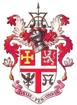
Islington Motto: Deus Per Omnia (God pervades all things) 
Islington within the County of LondonGeography Status Metropolitan borough HQ Town Hall, Upper Street History Created 1900 Abolished 1965 Succeeded by London Borough of Islington Politics Governance Islington Borough Council 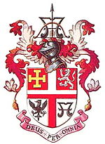
Coat of arms of the borough councilThe Metropolitan Borough of Islington was a Metropolitan borough within the County of London from 1900 to 1965, when it was amalgamated with the Metropolitan Borough of Finsbury to form the London Borough of Islington.
Contents
Boundaries
The borough comprised the districts of Pentonville, Islington, Barnsbury, Lower Holloway, Holloway, Tufnell Park, Archway, Highbury, and Canonbury.
The neighbouring boroughs were Finsbury, Hackney, Stoke Newington, Shoreditch, St Pancras.
Town Hall
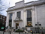 Islington Town Hall
The town hall is on Upper Street, and was opened in 1923. It is a listed building.
Today, the Town hall is the headquarters, and contains the council chambers of the successor authority, the London Borough of Islington.
Area and population
The metropolitan borough was conterminous with the Vestry authority, when it was formed in 1900. Statistics compiled by the London County Council, in 1901 show the population growth in London, over the preceding century.
The area of the borough in 1901 was 3,091 acres (12.5 km2). The populations recorded in National Censuses were:
Islington Vestry 1801-1899
Year[1] 1801 1811 1821 1831 1841 1851 1861 1871 1881 1891 Population 10,212 15,065 22,417 37,316 55,690 95,329 155,341 213,778 282,865 319,143 Metropolitan Borough 1900-1961
Year[2] 1901 1911 1921 1931 1941 1951 1961 Population 334,981 327,403 330,737 321,795 [3] 235,632 235,632 By comparison, after amalgamation with Finsbury, to form the modern London Borough of Islington, the combined area became 3,672 acres (14.9 km2); in 2005, this had a population of 182,600,[4] or a population density of 12,288/km². In 1901 Islington the population density was 26,778/km².
Archival records
Islington Local History Centre holds records of the Metropolitan Borough of Islington, including council and committee minutes, rate books and publications.[5]
See also
- Metropolis Management Act 1855
- London Government Act 1899
- London Government Act 1963
- London Borough of Islington
References
- ^ Statistical Abstract for London, 1901 (Vol. IV)
- ^ Islington MetB: Census Tables at Vision of Britain accessed on 14 Dec 2006
- ^ The census was suspended for World War II
- ^ 2005 estimate
- ^ "Local History Collections". Islington Local History Centre. http://www.islington.gov.uk/Leisure/heritage/heritage_lhc/lhc_collections/localhistorycollections.asp. Retrieved 3 March 2011.
Local government districts abolished or transferred by the London Government Act 1963 London · CC Battersea · Bermondsey · Bethnal Green · Camberwell · Chelsea · Deptford · Finsbury · Fulham · Greenwich · Hackney · Hammersmith · Hampstead · Holborn · Islington · Kensington · Lambeth · Lewisham · Paddington · Poplar · Shoreditch · Southwark · St. Marylebone · St. Pancras · Stepney · Stoke Newington · Wandsworth · Westminster · Woolwich
Constituent parts of Greater LondonEssex Barking · Chigwell (part) · Chingford · Dagenham · East Ham · Hornchurch · Ilford · Leyton · Romford · Walthamstow · Wanstead and Woodford · West Ham
Hertfordshire Middlesex · CC Acton · Brentford and Chiswick · Ealing · Edmonton · Enfield · Feltham · Finchley · Friern Barnet · Harrow · Hayes and Harlington · Hendon · Heston and Isleworth · Hornsey · Ruislip-Northwood · Southall · Southgate · Tottenham · Twickenham · Uxbridge · Wembley · Willesden · Wood Green · Yiewsley and West Drayton
Kent Surrey Transfers Categories:- Metropolitan boroughs of the County of London
- History of Islington
- Politics of Islington
- 1900 establishments in the United Kingdom
- 1965 disestablishments


Wikimedia Foundation. 2010.