- Metropolitan Borough of Wandsworth
-
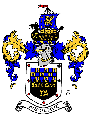
Wandsworth Motto: We Serve 
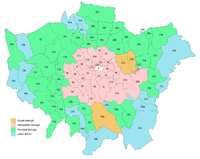
Wandsworth within the County of LondonGeography Status Metropolitan borough HQ Town Hall, Wandsworth High Street History Origin Wandsworth District Board of Works Created 1900 Abolished 1965 Succeeded by London Borough of Wandsworth
London Borough of LambethPolitics Governance Wandsworth Borough Council 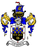
Coat of arms of the borough councilThe Metropolitan Borough of Wandsworth was a Metropolitan borough under the London County Council, from 1900 to 1965.
The borough was formed from five civil parishes: Clapham, Putney, Streatham, Tooting Graveney and Wandsworth. Before 1899 these parishes, together with Battersea, had been administered by the Wandsworth District Board of Works.
Contents
Coat of arms
The coat of arms were granted on 6 July 1901. The blue wavy division represents the Rivers Wandle and Thames. French Huguenot refugees arrived in the area in 1685, and the blue drops represent the tears of their struggle. The five stars represent the constituent former parishes. At the top is a long boat, with a dragon's head, commemorating 9th century Danish incursions along the river. The borough council's motto was We Serve.[1]
Population and area
The Borough covered 9,130 acres (36.9 km2), which made it the largest in the County of London. The population recorded in the Census was:
Civil Parish 1801–1899Year[2] 1801 1811 1821 1831 1841 1851 1861 1871 1881 1891 1901 Population 14,283 17,963 22,726 27,779 33,238 40,204 50,803 71,044 103,172 156,942 232,024 Replacement
When the metropolitan boroughs were replaced with larger London boroughs in 1965, this borough was split. The core area of Wandsworth (about 11 km²) became part of the London Borough of Wandsworth, along with the former Metropolitan Borough of Battersea, but the areas of Streatham and Clapham (totalling 4 km²) became part of the London Borough of Lambeth.
References
- ^ London County Council (Civic Heraldry) accessed 15 Jan 2008
- ^ Statistical Abstract for London, 1901 (Vol. IV); Census tables for Metropolitan Borough of Battersea
Local government districts abolished or transferred by the London Government Act 1963 London · CC Battersea · Bermondsey · Bethnal Green · Camberwell · Chelsea · Deptford · Finsbury · Fulham · Greenwich · Hackney · Hammersmith · Hampstead · Holborn · Islington · Kensington · Lambeth · Lewisham · Paddington · Poplar · Shoreditch · Southwark · St. Marylebone · St. Pancras · Stepney · Stoke Newington · Wandsworth · Westminster · Woolwich
Constituent parts of Greater LondonEssex Barking · Chigwell (part) · Chingford · Dagenham · East Ham · Hornchurch · Ilford · Leyton · Romford · Walthamstow · Wanstead and Woodford · West Ham
Hertfordshire Middlesex · CC Acton · Brentford and Chiswick · Ealing · Edmonton · Enfield · Feltham · Finchley · Friern Barnet · Harrow · Hayes and Harlington · Hendon · Heston and Isleworth · Hornsey · Ruislip-Northwood · Southall · Southgate · Tottenham · Twickenham · Uxbridge · Wembley · Willesden · Wood Green · Yiewsley and West Drayton
Kent Surrey Transfers Coordinates: 51°27′26″N 0°11′25″W / 51.4571°N 0.1903°W
Categories:- Metropolitan boroughs of the County of London
- History of Lambeth
- History of Wandsworth
- 1900 establishments in the United Kingdom
- 1965 disestablishments
- London geography stubs

Wikimedia Foundation. 2010.