- Municipal Borough of Barnes
-
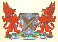
Barnes Motto: Not For Ourselves Alone Geography Status Urban district (until 1932)
Municipal borough (after 1932)1911 area 2,518 acres (10.2 km2) 1961 area 2,521 acres (10.2 km2) History Created 1894 Abolished 1965 Succeeded by Richmond upon Thames Demography 1911 population
- 1911 density30,377
12.06/acre1961 population
- 1961 density39,057
15.49/acreBarnes was a local government district in north west Surrey from 1894 to 1965.[1]
It was formed as an urban district in 1894 and became a municipal borough in 1932.
It contained the settlements of Barnes, Mortlake and East Sheen. It was part of the London postal district and Metropolitan Police District. The district was bounded by the County of London to the east, the River Thames and Middlesex to the north, and the Municipal Borough of Richmond to the west and south.
In 1965 it was abolished and its former area became part of the London Borough of Richmond upon Thames.
References
- ^ Vision of Britain - Barnes UD/MB (historic map). Retrieved on 2008-07-28.
Coordinates: 51°28′05″N 0°15′36″W / 51.468°N 0.260°W
Categories:- History of Richmond upon Thames
- Districts of England created by the Local Government Act 1894
- Districts abolished by the London Government Act 1963
- Municipal boroughs of England
- London geography stubs
Wikimedia Foundation. 2010.


