- Tétouan
-
For the district in Madrid, see Tetuán (Madrid).
Tétouan
تطوان / تطّاون
Tettawen

FlagLocation in Morocco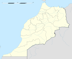
 Tétouan
Coordinates: 35°34′N 5°22′W / 35.567°N 5.367°WCoordinates: 35°34′N 5°22′W / 35.567°N 5.367°W Country  Morocco
Region Tangier-Tétouan Province Tétouan Government – Mayor Mohamed Ideêmar Elevation(at Place Moulay El Mehdi) 187 ft (57 m) Population (2004) – Total 320,539 – Religions Islam Time zone WET (UTC+0) – Summer (DST) WEST (UTC+1) Postal Code 93000 Website The official web site Official name: Medina of Tétouan (formerly known as Titawin) Type: Cultural Criteria: ii, iv, v Designated: 1997 (21st session) Reference #: 837 State Party:  Morocco
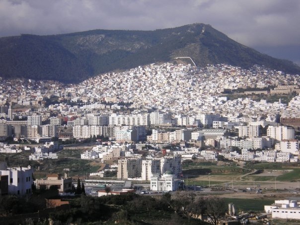
Region: Arab States Tetouan (from the Berber Tiṭṭawin, Arabic: تطوان, Spanish: Tetuán, French: Tétouan) is a city in northern Morocco. The Berber name means literally "the eyes" and figuratively "the water springs". Tetouan is one of the two major ports of Morocco on the Mediterranean Sea. It lies a few miles south of the Strait of Gibraltar, and about 40 mi (60 km) E.S.E. of Tangier. In 2004 the city had 320,539 inhabitants (census figure). Tetouan's civil airport Sania Ramel Airport is located 6 km to the east.
Arabic is the official language but it is not used for everyday dialogue. The city has its own dialect,[1][2] a particular citadin variant of non-hilalian Arabic which is distinct from Jebli Arabic.[3][4] However, Jebli arabic is predominant since people from the neighboring rural areas settled in the city during the 20th century rural flights.[5] The use of Spanish and French is still widespread especially by the businessmen and intellectual elites. Its main religion is Islam. A small Christian minority lives in the city.
Contents
Description
The city is situated about 60 km east of the city of Tangier and 40 km south of the Spanish exclave of Ceuta (Sebta) and the Strait of Gibraltar. It is in the far north of the Rif Mountains. To the south and west of the city there are mountains. Tetuan is situated in the middle of a belt of orchards that contain orange, almond, pomegranate and cypress trees. The Rif Mountains are nearby, as the city is located in the Martil Valley. It is picturesquely situated on the northern slope of a fertile valley down which flows the Martil river, with the harbour of Tetouan, Martil, at its mouth. Behind rise rugged masses of rock, the southern wall of the Anjera country, once practically closed to Europeans, and across the valley are the hills which form the northern limit of the still more impenetrable Rif.
The streets are fairly wide and straight, and many of the houses belonging to aristocratic families, descendants of those expelled from Al-Andalus by the Spanish "Reconquista", possess marble fountains and have groves planted with orange trees. Within the houses the ceilings are often exquisitely carved and painted in hispano-moresque designs, such as are found in the Alhambra of Granada, and the tile-work for which Tetuan is known may be seen on floors, pillars and dados. The traditional industries are tilework, inlaying with silver wire, and the manufacture of thick-soled yellow slippers, much-esteemed flintlocks, and artistic towels used as cape and skirt by Arabic girls in rural areas. The Jews lived in a mellah, separated from the rest of the town by gates which were closed at night. The harbour of Tetuan was obstructed by a bar, over which only small vessels can pass, and the roadstead, sheltered to the north, northwest and south, is exposed to the east, and is at times unsafe in consequence of the strong Levanter.
History
The city was founded in the 3rd century BC. Artifacts from both the Roman and the Phoenician era have been found in the site of Tamuda.
Around 1305 a city was built here by the Marinid king Abu Thabit. It served as a base for attacks on Ceuta. Around 1400 it was destroyed by the Castilians, because pirates used it for their attacks. By the end of the 15th century it was rebuilt by refugees from the Reconquista (reconquest of Spain, completed by the fall of Granada in 1492), when the Andalusian Moors first reared the walls and then filled the enclosure with houses. It had a reputation for piracy at various times in its history. It was taken on 4 February 1860 by the Spaniards under Leopoldo O'Donnell, (a descendant of an old Irish royal family, O'Donnell of Tyrconnell, who was made hereditary Duke of Tetuan, and later Prime Minister of Spain; the Dukedom is currently held by his descendant S.E. Don Hugo O'Donnell, Duke of Tetuan, Grandee of Spain and Count of Lucena) and almost transformed by them into a European city before its evacuation on 2 May 1862, but so hateful were the changes to the Moors that they completely destroyed all vestiges of alteration and reduced the city to its former state.
 The Battle of Tetuan, part of Leopoldo O'Donnell's Moroccan campaigns on behalf of Spain's Queen Isabella II in the early 1860s, painted by Mariano Fortuny - a collection of Morohashi Modern Art Museum
The city is situated in the area of Morocco which was formerly ruled by Spain. In 1913 it became the capital of the part of Morocco under Spanish protectorate which was governed by the Jalifa (Moroccan prince, serving as Viceroy for the Sultan, and the Spanish "Alto Comisario" accredited to him), and it remained its capital until 1956.
Many people in the city still speak Spanish. On road signs often names are written both in Spanish and in Arabic, though many signs are in Arabic and French, the second language of modern Morocco. Tétouan became part of the independent state of Morocco when it was founded out of French Morocco and most of Spanish Morocco in 1956.
Tétouan has also been home to an important Sephardi Jewish community, which immigrated from Spain after the Reconquista and the Spanish Inquisition. This Jewish Sephardi community spoke a form of Judaeo-Spanish known as Haketia. Some of them emigrated later to Oran (in Algeria), to South America and much later to Israel, Spain, France and Canada. There are very few Jews left in Tétouan nowadays. [6] There is a small population of former Jews who converted to Islam that still remain in Tetouan[7]
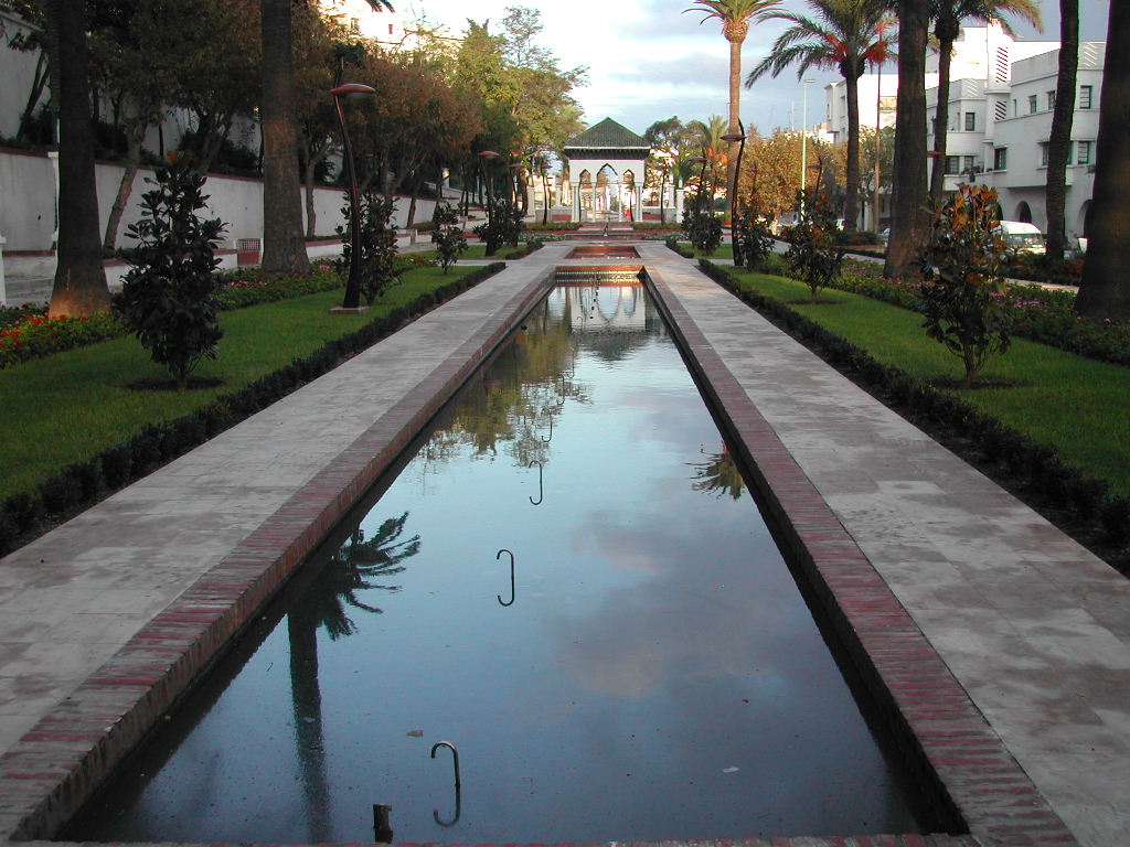
Sights in and around Tétouan
 Tétouan church
- Medina
- The medina (old town) of Tétouan is on the World Heritage List of the UNESCO.[8] The inner city is very characteristic and traditional. One can find many white houses there, especially low houses. Everywhere in the city there are people performing their craftsmanship, like weavers, jewellers, leather workers. Street sellers often try to sell carpets to tourists as well.
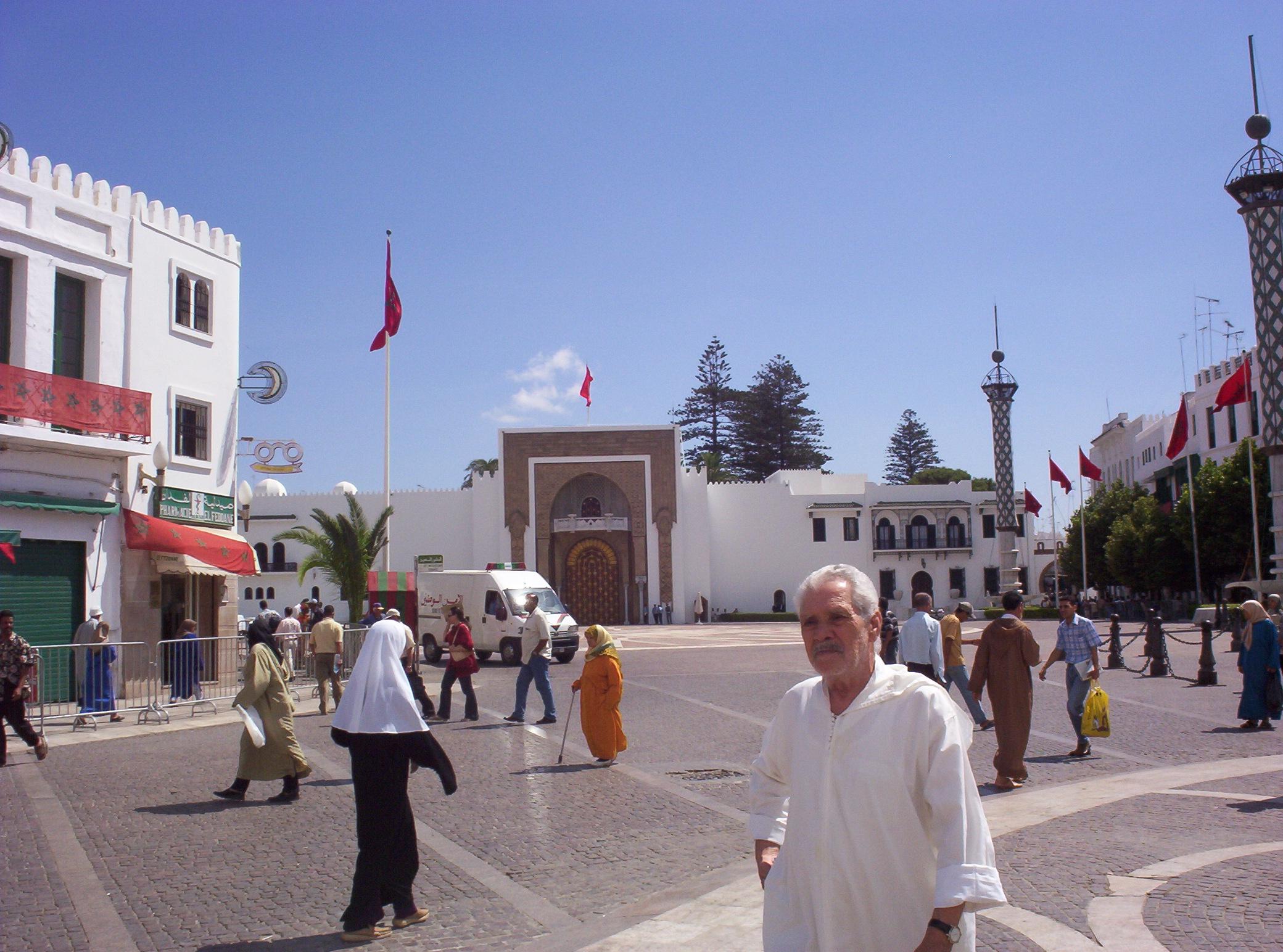
 Royal Palace
- The royal palace in Tétouan is situated just outside and by one of the entrances to the medina. There is a public square in front of it.
- Kasbah
- Mosques
See also
- Spanish Morocco
- Atletico Tetuán
Notes and references
 This article incorporates text from a publication now in the public domain: Chisholm, Hugh, ed (1911). Encyclopædia Britannica (11th ed.). Cambridge University Press.
- ^ L. Messaoudi, Cahiers de Sociolinguistique n°6 (2001), Variations linguistiques: images urbaines et sociales, pp.87-98
- ^ S. Levy, EDNA n°1 (1996), Reperes pour une histoire linguistique du Maroc, pp.127-137
- ^ Dominique Caubet, Questionnaire de dialectologie du Maghreb
- ^ (French)Jordi Aguadé, Patrice Cressier, Ángeles Vicente : Peuplement et arabisation au Maghreb occidental, Casa de Velázquez, 1998 (ISBN 8486839858)[1]
- ^ (French)M. Lazaar, Migration internationale et croissance des villes du Nord-Ouest marocain: Les cas de Tétouan et de Tanger (Maroc), in Urbanisation du monde arabe, no.28 (1995), pp.145-150 (ISSN 0760-3819)
- ^ YouTube - Broadcast Yourself
- ^ [2]
- ^ Medina of Tétouan - unesco.org
World Heritage Sites in Morocco Northern Medina of Fes el Bali · Medina of Tétouan (formerly known as Titawin) Archaeological Site of Volubilis · Historic City of Meknes ·

Central Medina of Essaouira (formerly Mogador) · Medina of Marrakech · Portuguese City of Mazagan (El Jadida)
Southern Tangier-Tetuan regionCapital: TangierProvinces Chefchaouen Province · Fahs-Anjra province · Larache Province · Tangier-Assilah province · Tetuan Province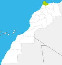
Cities Categories:- World Heritage Sites in Morocco
- Populated places in the Tangier-Tétouan Region
- Port cities in Morocco
- Tetouan
- Archaeological sites in Morocco
- Medina


Wikimedia Foundation. 2010.