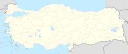
- Nilüfer, Bursa
-
Nilüfer Location of Nilüfer in Bursa Location of Nilüfer in Turkey Coordinates: 40°17.00′N 28°57.00′E / 40.283°N 28.95°E Country  Turkey
Region Marmara Province Bursa Area – City 186 km2 (71.8 sq mi) Population (2007) – City 251,344 – Density 960.7/km2 (2,488.2/sq mi) – Urban 199,270 Time zone EET (UTC+2) – Summer (DST) EEST (UTC+3) Postal code 16x xx Area code(s) 0224 Licence plate 16 Website www.nilufercity.eu A view of Nilüfer from the Uludağ road.
Nilüfer is a district of Bursa Province of Turkey. It was established in 1987. It is the one of three central districts of Bursa Province. The others are Osmangazi and Yıldırım. It is established as the main residential development area of Bursa in order to meet the housing needs of Bursa. [1]
Contents
Name origin
The name of the district comes from Nilüfer River that passes through the district. Besides that also the name of the river comes from Nilüfer Hatun. According to traditional stories, Nilüfer Hatun ordered to built a bridge over a river in Bursa and after the completion of bridge, both the river and the bridge were named "Nilüfer". [2]
History
Nilüfer district hosting the first settlement in Bursa Region as per some researchers, bears the traces of both Byzantine and Ottoman and the older periods in history. In Nilüfer; Tepecik Tumulus, Gölyazı and Tahtalı villages in Alaaddinbey Neighborhood and Aktopraklık Tumulus and Gölyazı islands region in Akçalar district are rich in historical findings. There are ruins of churches, mosques, baths, fountains, monasteries and castles in these regions together with historical remains and monument trees.
There are many historical structures scattered in different parts of Nilüfer. Mosques, bridges and baths from Ottomand region and church ruins remained from various times. Some of them are: H. Ioannes Theologos Church in Çatalağıl village, Saint Helena Church in Özlüce Neighborhood, Demirci Mosque, Yaylacık Mosque, Mihraplı Bridge. Also Misi village and Gölyazı district are the richest ancient settlement areas in Nilüfer. The history of the district goes back to 6th century B.C. [3]
Population
Due to being a new residential development area, Nilüfer has a high population growth rate with respect to other places. The population of the district rose %13 in yearly basis between 1990-2000 and %5.6 in yearly basis between 2000-2007. The official results of the recent censuses are:
Results of Recent National Censuses[4] Years Urban Rural Total 2007 199.270 52.074 251.344 2000 136.311 42.371 178.682 1997 99.323 36.107 135.430 1990 36.897 28.902 65.799 Climate
The weather of district shows characteristics of Marmara climatic region. While, the hottest month of the year is July, the coldest month is February. The rainy weather can be seen mostly in winter and spring time. The annual average precipitation is about 500-700 mm. The humidity in district is about 58% in average.
Industry
Nilüfer comes first among the districts of Bursa in terms of the economical contribution it provides to Turkey. Because, Bursa Organized Industry Area, Nilüfer Organized Industry area and Beşevler Small Industry Site, which provide employment opportunities for a great amount of Bursa population take place within the borders of Nilüfer. There are many other industry areas and business centers in Çalı, Kayapa, Hasanağa, Akçalar and Görükle under the body of Nilüfer. Nilüfer provides employment opportunities to 80 % of Bursa population and derives great income for Turkey. The most important sectors within the district are textile, automotive, machine, spare parts and related industry products. [5]
Cultural activities
The cultural activities in district are organized mainly by Nilüfer Municipality. The Municipality provides several hobby and art classes in several activities, such as; drawing, sculpture, acting, photographing, ornament design, ebru, mosaic etc. Also several plays, concerts, exhibitions and conferences are performed every year in two culture centers (Konak Kültürevi and Uğur Mumcu Sahnesi) of municipality. In summer time, several open-air public concerts are given by different musicians as a part of two summer festivals organized by Uludag University and Nilüfer Municipality. Also there are several local, traditional festivals held by villagers and other small communities in district. Most of them originate from traditional harvest festivals.
Main sights
- Misi Village
- Gölyazı District
- Mihraplı Bridge
- H. Ioannes Theologos Church
- Nilüfer Bridge
- Demirci Mosque
- Apolyont Lake
- Ayvaini Cave
- Saint Helena Church
References
- ^ "Translated from Turkish version of article". Wikipedia. http://tr.wikipedia.org/wiki/Nil%C3%BCfer%2C_Bursa. Retrieved 2008-07-21.
- ^ "Translated from Turkish version of article". Wikipedia. http://tr.wikipedia.org/wiki/Nil%C3%BCfer%2C_Bursa. Retrieved 2008-07-21.
- ^ "Official Site of Nilüfer Municipality". Nilufer Municipality. http://www.nilufercity.eu. Retrieved 2008-07-21.
- ^ "Turkish Statistical Institute". TUIK. http://www.turkstat.gov.tr/Start.do;jsessionid=7y5fLGMPT2sNGBx1RSYKh1z190k0RNP4RPrc1myNjjnN4LvQj1zl!917330252. Retrieved 2008-07-21.
- ^ "Official Site of Nilüfer Municipality". Nilufer Municipality. http://www.nilufercity.eu. Retrieved 2008-07-21.
External links
- Nilüfer Municipality (English)
- Nilüfer Photos
- Map of Nilüfer
 Nilüfer, Bursa in Bursa Province (in the Marmara region) of Turkey
Urban districts 
Rural districts Büyükorhan - Harmancık - İnegöl - İznik - Karacabey - Keles - Mustafakemalpaşa - Orhaneli - Orhangazi - YenişehirRegionsAegean Black Sea Central Anatolia Eastern Anatolia Marmara Mediterranean Southeastern Anatolia Categories:- Districts of Bursa
- Marmara Region
- Populated places in Bursa Province
Wikimedia Foundation. 2010.


