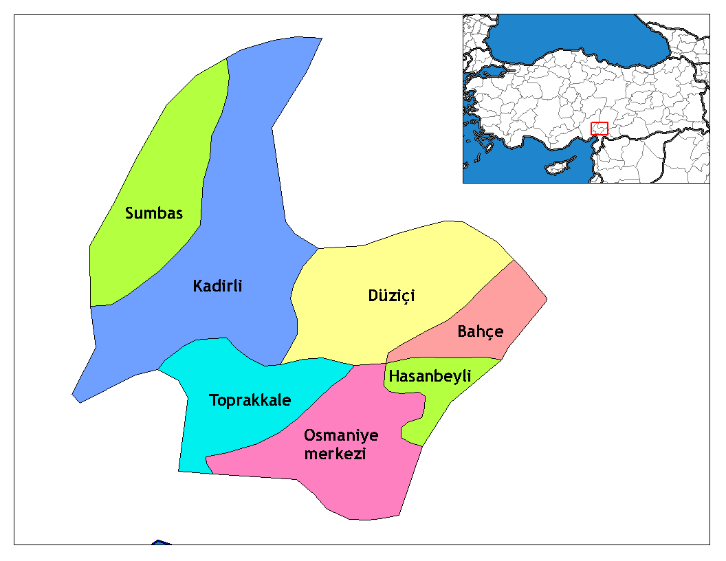
- Düziçi
-
Düziçi — Town — Location of Düziçi within Turkey.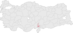
Coordinates: 37°15′N 36°28′E / 37.25°N 36.467°ECoordinates: 37°15′N 36°28′E / 37.25°N 36.467°E Country  Turkey
Region Mediterranean Province Osmaniye Area – Total 460 km2 (177.6 sq mi) Elevation 440 m (1,444 ft) Time zone EET (UTC+2) – Summer (DST) EEST (UTC+3) Area code(s) 0328 Licence plate 80 Website www.duzici.gov.tr Düziçi is a town and district of Osmaniye Province in the Mediterranean region of Turkey. It is located in a small plain in the foothills of the Nur Mountains and 440 m above the sea level.
Düziçi is on a route from the Middle East to Anatolia and has seen numerous armies and campaigns throughout the centuries. There is a castle built by Abbasid caliph Harun Rashid following his capture of the area from the Byzantines in 797.
Contents
History
Following the battle of Malazgirt in 1071 Turks began to move into Anatolia and these hills were settled by the Avşar (Afshar) tribe of the Turkmen, the last groups of Turks to arrive in Anatolia from Central Asia. The Ottomans took control in 1516 during the campaign against Egypt of Sultan Selim I. In the Ottoman period the town was known as Haruniye.
Düziçi is one of many places in the Çukurova area that claims association with the legendary 17th century folk-poet Karacaoğlan.
The town was occupied by the French forces after the First World War until the Turkish War of Independence.
Düziçi today
This is a farming district, growing peanuts, corn and wheat, irrigated by Berke reservoir.
Places of interest
- The castle of Harun al-Rahshid.
- The Haruniye hot springs.
- Mount Düldül, a peak in the Nur Mountains
External links
- District governor's official website (Turkish)
- District municipality's official website (Turkish)
 Düziçi in Osmaniye Province (in the Mediterranean region) of Turkey
Urban districts 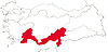
Rural districts RegionsAegean Black Sea Central Anatolia Eastern Anatolia Marmara Mediterranean Southeastern Anatolia Categories:- Districts of Osmaniye
- Mediterranean Region, Turkey
- Populated places in Osmaniye Province

Wikimedia Foundation. 2010.