- Nagahama, Shiga
-
Nagahama
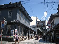
長浜市— City — Kurokabe square and main shopping street of central Nagahama 
FlagLocation of Nagahama in Shiga Coordinates: 35°23′N 136°17′E / 35.383°N 136.283°ECoordinates: 35°23′N 136°17′E / 35.383°N 136.283°E Country Japan Region Kansai Prefecture Shiga Government - Mayor Nobuya Kawashima Area - Total 680.79 km2 (262.9 sq mi) Population (August 1, 2011) - Total 122,280 - Density 180/km2 (466.2/sq mi) Time zone Japan Standard Time (UTC+9) Phone number 0749-62-4111 Address 12-34 Takada-chō, Nagahama-shi, Shiga-ken
526-8501Website City of Nagahama Nagahama (長浜市 Nagahama-shi) is a city located in Shiga Prefecture, Japan on the eastern shore of Lake Biwa. The city center was developed and renamed by Toyotomi Hideyoshi when Hideyoshi moved his center of administration from Odani Castle. Kunitomo (国友), the northeast of Nagahama, had been known for the production of arquebuses and guns since 1544.
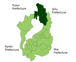
On February 13, 2006, the towns of Azai and Biwa from Higashiazai District merged with the city to create the current city of Nagahama, which replaced all municipal organizations—including the old city of Nagahama itself. The current city is now historically located within three former districts; Sakata District, Higashiazai District and Ika District.
Contents
The naming
Nagahama used to be known as Imahama (今濱), but Toyotomi Hideyoshi renamed it Nagahama for Oda Nobunaga. It is not related to same name area in Fukuoka city and same name town in Ehime Prefecture.
History
On April 1, 1943, the town of Nagahama from Sakata District merged with 6 other towns to gain city status. The last population count was held on December 1, 2005, and the city had the population of 63,057. The total area was 45.50km².
On February 13, 2006, the towns of Azai and Biwa from Higashiazai District merged with the city to create the current city of Nagahama. As a result of the city's annexation of Azai and Biwa in 2006, the total population stood at 84,410.
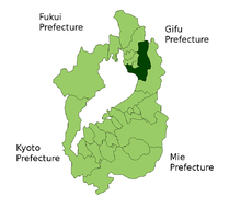
On January 1, 2010, several municipalities were merged into the city of Nagahama. Kohoku and Torahime in Higashiazai District and Kinomoto, Nishiazai, Takatsuki, and Yogo in Ika District and merged into Nagahama. Both districts were thereby dissolved.[1]
Sightseeing
Nagahama is one of the most famous tourism city in Shiga. Attractions to be found in the city include:
- Central Nagahama
- Nagahama Castle
- Kurokabe Square (aka "Black Wall Square")
- The Old Nagahama Station Museum, built in 1882 and the oldest preserved railroad station in Japan.
- The Nagahama Roman Beer Brewery
- Nagahama Flintlock Gun Museum
- Nagahama Hachimangu Shrine
- Daitsu-ji Temple
- Shana-in Temple
- Soji-ji Temple
- Jinsho-ji Temple
- Chizen-in Temple
- Hōkoku Shrine
- Nagahama Hikiyama Festival event in April 13-16, every year, since Azuchi-Momoyama period.
- Nagahama Bonbai (bonsai of ume) event in January 20 to March 10, every year, since 1952.[2]
- Tonda Traditional Bunraku Puppet Troupe
- Chikubu Island
- Odani Castle
- Anegawa River
- Mount Shizugatake
- Lake Yogo
Sister cities
The following cities were once sister cities of the former city of Nagahama.
Within Japan
Outside Japan
Gallery
-
Kaiyodo Figure Museum Kurokabe
References
- ^ http://www.kokudo.or.jp/new/cities/sub/chubu/20.htm
- ^ Nagahama city. "長浜盆梅展のはじまり [The origin of Nagahama Bonbai]" (in Japanese). http://www.nagahamashi.org/bonbai/rekisi.htm. Retrieved 2011-08-28.
External links
- Official website (Japanese)
- Nagahama Tourism Association (Japanese)
 Shiga Prefecture
Cities 
Echi District Gamō District Inukami District See also: List of mergers in Shiga Prefecture Categories:- Cities in Shiga Prefecture
- Central Nagahama
Wikimedia Foundation. 2010.


