- Muskoka Lakes
-
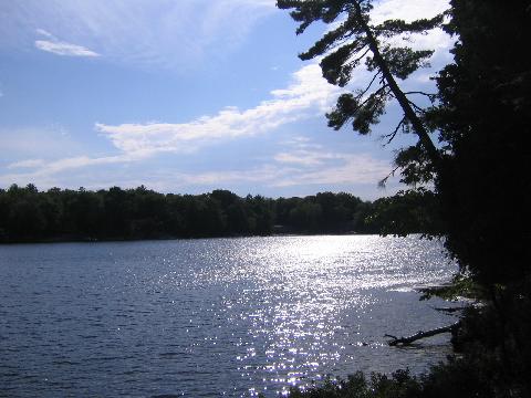
Township of Muskoka Lakes — Township — A typical lake scene in Muskoka Lakes.
Country  Canada
Province  Ontario
Regional Municipality Muskoka Established 1971 Government – Type Township – Mayor Alice Murphy – Governing Body Muskoka Lakes Township Council – MP Tony Clement (CPC) – MPP Norm Miller (OPC) Area – Total 781.55 km2 (301.8 sq mi) Population (2006)[1] – Total 6,467 – Density 8.3/km2 (21.5/sq mi) Time zone EST (UTC-5) – Summer (DST) EDT (UTC-4) Postal code span Area code(s) 705 Website Township of Muskoka Lakes The Township of Muskoka Lakes is an area municipality of the District Municipality of Muskoka, Ontario. It has a year-round population of 6,467 and a summer population of 34,000.
Contents
History and government
The area now covered by the township was opened for settlement and organized in 1870 into the following geographic (and sometime municipal) townships of Watt, Cardwell, Humphrey, Christie, Medora and Wood.
In 1971, the current municipal structure took hold when Cardwell Township, Watt Township, Medora and Wood Townships, Bala, Port Carling, Windermere and part of Monck Township were merged.
The municipal offices are located in Port Carling.
Communities
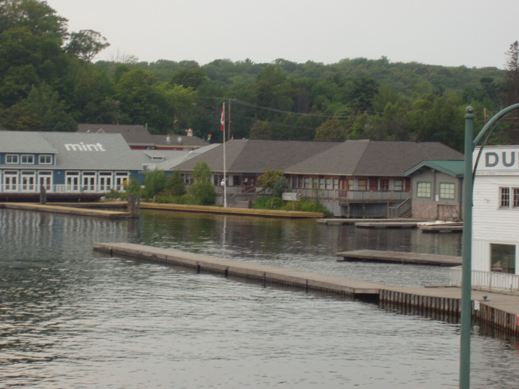
 Steamboat Bay in Port Carling.
The township contains the communities of Bala, Bala Park, Bardsville, Barlochan, Beaumaris, Baysville, Bear Cave, Beatrice, Bent River, Brackenrig, Cedar Village, Dee Bank, Dixon's Corners, Dudley, Duffy, Echo Beach, Ferndale, Foot's Bay, Glen Orchard, Gregory, Gull Rock, Hekkla, Inverness Lodge, Juddhaven, Mendora, Milford Bay, Minett, Morinus, Mortimers Point, Park Beach, Port Carling, Port Keewaydin, Port Sandfield, Raymond, Redwood, Roderick, Rossclair, Rosseau Falls, Rostrevor, Shannon Hall, Sunset Beach, Thorel House, Tomelin Bluffs, Torrance, Ufford, Ullswater, Valley Green Beach, Walkers Point, Willow Beach, Whiteside, Windermere, Woodington, Woodward Station and Ziska.
Geography and economy
The township is located on Canadian Shield and thus is marked with outcrops of igneous rock and evergreen trees. Although inland from both Lake Huron's Georgian Bay and Lake Simcoe, the township contains the Muskoka Lakes consisting of Lake Muskoka, Lake Rosseau and Lake Joseph, amongst many other smaller lakes.
Timber was initially the greatest economic attraction for the region. The soil is poor and rocky and consequently is not especially suited to agriculture.
As the resource industries dried up, the area soon latched onto tourism as its economic base based on its proximity to Toronto and the rest of Southern Ontario. For many Ontarians, this is the centre of cottage country.
Demographics
Racial groups
- 97.1% White
- 2.0% Aboriginal
- 0.3% Chinese
- 0.2% Black
- 0.4% other
Religious groups
- 58.8% Protestant
- 17.4% Roman Catholic
- 2.0% other Christian
- 21.8% non-religion
People from Muskoka
- Viola R. MacMillan
See also
- YMCA Camp Pine Crest near Torrance
External links
- Township of Muskoka Lakes
- Muskoka Lakes Association residents' organization
- Muskoka Area Attractions
- Township of Muskoka Lakes Ratepayers' Association organizational site
- Muskoka Lakes Chamber of Commerce business site
- Boating Muskoka Lakes

The Archipelago (south part) Seguin McMurrich/Monteith Georgian Bay Twp., Wahta Mohawk Territory 
Huntsville  Muskoka Lakes

Severn Gravenhurst Bracebridge Towns Townships First Nations Coordinates: 45°06′55″N 79°34′40″W / 45.11528°N 79.57778°W
Categories:- Township municipalities in Ontario
- Municipalities in Muskoka District, Ontario
Wikimedia Foundation. 2010.