- Chatham (town), New York
-
Chatham, New York — Town — Old Chatham, NY Location within the state of New York
 Chatham, New York
Coordinates: 42°25′05″N 73°34′35″W / 42.41806°N 73.57639°WCoordinates: 42°25′05″N 73°34′35″W / 42.41806°N 73.57639°W Country United States State New York County Columbia Established 1795 Government – Type Town Council – Town Supervisor Jesse DeGroodt (D, R) – Town Council Members' ListArea – Total 53.5 sq mi (138.7 km2) – Land 53.3 sq mi (138.0 km2) – Water 0.3 sq mi (0.7 km2) Elevation 239 ft (73 m) Population (2000) – Total 4,249 – Density 79.8/sq mi (30.8/km2) Time zone Eastern (EST) (UTC-5) – Summer (DST) EDT (UTC-4) ZIP code 12037 Area code(s) 518 FIPS code 36-14014 GNIS feature ID 0978814 Website Town of Chatham, NY Chatham is a town in Columbia County, United States. New York, United States. The population was 4,249 at the 2000 census.
The Town of Chatham has a village also called Chatham on its south town line. The town is at the north border of Columbia County.
Contents
History
The early settlers were Dutch, but later Quakers and New Englanders arrived. The Town of Chatham was formed from the Towns of Canaan and Kinderhook in 1795. Contradictory of its current condition or image, Chatham, in fact, was an industrial center of multiple inter-state rail lines in the early 1900s, including the Boston and Albany Line, as well as the New York Central line, from the Harlem Valley.
Geography
According to the United States Census Bureau, the town has a total area of 53.5 square miles (138.7 km²), of which, 53.3 square miles (138.0 km²) of it is land and 0.3 square miles (0.7 km²) of it (0.50%) is water.
The north town line is the border of Rensselaer County, New York.
The north end of the Taconic State Parkway is in the town and Interstate 90 passes through the town.
New York State Route 66 and New York State Route 203 intersect in the town.
Adjacent towns and areas
The Town of Kinderhook is to the west, and the Town of Canaan is to the east. The Towns of Schodack and Nassau are to the north in Rensselaer County. The Towns of Austerlitz and Ghent are to the south.
Demographics
As of the census[1] of 2000, there were 4,249 people, 1,762 households, and 1,196 families residing in the town. The population density was 79.8 people per square mile (30.8/km²). There were 2,110 housing units at an average density of 39.6 per square mile (15.3/km²). The racial makeup of the town was 96.00% White, 1.74% Black or African American, 0.21% Native American, 0.71% Asian, 0.16% Pacific Islander, 0.16% from other races, and 1.01% from two or more races. Hispanic or Latino of any race were 0.75% of the population.
There were 1,762 households out of which 29.4% had children under the age of 18 living with them, 56.1% were married couples living together, 8.3% had a female householder with no husband present, and 32.1% were non-families. 25.1% of all households were made up of individuals and 8.3% had someone living alone who was 65 years of age or older. The average household size was 2.41 and the average family size was 2.87.
In the town the population was spread out with 23.5% under the age of 18, 5.7% from 18 to 24, 24.6% from 25 to 44, 33.0% from 45 to 64, and 13.2% who were 65 years of age or older. The median age was 43 years. For every 100 females there were 96.0 males. For every 100 females age 18 and over, there were 93.1 males.
The median income for a household in the town was $49,234, and the median income for a family was $60,097. Males had a median income of $40,067 versus $26,452 for females. The per capita income for the town was $28,599. About 4.8% of families and 6.6% of the population were below the poverty line, including 6.6% of those under age 18 and 4.6% of those age 65 or over.
Communities and locations in the Town of Chatham
- Chatham – The Village of Chatham is partly in the town by the south town line.
- Chatham Center – A hamlet on NY-66 north of Chatham village.
- East Chatham – A hamlet at the east town line east of Old Chatham.
- Kinderhook Lake – A lake partly in the town by the west town line.
- Malden Bridge – A hamlet in the north part of the town, east of North Chatham.
- New Concord – A hamlet east of Rock City by the east town line.
- North Chatham – A hamlet by the north town line.
- Old Chatham – A hamlet in the northeast quadrant of the town. It is one of the earliest settlements in the town.
- Rayville – A hamlet near the east town line, northeast of Old Chatham on NY-66.
- Riders – A hamlet in the northeast quadrant of the town between Riders Mills and Rayville.
- Riders Mills – A hamlet in the northeast part of the town. Home of Michael Flemming.
- Rock City – A hamlet northeast of Chatham village.
References
- ^ "American FactFinder". United States Census Bureau. http://factfinder.census.gov. Retrieved 2008-01-31.
External links
- Town of Chatham, NY
- Chatham Public Library
- Historical information about Chatham, NY
- Chatham information (rather out of date at this point)
- Shaker Museum, Old Chatham
Municipalities and communities of Columbia County, New York City 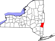
Towns Ancram | Austerlitz | Canaan | Chatham | Claverack | Clermont | Copake | Gallatin | Germantown | Ghent | Greenport | Hillsdale | Kinderhook | Livingston | New Lebanon | Stockport | Stuyvesant | Taghkanic
Villages Chatham | Kinderhook | Philmont | Valatie
CDPs Other
hamletsBoston Corner‡ | East Chatham | Old Chatham | Stuyvesant Falls
Footnotes ‡This populated place also has portions in an adjacent county or counties
Categories:- Towns in New York
- Populated places in Columbia County, New York
- Populated places established in 1795


Wikimedia Foundation. 2010.