- Claverack-Red Mills, New York
-
Claverack-Red Mills, New York — CDP — Location within the state of New York
 Claverack-Red Mills, New York
Coordinates: 42°13′31″N 73°43′17″W / 42.22528°N 73.72139°WCoordinates: 42°13′31″N 73°43′17″W / 42.22528°N 73.72139°W Country United States State New York County Columbia Area - Total 2.9 sq mi (7.6 km2) - Land 2.9 sq mi (7.6 km2) - Water 0.0 sq mi (0.0 km2) Population (2010) - Total 913 Time zone Eastern (EST) (UTC-5) - Summer (DST) EDT (UTC-4) FIPS code 36-16050 Claverack-Red Mills is a census-designated place (CDP) in Columbia County, New York, United States. The population was 913 at the 2010 census.
The census region is in the western part of the Town of Claverack and derives its name from the two hamlets of Claverack and Red Mills.
This place has a number of historic buildings, including the Harriet Phillips Bungalow. From 1779 to 1902 the Claverack College operated in the village.
Geography
Claverack-Red Mills is located at 42°13′31″N 73°43′17″W / 42.22528°N 73.72139°W (42.225214, -73.721449)[1].
According to the United States Census Bureau, the CDP has a total area of 2.9 square miles (7.5 km2), of which, 2.9 square miles (7.5 km2) of it is land and 0.34% is water.
Demographics
As of the census[2] of 2000, there were 1,061 people, 470 households, and 308 families residing in the CDP. The population density was 362.0 per square mile (139.8/km²). There were 510 housing units at an average density of 174.0/sq mi (67.2/km²). The racial makeup of the CDP was 97.74% White, 0.75% African American, 0.09% Native American, 0.38% from other races, and 1.04% from two or more races. Hispanic or Latino of any race were 0.94% of the population.
There were 470 households out of which 24.3% had children under the age of 18 living with them, 54.3% were married couples living together, 9.1% had a female householder with no husband present, and 34.3% were non-families. 30.0% of all households were made up of individuals and 14.9% had someone living alone who was 65 years of age or older. The average household size was 2.26 and the average family size was 2.79.
In the CDP the population was spread out with 18.9% under the age of 18, 4.9% from 18 to 24, 23.3% from 25 to 44, 29.5% from 45 to 64, and 23.5% who were 65 years of age or older. The median age was 47 years. For every 100 females there were 98.7 males. For every 100 females age 18 and over, there were 92.6 males.
The median income for a household in the CDP was $49,476, and the median income for a family was $60,677. Males had a median income of $41,591 versus $32,222 for females. The per capita income for the CDP was $30,237. None of the families and 3.1% of the population were living below the poverty line, including no under eighteens and 7.1% of those over 64.
References
- ^ "US Gazetteer files: 2010, 2000, and 1990". United States Census Bureau. 2011-02-12. http://www.census.gov/geo/www/gazetteer/gazette.html. Retrieved 2011-04-23.
- ^ "American FactFinder". United States Census Bureau. http://factfinder.census.gov. Retrieved 2008-01-31.
Municipalities and communities of Columbia County, New York County seat: Hudson City 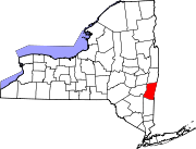
Towns Ancram | Austerlitz | Canaan | Chatham | Claverack | Clermont | Copake | Gallatin | Germantown | Ghent | Greenport | Hillsdale | Kinderhook | Livingston | New Lebanon | Stockport | Stuyvesant | Taghkanic
Villages Chatham | Kinderhook | Philmont | Valatie
CDPs Claverack-Red Mills | Copake Lake | Germantown | Ghent | Lorenz Park | Niverville | Stottville
Other
hamletsBoston Corner‡ | East Chatham | Old Chatham | Stuyvesant Falls
Footnotes ‡This populated place also has portions in an adjacent county or counties
Categories:- Claverack, New York
- Census-designated places in New York
- Populated places in Columbia County, New York


Wikimedia Foundation. 2010.