- Marmion Avenue, Perth
Infobox Australian Road
road_name = Marmion Avenue
route_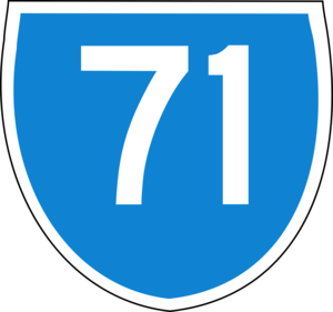
route_
route_
photo =
caption =
length = 27
direction = South-North
start = Karrinyup Road, Trigg
finish = Butler
est = 1960s
through = Hillarys, Ocean Reef, Quinns Rocks & Jindalee
route = part of State Route 71
exits =Reid Highway , Hepburn Avenue, Ocean Reef Road, Burns Beach RoadMarmion Avenue is a major arterial road in
Perth, Western Australia . It runs through the northern coastal suburbs of Perth from the end ofWest Coast Highway in Karrinyup to the newly developed areas of Butler & Jindalee. Its speed limit is 80km/h, dropping to 70km/h past Hester Avenue. It is designated State Route 71. It is a Highway Grade road, being Dual Carriageway for its entire length, with two lanes each way. It generally runs parallel to the coast at a distance of one or two kilometres, and provides an important link to Fremantle and to the outer northern suburbs.History
Marmion Avenue was first created as an arterial road that tracked the then-new outer northern suburbs of Perth, following the outer northern limit as it expanded. Its namesake, the suburb of Marmion was the start of the road in the late 1960s, when it was an arterial road from Warwick to then-remote Mullaloo Beach. Until the early 1980s, the road was a single carriageway. In 1984-85,
West Coast Highway , the main road from Scarborough and Fremantle, was brought inland from Pearl Parade and joined to the end of Marmion Avenue at Karrinyup Road, and Marmion Avenue - now the most important road in the coastal suburbs - was dualled to Whitfords Avenue. In early 1986, it was assigned State Route 71, and from then on, it was gradually extended as a single carriageway road further north - extending first to Ocean Reef Road, then Shenton Avenue, Burns Beach Road and then in the mid-1990s fully extended to Quinns Rocks. Marmion Avenue was completely dualled in2001 , with the last portion being the empty stretch between Burns Beach Road & Quinns Rocks.Marmion Avenue is an important road for those in the northern suburbs, especially those living beyond the end of the
Mitchell Freeway and in the broader suburban region of Joondalup. It is generally referred to by locals as just "The Marmion" or as "Marmion Av".Future Extensions
At present, Marmion Avenue ends at Kingsbridge Boulevard in Butler (part of the Brighton Estate), and was due to be constructed as a single carriageway to Yanchep in
2004 . The extended stretch will finish at the large roundabout at Yanchep Beach Road and Lagoon Drive, Yanchep. It is rumoured that the extension to Yanchep would be completed by October 2008.The completion will allow the future
Satellite city of Alkimos/Eglinton to start construction. Currently the extension is being delayed due to disagreements at State Government level about what route the road should follow. This extension will be built in one go as a single road with no intersections past its present terminus, serving as a link to a growing Yanchep. Extensions after this are possible to Two Rocks, however there are no plans for this at present - one possible complication would be Two Rocks's past use as a munitions dump, meaning that most non-suburban sections of the suburb are fenced off.Major Intersections
Marmion Avenue starts at the end of
West Coast Highway at the Karrinyup Road intersection in Trigg, and currently ends at theKingsbridge Boulevard &Jindalee Boulevard Junction in Butler/Jindalee. All major intersections are controlled by traffic lights, or in some cases very large roundabouts.
*.
*
*Beach Road, Carine, Duncraig and Marmion
*
*
*
*
*Hodges Drive, Ocean Reef, Heathridge and Connolly
*Shenton Avenue, Ocean Reef, Connolly, Iluka and Currambine
*
*Grand Ocean Entrance Burns Beach/Edbinburgh Avenue, Kinross
*Anchorage Drive/Neerabup Road, Mindarie and Clarkson
*Hester Avenue, Mindarie and Clarkson
*Kingsbridge Boulevard/Jindalee Boulevard, Jindalee and ButlerReferences
*Various UBD & Perth Metropolitan Street Directories - 1970s-1990s
* [http://www.landonline.com.au/skyviewwa/content/asp/skyviewwa_index.asp?product_group_id=78 Skyview WA - Department of Land Information, Western Australia]ee also
*
West Coast Highway
*List of major roads in Perth, Western Australia

Wikimedia Foundation. 2010.