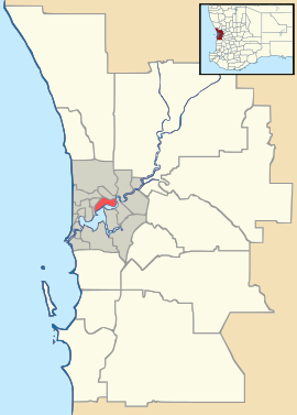
- Ocean Reef, Western Australia
-
Ocean Reef
Perth, Western AustraliaPopulation: 8,090 (2006 census)[1] Postcode: 6027 Location: 28 km (17 mi) NNW of Perth LGA: City of Joondalup State District: Ocean Reef Federal Division: Moore Suburbs around Ocean Reef: Iluka Currambine Indian Ocean Ocean Reef Connolly
HeathridgeMullaloo Beldon Coordinates: 31°45′07″S 115°44′06″E / 31.752°S 115.735°E
Ocean Reef is a suburb in northern Perth, Western Australia. It is located within the City of Joondalup. The name was coined by developers in the 1970s from the line of a reef visible several kilometres offshore. The name was formally adopted in 1974, replacing the prior name of Beaumaris, a name still retained by one of the shopping centres and one primary school.
The suburb is divided in two by Hodges Drive, with the development to the south often referred to as 'old' Ocean Reef (there are only a few years between the two). The boat harbour sits on this midway point at the western end of Hodges Drive, and there is a shopping centre in each end of the suburb - Beaumaris Shopping Centre in the north and Ocean Reef Shopping Centre to the south. Roadworks have recently been completed to extend the foreshore road from Hodges Drive (south) to Shenton Ave (north), extending the 'Sunset Coast' drive into the adjacent suburb of Iluka.
Plans have been in development for several years to expand the Ocean Reef Boat Harbour into an entertainment centre to help with the overspill from the popular Hillarys Boat Harbour development to the south. Delays with this development are exacerbated at the moment by the lack of an elected council in the city of Joondalup, due to their sacking by the local government minister some two years previously. There are different opinions as to this expansion. Many people want it to be kept as just a public launching ramp for boats and a small fishing harbour, whereas other people want it to be more "modernised" and for some closer to home entertainment.
Ocean Reef is served by three primary schools (Beaumaris Primary, St Simon Peter Catholic Primary, and Ocean Reef Primary).
A dune walkway and cycle path hugs the coast from south to north, offering access to several small beaches, picnic areas, rest stops, and access paths into the suburb itself. A large protected dune area which is at times around 400 hundred metres wide separates the houses from the Indian Ocean.
Senior and Tertiary Education
Ocean Reef contains three Primary Schools:
- Ocean Reef Primary School (public)
- Beaumaris Primary School (public)
- Saint Simon Peter Catholic Primary School (private)
Ocean Reef also contains two High Schools:
- Ocean Reef Senior High School (public)
- Prendiville Catholic College (private)
References
- ^ Australian Bureau of Statistics (25 October 2007). "Ocean Reef (State Suburb)". 2006 Census QuickStats. http://www.censusdata.abs.gov.au/ABSNavigation/prenav/LocationSearch?collection=Census&period=2006&areacode=SSC52096&producttype=QuickStats&breadcrumb=PL&action=401. Retrieved 2008-10-05.
Suburbs of the City of Joondalup | Perth | Western Australia North Burns Beach · Connolly · Currambine · Edgewater · Heathridge · Iluka · Joondalup · Kinross · Ocean Reef
South Categories:- Suburbs of Perth, Western Australia
Wikimedia Foundation. 2010.

