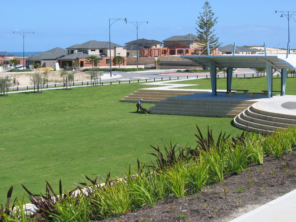
- Jindalee, Western Australia
Infobox Australian Place | type = suburb
name=Jindalee
city=Perth
state=wa
caption=Park on Jindalee Boulevard.
lga=City of Wanneroo
area=3
postcode=6036
dist1=40
location1=Perth
fedgov=Pearce
stategov=Mindarie
near-nw=
near-n=Alkimos
near-ne=
near-w=
near-e=Butler
near-sw=
near-s=Quinns Rocks
near-se=Merriwacoord|-31.651|115.692|type:city(200)_region:AU-WA_scale:30000|format=dms|display=titleJindalee is a developing outer northern suburb in the
Western Australia n capital city of Perth, located approximately convert|40|km|mi|0 north of Perth'scentral business district on theIndian Ocean . Its local government area is theCity of Wanneroo .History
The name Jindalee was proposed by the Shire of Wanneroo on 29 June 1979 and is an imported Aboriginal word from an unknown New South Wales dialect meaning "a bare hill", possibly referring to Eglinton Hill which is covered in low vegetation. [LandInfo WA|m|J|2007-05-01] The suburb of Jindalee in south-western Brisbane, applied in 1964, notes the same word origin. [cite web|url=http://www.nrm.qld.gov.au/property/placenames/detail.php?id=41946|title=Place Names Online Search - Jindalee (QLD)|author=Queensland Department of Natural Resources and Water|month=May|year=2006|accessdate=2006-10-08]
Current/Future Development
The planning of Jindalee goes back to 1997, but the Butler-Jindalee District Structure Plan was approved on 18 November 2003 by the WA Planning Commission. Satterley Property Group is managing the development (titled "Brighton Beachside") in conjunction with the Department of Housing and Works, and around 900 residential lots are proposed, all of which will have high-speed internet, cable TV and underground power. A small cafe/shopping node on the beachfront at the end of Jindalee Boulevard has yet to be approved. Approximately 15% of the lots have been developed and the projected completion date is 2010. [ [http://www.wapc.wa.gov.au/Coast/Perth+coastal+planning+strategy/north%20low%20res.pdf Perth Coastal Planning Strategy] , WA Planning Commission, 2005. Accessed 29 September 2006.] [ [http://www.satterley.com.au/go/residential-estates/brighton-beachside Brighton Beachside] , Satterley Property Group, 2006. Accessed 2006-09-29.]
Geography
Jindalee is bounded by an east-west line near Eglinton Rocks to its north,
Marmion Avenue to the east, Hampshire Drive to the south and the Indian Ocean to the west. Approximately 75% of the suburb is still within its native state.cite book|title=StreetSmart Perth Street Directory|edition=48 (2007)|pages=Maps 158-159|author=Department of Land Information|publisher=West Australian Newspapers Ltd]Jindalee had a nil population at the ABS 2001 census.
Facilities
Jindalee has no conventional facilities at the present stage, apart from a medical centre on Jindalee Boulevard. Brighton Village Shopping Centre on the suburb's eastern border provides basic shopping needs, and Butler Primary School is nearby.
Eglinton Hill provides views of the ocean and the scrub leading north towards Eglinton and Yanchep, and almost untouched beaches continuous almost to Yanchep are accessible by sand tracks. The undeveloped part of the suburb offers a wide array of native scrubland, woodland and heath, varying in condition from excellent to completely degraded, and including
Xanthorrhoea preissii (commonly known as "black boys"),banksia ,sheoak and Nuytsia floribunda. Some degradation has occurred due to uncontrolled vehicular access, clearing for stock grazing, fire and rabbits. [ [http://www.planning.wa.gov.au/comment/amendments/1029/EnviroReports/1%20Environmental%20Review.pdf Environmental Review: Alkimos/Eglinton (MRS Amendment 1029/33)] , WA Planning Commission, 2003, p.45 etc. (Large PDF)]Transport
Jindalee is served by a deviation of the 483 bus between Clarkson train station and Butler along Marmion Avenue. [ [http://www.transperth.wa.gov.au/timetablePDFs/Northern%2078%2020070429.pdf Northern 78 timetable] , Transperth, effective 29 April 2007. Accessed 1 May 2007.] This service is operated by
Path Transit .Politics
Jindalee's political leanings are unclear as there were a negligible number of residents at the time of the last Federal and State elections.
References
Wikimedia Foundation. 2010.
