- Nowergup, Western Australia
-
Nowergup
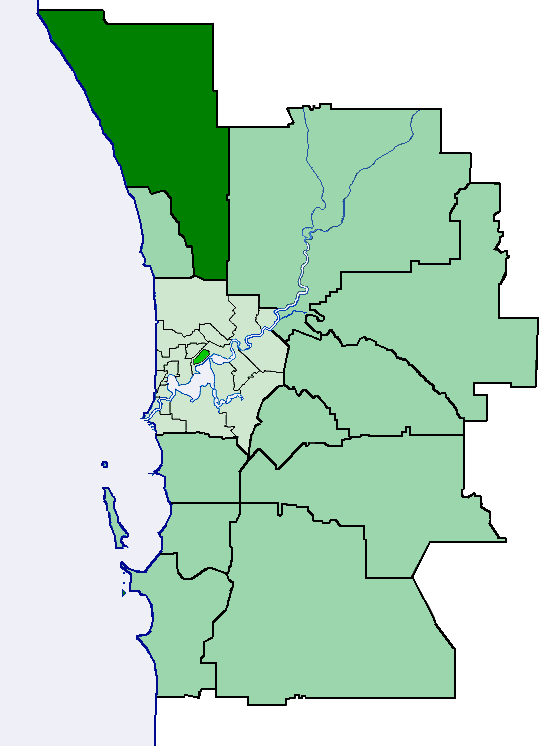
Perth, Western Australia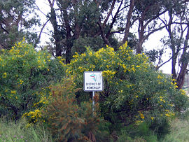

 Nowergup
Population: 211 (2006 census)[1] Postcode: 6032 Area: 40 km² (15.4 sq mi) Location: 40 km (25 mi) N of Perth City LGA: City of Wanneroo State District: Mindarie Federal Division: Pearce Suburbs around Nowergup: Alkimos Carabooda Butler Nowergup Pinjar Ridgewood Neerabup Coordinates: 31°38′13″S 115°44′46″E / 31.637°S 115.746°E
Nowergup is a rural locality about 40 kilometres (25 mi) north of Perth, Western Australia. Its Local Government Area is the City of Wanneroo.
Contents
History
The suburb of Nowergup (sometimes spelled Nowgerup in earlier documents) takes its name from Lake Nowergup. The lake name was first recorded by Surveyor General John Septimus Roe in 1841, and is a Noongar Aboriginal word which possibly means "place of sweet water". It was approved as a suburb name in 1982.[2]
Geography
Nowergup is bounded by Romeo Road/Karoborup Road to the north, the proposed Mitchell Freeway to the west, Pinjar Road to the east and Hester Avenue and Wattle Avenue to the south.[3]
At the ABS 2006 census, Nowergup had a population of 211 people living in 76 dwellings.[1]
Lake Nowergup
Largest fresh water lake in Perth surrounds, Western Australia.
Facilities
Nowergup is a sparsely populated agricultural suburb. Several plant nurseries, the Ocean View Tavern and the Nowergup Lake wetland and fauna sanctuary are situated along Wanneroo Road. The western strip between Wanneroo Road and the proposed Mitchell Freeway is approximately the northern half of the Neerabup National Park. The area also contains most of the Pinjar Pine Plantation, numerous sand and limestone quarries and a Water Corporation biosolids facility. Barbagallo Raceway, WA's premier motorsport facility, is located just beyond Nowergup's southern border.
The Nowergup Depot is located off Hester Avenue and currently marks the end of the Joondalup railway line.[3]
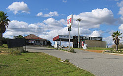 Ocean View Tavern on Wanneroo Road.
Transport
Nowergup was formerly served by the Transperth 490 bus route between Clarkson train station and Two Rocks along Wanneroo Road. However, the service was relocated to Marmion Avenue on 14 December 2008 and the suburb is presently not served.[4]
Politics
Nowergup's political leanings are unclear due to its small size and the lack of a polling booth. The nearest large booths tend to favour the Australian Labor Party historically, although most have been won by the Coalition in recent times, especially at federal level.
References
- ^ a b Australian Bureau of Statistics (25 October 2007). "Community Profile Series : Nowergup (State Suburb)". 2006 Census of Population and Housing. http://www.censusdata.abs.gov.au/ABSNavigation/prenav/ProductSelect?newproducttype=Community+Profiles&collection=Census&period=2006&areacode=SSC52081&breadcrumb=LP¤taction=201&action=401. Retrieved 15 July 2011.
- ^ Western Australian Land Information Authority. "History of metropolitan suburb names". http://www.landgate.wa.gov.au/corporate.nsf/web/History+of+metropolitan+suburb+names. Retrieved 2007-06-22.
- ^ a b Department of Land Information. StreetSmart® Perth Street Directory (50 (2009) ed.). West Australian Newspapers Ltd. pp. Maps 129-130; 159-161. ISBN 978-1-921048-28-9.
- ^ Transperth (4 December 2008). "Route 490 & new School Special 718 - service change". http://www.transperth.wa.gov.au/ServiceUpdates/ServiceChanges/tabid/132/newsid568/856/Default.aspx. Retrieved 26 May 2010.
Suburbs and localities of the City of Wanneroo | Perth | Western Australia North West 
North East South Alexander Heights · Darch · Girrawheen · Koondoola · Landsdale · Madeley · Marangaroo · Wangara · Woodvale¹
¹ Suburb shared with the City of JoondalupCategories:- Suburbs of Perth, Western Australia
- Australian Aboriginal placenames


Wikimedia Foundation. 2010.