- Cherry Run, West Virginia
-
Cherry Run — Unincorporated hamlet — Location within the state of West Virginia
 Cherry Run
Coordinates: 39°37′39″N 78°2′2″W / 39.6275°N 78.03389°WCoordinates: 39°37′39″N 78°2′2″W / 39.6275°N 78.03389°W Country United States State West Virginia County Morgan Time zone Eastern (EST) (UTC-5) – Summer (DST) EDT (UTC-4) ZIP codes FIPS code GNIS feature ID Cherry Run is a small unincorporated hamlet located along the CSX Transportation (formerly Baltimore and Ohio Railroad) mainline on the Potomac River in Morgan County in the U.S. state of West Virginia. The community is named for the stream, Cherry Run, that meets the Potomac in its vicinity. It was originally known as Cherry Run Depot because of the important interchange between the B&O and the Western Maryland Railway located there.
The last remnant of the interchange was Miller Tower,[1] an interlocking tower controlling the junction. The tower was closed in September 2000, disassembled, and moved to the Martinsburg Shops site in February 2001. It was eventually reassembled there in November 2005.
Across the Potomac from Cherry Run lies Big Pool on the Chesapeake and Ohio Canal.
Cherry Run is reached by Householder Road (WV Secondary Route 10) from the west and both Cherry Run Road (WV Secondary Route 5) and Fulton Road (WV Secondary Route 1/5) from Martinsburg Road (West Virginia Route 9) to the south. On the B&O mainline, Cherry Run is located between Hancock to its west and Little Georgetown in Berkeley County to its east.
References
- ^ "Reconstruction of Miller Tower". Bull Sheet Monthly News. http://www.bullsheet.com/news/atmqy.html. Retrieved 2008-08-01.
External links
- Miller Tower at Martinsburg Roundhouse Center - Berkeley County Roundhouse Authority
- Miller Tower Project - Semaphores.com
Municipalities and communities of Morgan County, West Virginia Towns 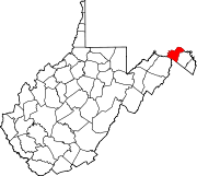
CDP Unincorporated
communitiesBerryville | Burnt Factory | Campbells | Cherry Run | Doe Gully | Duckwall | Green Ridge | Greenwood | Hancock | Hansrote | Holton | Jerome | Jimtown | Johnsons Mill | Largent | Lineburg | Magnolia | Mount Trimble | New Hope | North Berkeley | Oakland | Omps | Orleans Cross Roads | Redrock Crossing | Ridersville | Ridge | Rock Gap | Sir Johns Run | Sleepy Creek | Smith Crossroads | Spohrs Crossroads | Stotlers Crossroads | Unger | Woodmont | Woodrow
Categories:- Populated places in Morgan County, West Virginia
- Unincorporated communities in West Virginia
- Baltimore and Ohio Railroad
- Western Maryland Railway
- Populated places on the Potomac River
- Eastern Panhandle geography stubs


Wikimedia Foundation. 2010.