- Unorganized North Nipissing District
-
Unorganized Nipissing North Part — Unorganized territory — 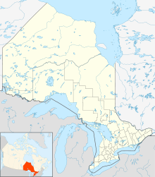
 Unorg. North Nipissing
Coordinates: 46°40′N 79°30′W / 46.667°N 79.5°WCoordinates: 46°40′N 79°30′W / 46.667°N 79.5°W Country  Canada
Province  Ontario
District Nipissing Settled Government – Federal riding Nipissing—Timiskaming – Prov. riding Timiskaming—Cochrane, Nipissing Area[1] – Land 3,749.48 km2 (1,447.7 sq mi) Population (2006)[1] – Total 1,798 – Density 0.5/km2 (1.3/sq mi) Time zone EST (UTC-5) – Summer (DST) EDT (UTC-4) Postal Code Area code(s) 705 Unorganized Nipissing North Part is an unorganized area in northeastern Ontario, Canada. It includes the unincorporated areas in northern Nipissing District north of the Mattawa River.
Communities
- Balsam Creek
- Eldee
- Redbridge
- Songis
- Thorne
- Tilden Lake
Demographics
According to the Canada 2006 Census:[1]
- Population: 1,798
- % Change (2001-2006): -3.1
- Area (km²): 3,749.48
- Density (persons per km²): 0.5
- Private dwellings, excluding seasonal cottages: 729 (total: 1078)
- Mother tongue:
- English as first language: 79.7 %
- French as first language: 19.1 %
- English and French as first language: 0 %
- Other as first language: 1.1 %
Population trend:[2]
- Population in 2006: 1798
- 2001 to 2006 population change: -3.1 %
- Population in 2001: 1856
- Population in 1996: 4149 (or 2016 when adjusted to 2001 boundaries)
- Population in 1991: 3911
References

Temagami Unorganized West Timiskaming Ottawa River / Laniel, Quebec Unorganized North Sudbury District 
Ottawa River, bridge to
Témiscaming, Quebec Unorganized North Nipissing

West Nipissing, Nipissing 10 North Bay, East Ferris, Bonfield, Calvin Mattawan Cities 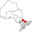
Towns Mattawa • Temagami • West NipissingTownships First Nations reserves Unorganized territories North Part • South PartSee also: Communities in Nipissing District • Census divisions of OntarioCategories:- Nipissing District, Ontario
- Unorganized areas in Ontario
- Northern Ontario geography stubs


Wikimedia Foundation. 2010.