- Unorganized South Nipissing District
-
Unorganized Nipissing South Part — Unorganized territory — The Barron Canyon in Algonquin Park

 Unorg. South Nipissing
Coordinates: 45°50′N 78°25′W / 45.833°N 78.417°W Country  Canada
Province  Ontario
District Nipissing Settled Government – Federal riding Nipissing—Timiskaming – Prov. riding Nipissing, Renfrew—Nipissing—Pembroke Area[1] – Land 6,704.78 km2 (2,588.7 sq mi) Population (2006)[1] – Total 67 – Density 0.01/km2 (0/sq mi) Time zone EST (UTC-5) – Summer (DST) EDT (UTC-4) Postal Code Area code(s) 705 Unorganized Nipissing South Part is an unorganized area in north-central Ontario, in the District of Nipissing. It makes up a large area and includes most of Algonquin Provincial Park.
Communities
- Acanthus
- Achray
- Brent
- Canoe Lake
- Coristine
- Daventry
- Government Park
- Kilrush
- Kiosk
- Lake Traverse
- Mink Lake
- Odenback
- Radiant
- Stuart
Demographics
According to the Canada 2006 Census (corrections and updates):[2]
- Population: 67
- % Change (1996–2001): +19.6
- Area (km²): 6,704.78
- Density (persons per km²): 0.01
- Private dwellings, excluding seasonal cottages: 25 (total: 99)
Population trend:[3]
- Population in 2006: 67
- 2001 to 2006 population change: 19.6 %
- Population in 2001: 51
- Population in 1996: 636 (or 77 when adjusted to 2001 boundaries)
- Population in 1991: 628
References
- ^ a b Statistics Canada 2006 Census - Nipissing, Unorganized, South Part community profile
- ^ Statistics Canada 2006 Census corrections and updates
- ^ Statistics Canada: 1996, 2001, 2006 census
Cities 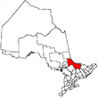
Towns Mattawa • Temagami • West NipissingTownships First Nations reserves Unorganized territories North Part • South PartSee also: Communities in Nipissing District • Census divisions of OntarioCoordinates: 45°50′N 78°25′W / 45.833°N 78.417°W
Categories:- Nipissing District, Ontario
- Unorganized areas in Ontario
- Northern Ontario geography stubs


Wikimedia Foundation. 2010.