- Mountain Railways of India
-
Mountain Railways of India * UNESCO World Heritage Site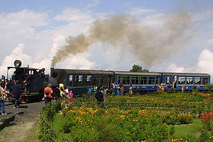

Country India Type Cultural Criteria ii, iv Reference 944 Region ** Asia-Pacific Inscription history Inscription 1999 (23rd Session) Extensions 1999 Darjeeling Himalayan Railway; 2005 Kalka-Shimla Railway; 2008 Nilgiri Mountain Railway * Name as inscribed on World Heritage List
** Region as classified by UNESCOThe Mountain Railways of India refer to the five railway lines built in the mountains of India in the nineteenth and early twentieth century, during the British Raj, which are run even today by the Indian Railways. Three out of these five railways, the Darjeeling Himalayan Railway (1881), the Kalka-Shimla Railway (1898) and the Kangra Valley Railway (1924), are located in the rugged hill regions of the Himalayas of Northern India and the other two are much further south in the Western Ghats; the Nilgiri Mountain Railway in Southern India, and the Matheran Hill Railway in Maharashtra. The Darjeeling Himalayan Railway, the Nilgiri Mountain Railway and the Kalka-Shimla Railway have been collectively designated as a UNESCO World Heritage Site entitled "Mountain Railways of India".[1][2][3] These five railways in India are part of around twenty similar lines of narrow gauge and metre gauge found in the world.[4]
All the five railway lines are still operational and connect to important hill resorts, from foot hills, winding through rugged and scenic mountainous terrains. Given the terrain that they were constructed on, in the British colonial period they were considered, "outstanding examples of the interchange of values on development in technology" and engineering marvels.[1][2][3]
Contents
History
The mountain railways in the hills emerged as a result of the delayed interest evinced during the British Raj for establishing control over the Himalayas and other mountain ranges of India. It was in 1844 that Sir John Lawrence, the then Viceroy of India,[5] had mooted the idea of phased colonization of hills, particularly as military garrisons. The British, in a proposal termed simply as ‘Hill Railway’, considered establishing geographically and culturally rich stations across the country. The hill stations chosen for this purpose were Shimla, the then capital of British India, Darjeeling, known for its tea gardens and scenic views of the Himalayas in the state of West Bengal, the Kangra Valley in Himachal Pradesh, the Ootacamund in the Nilgiri mountains of Tamilnadu and the Matheran hill station in the Western Ghats near Mumbai were considered.[2][6][7]
The pioneering effort to link mountainous terrain of enchanting beauty with a hill passenger railway commenced in 1878 with the building of the Darjeeling Himalayan Railway line, when Franklin Prestage of the then Eastern Bengal Railway initiated plans for the building of a hill tramway along the alignment of the Hill Cart Road from Siliguri to Darjeeling. Construction subsequently began, and in 1881 the line was commissioned up to Darjeeling.[2][6]
The next project launched was of the Nilgiri Mountain Railway in South India, a proposal which initially was proposed in 1854. Work started in 1894, but the railway was not completed until 1908, as the hill terrain was very difficult, given its wide fluctuation in altitude between 326 meters (1,070 ft) and 2,203 meters (7,228 ft) over a distance of 46 kilometers (29 mi). The building of the 96 kilometers (60 mi) Kalka Shimla Railway link commenced in 1898 to open up the remote hill regions to the rest of the country and was inaugurated by the British Viceroy Lord Curzon in November 1903. The Matheran–Narela toy train was commissioned in 1907; Matheran is a hill station 108 kilometers (67 mi) away from Mumbai. The Kangra line was built in 1929 in the picturesque Kangra valley.[1][2][3]
The World Heritage UNESCO recognition to three of the five Mountain Railways of India has been stated as for being "outstanding examples of bold, ingenious engineering solutions for the problem of establishing an effective rail link through a rugged, mountainous terrain."[1] The Darjeeling Himalayan Railway was recognized first in 1999, the Nilgiri Mountain Railway followed suite as an extension to the site in 2005, and in 2008 the Kalka–Shimla Railway was further added as an extension; and the three together have been titled as Mountain Railways of India under Criteria : ii, iv under the region in the Asia-Pacific. The claims of the Matheran Railway, the fourth hill line, is pending acceptance by the international body.[1][7]
The five Mountain Railway systems in India are:
- Darjeeling Himalayan Railway - 88 kilometers (55 mi) (1881) 610 mm (2 ft)
- Nilgiri Mountain Railway - 46 kilometers (29 mi) (1908) 762 mm (2 ft 6 in)
- Kalka-Shimla Railway - 95.66 kilometers (59.44 mi)
- Matheran Hill Railway - 20 kilometers (12 mi)
- Kangra Valley Railway - 164 kilometers (102 mi)
Darjeeling Himalayan Railway

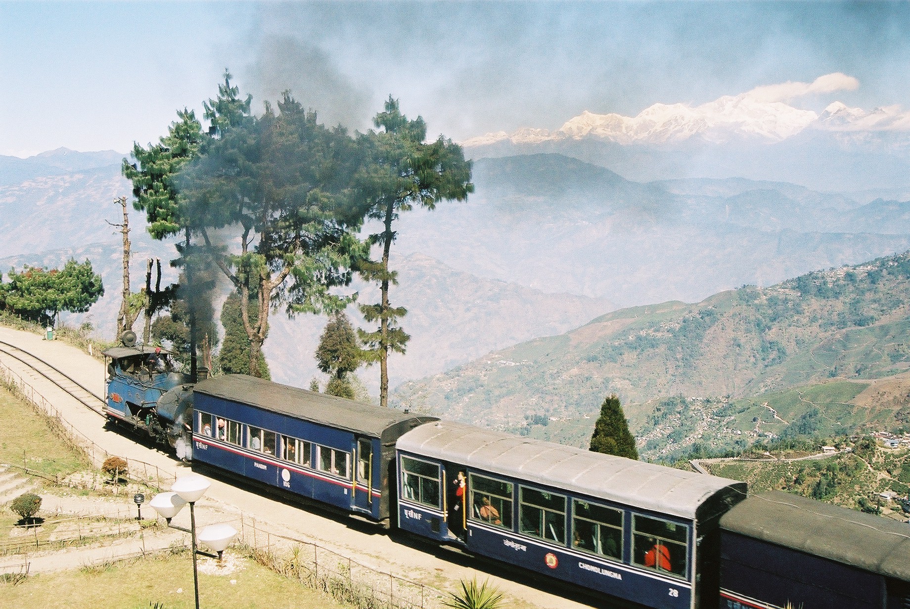
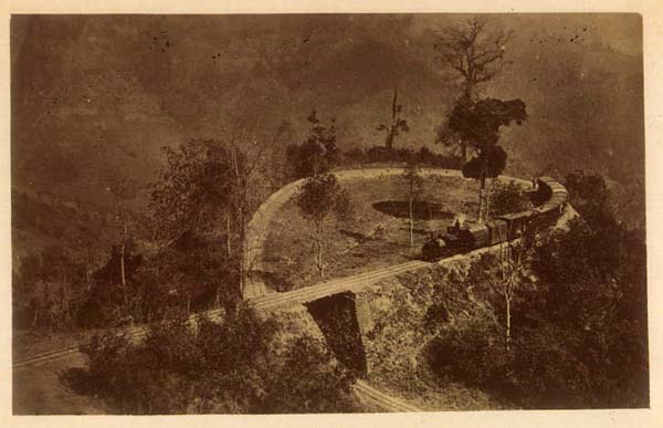
 Left: An excursion train (actually empty carriages returning to Siliguri) on the upper part of Batasia Loop. The Himalayan mountains (including Kanchenjunga) form the background. Right: The Loop Line on Darjeeling Himalayan Railway, 1921Main article: History of Darjeeling Himalayan Railway
The Darjeeling Himalayan Railway (DHR), given the epithet, the "Toy Train", is a 610 mm (2 ft) narrow–gauge railway that runs for 88 kilometers (55 mi) from Siliguri to Darjeeling in the Indian state of West Bengal, operated by the Indian Railways. Highly regarded in India to this day, the railway line was built by the British Government. Darjeeling was a major summer hill station and the centre of a flourishing tea-growing district. The elevation level along this line starting with about 100 meters (330 ft) at Siliguri rose to about 2,200 meters (7,200 ft) at Darjeeling but attained highest elevation at Ghoom station of 2,300 meters (7,500 ft).[8][9] The Siliguri town was connected with Calcutta (now called Kolkata) in 1878 while an alternative journey to Darjeeling used to be performed by tongas (horse-driven carts) along a dust track. On the recommendations of a Committee appointed by Sir Ashley Eden, the then Lt. Governor of the Government of West Bengal, and the request of Franklyn Prestage, the Agent of the Eastern Bengal Railway Company, work on the railway commenced in 1879 and was completed by July 1881.[10] [8]The railway line underwent several improvements over the years to ease the gradient of the line for convenience of manoeuvrability. By 1909–1910, Darjeeling Himalayan Railway was carrying 174,000 passengers and 47,000 tonnnes of goods annually. [9]
Important features incorporated in the line consisted of four loops (spirals) and four reverses (zigzags). The introduction of the first bogie carriages service replaced the very basic four wheel carriages and extensive improvements were made to the track and stations after the earthquake of 1897 and underwent further modernization under the Northeast Frontier Railway Zone of Indian Railway. It is still powered by a steam engine, although a modern diesel engine is used for the Darjeeling mail train. [10][8][11]
In 1999, this mountain line in India was the first to be recognized by the UNESCO Committee at its 23rd session held at Marrakech, Morocco. It was then inscribed on the World Heritage List under the following criteria (ii) and (iv). An assurance recorded was that apart that from creating a buffer zone under the declared heritage site, the steam trains would be retained within the site.[1]
Criterion (ii): The Darjeeling Himalayan Railway is an outstanding example of the influence of an innovative transportation system on the social and economic development of a multi-cultural region, which was to serve as a model for similar developments in many parts of the world. Criterion (iv): The development of railways in the 19th century has a profound influence on social and economic developments in many parts of the world. This process is illustrated in an exceptional and seminal fashion by the Darjeeling Himalayan Railway.[1]
The initial difficulties faced by the British engineer in charge of building this line from both ends of the tunnel was due to erosion in the precipitous hillside and negotiating a gradient within the limits of rail transport. It was then a remark by the engineer’s wife who suggested, “Darling if you can’t go ahead, why you don’t come back?” that created the inventive plan of climbing mountains adopting ‘Z’ reversing stations. In this plan, the train chugs forward up to the edge of the rock face, then reverses at a slanted angle up the hillside, again moves forward to a higher level above the original track. This helps to negotiate above the zone of land erosion. This layout of the extended line came to be popularly known as the ‘Z’ form. In the initial 40 years, there were four reversing stations and four complete loops. Another 'Z' reversing station was added much later to ease the gradient.[2][6]
Another feature along this line is the pithy signages located at key vantage points along the route which proclaim to the passengers travelling by the train, and creates excitement to explore the locations, such as the ‘Agony Point’, the 'Sensation Corner' and so forth. The loop points or spirals constructed on precipitous hills are also view points, which provide spectacular views of the valley down below.[2]
Nilgiri Mountain Railway
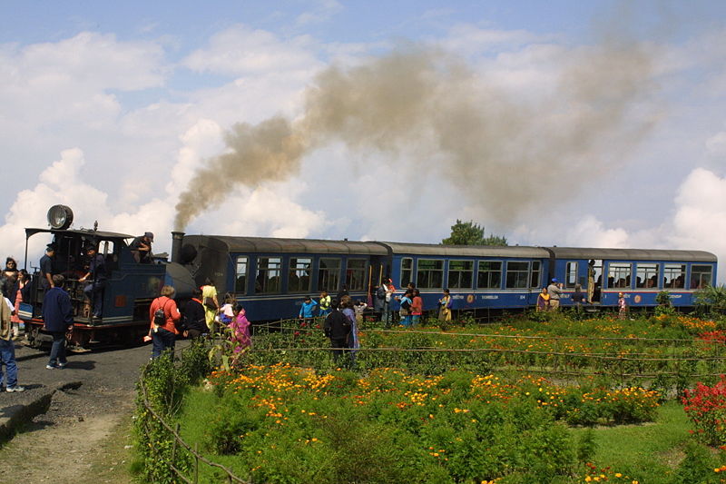
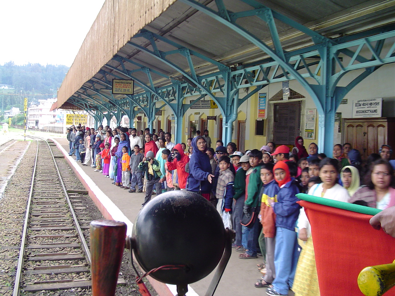
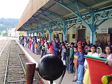 An excited crowd receives the Nilgiri Mountain Train at Ooty station
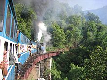
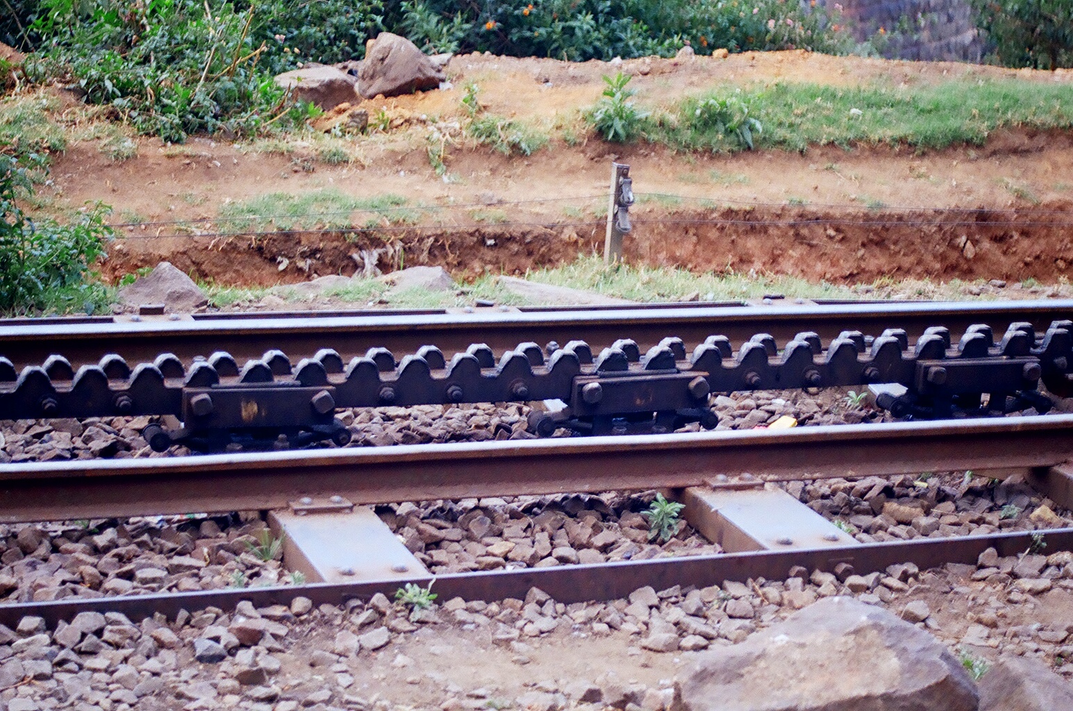
 The unique rack and pinion rack system
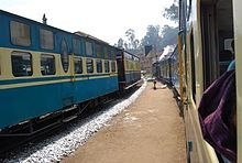 The Nilgiri Passenger at LovedaleMain article: Nilgiri Mountain Railway
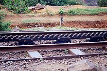
The Nilgiri Mountain Railway is a single track, 46 kilometers (29 mi) long metre gauge single line. Coonoor was initially the final hill station on the line in June 1899 but this was extended up to Fernhill in September 1908 and up to Udagmandalam by October 15, 1908. It now connects the town of Mettupalayam with the hill station of Udagamandalam (Ootacamund), in the Nilgiri hills, popularly known as the 'Blue Mountains' of Southern India. Both towns are in the state of Tamil Nadu. The only rack railway in India, it uses the alternate biting system (Abt) commonly termed as 'rack and pinion' rail system and is operated with special steam locomotives. This system is described in Sir Gulford L. Molesworth’s report of 1886, which says: [12]
Two distinct functions – 1st that of traction by adhesion as in an ordinary loco; 2nd that of traction by pinions acting on the track bars. The brakes are four in number – two hand brakes action by friction; and two acting by preventing the free escape of air from cylinder and thus using compressed air in retarding the progress of the engine. The former are used for shutting whilst the later for descending steep gradients. One of the hand breaks acts on the tyres of the wheels in the ordinary manner and the second acts on grooved surfaces of the pinion axle, but can be used in those places where the rack is laid.[13]
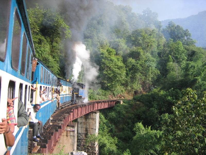
The trains that run on this line cover a distance of 46 kilometers (29 mi), travel through 208 curves, 16 tunnels, and 250 bridges. The uphill journey takes around 290 minutes (4.8 hours), and the downhill journey takes 215 minutes (3.6 hours).[2][14][15]
The Nilgiri Mountain Railway was inscribed as World Heritage Site by UNESCO in July 2005. The unique feature of this line, which is still fully operational, is its oldest and the steepest ‘rack and pinion technology’. As it now operates, the line has a metre gauge section for 7.2 kilometers (4.5 mi) up to the foothill station of Kallar from where the rack rail system begins and runs hugging the hills, passing through tunnels, 12 in number with the longest tunnel measuring 97 meters (318 ft), for 7.2 kilometers (4.5 mi) up the hills at a gradient of 1:12.5 up to Coonoor. Beyond Coonoor, up to the last station at Ooty or Oottacamund, the track has a ruling gradient of 1:23.[2][6]
Kalka-Shimla Railway
Main article: Kalka-Shimla Railway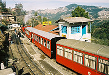 Shivalik Deluxe Express in Taradevi Station.
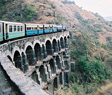 A typical passenger train on one of the line's big bridges
Shimla, the modern capital city of Himachal Pradesh,[2][16]is located at 7,234 feet (2,205 m), in the foothills of the Himalayas. It was the summer capital of British India in 1864 and it was also the headquarters of the British Army in India. Kalka is a town in the Panchkula district of Haryana.[2][16][17]
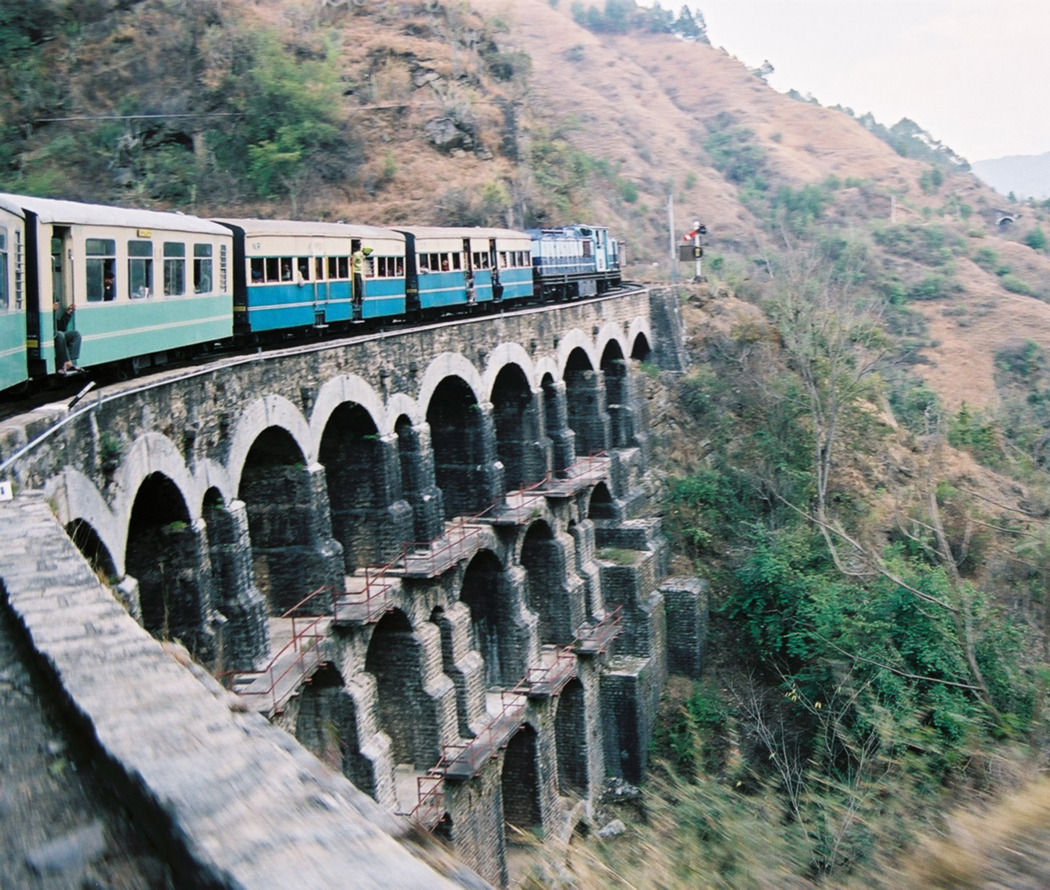
Prior to construction of the railway communication, connection with the outside world was via a village cartway. The railway line was constructed by the Delhi–Ambala–Kalka Railway Company commencing in 1898 in the Siwalik Hills ranges. However, several plans with alternative routes were surveyed between 1884 and 1898, and the contract to build this line was finally awarded to Delhi–Ambala–Kalka Railway Company. The 95.66 kilometers (59.44 mi) long, 2 ft 6 in (762 mm) narrow gauge line was opened for traffic on November 9, 1903.[6]
The line has 103 tunnels and 864 bridges (multi-arched gallery type, like the Roman aqueducts), except for one bridge of 18.29 meters (60.0 ft) length with plate girder span and steel truss. The ruling gradient is 1:33 or 3%, with 919 curves, the sharpest being 48 degrees (a radius of 37.47 meters (122.9 ft) and climbs from 656 meters (2,152 ft) and terminates at an elevation of 2,076 meters (6,811 ft) at Shimla. The Barog Tunnel (No. 33) is the longest tunnel on the line at 1,144 meters (3,753 ft) in length between Dagshai and Solan (270 meters (890 ft) below the road) and is named after the engineer who had commenced digging the tunnel from both sides of the mountain but could not complete it and hence committed suicide (he was buried near the site of the tunnel). His Indian counterpart, known by the name Bhalku, who helped H. S. Harrington to build another tunnel about 1 kilometer (0.62 mi) away from the abandoned tunnel, was honoured with a medal and turban as an appreciation for his contribution to building tunnels, by the then Viceroy of India.[6]
The route from Kalka to Shimla involves journey through the Koti tunnel 3.2 kilometers (2.0 mi) long, the Dharampur main station, 32 kilometers (20 mi) from Kalka, three loops at Taksal, Gumman and Dharampur to attain flatter gradients, Taradevi, Prospect Hill to Jatogh, Inverarm to the terminus at old Dovedell chambers at Shimla. Other important stations on this route, distance wise from Kalka include Dagshai–38.4 kilometers (23.9 mi), at an elevation of 1,600 meters (5,200 ft) and Solan. Special luxury trains called the Shivalik Express and Shivalik Palace Saloon operate during the summer months to cater for heavy traffic from tourism, apart from several passenger and cargo (potato, in particular) trains, in addition to catering to the requirements of the armed services.[2]
This line was added to the list of World Heritage Sites in 2008, joining the Nilgiri and Darjeeling lines.[1]
Matheran Hill Railway
Further information: Matheran Hill Railway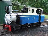
 Left: Matheran Railway No.740 preserved in the UK at Railworld in Peterborough Right: Toy Train on Matheran railway
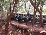
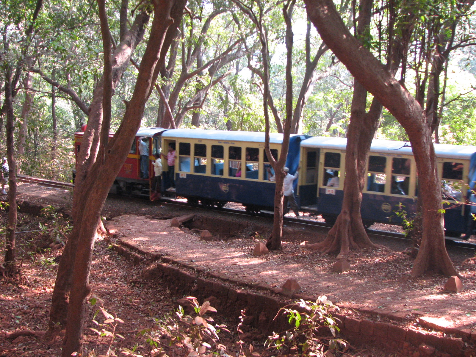
Matheran Hill Railway, a heritage railway in Maharashtra, was built between 1901 and 1907 by Abdul Hussein Adamjee Peerbhoy and was financed by his father, Sir Adamjee Peerbhoy of the Adamjee Group. The railway line, a 610mm (2 ft) gauge line, covers a distance of 20 kilometers (12 mi), over large swathes of forest territory connecting Neral to Matheran in the Western Ghats hills near Karjat and Mumbai. The plan, formulated in 1900, began construction in 1904 and the line was opened to traffic by 1907. Originally, the tracks were laid with 30 lb/yard rails but now use heavier 42 lb/yard rails. Ruling gradient is 1:20 (5%) with tight curves and speeds are limited to 20 kilometres per hour (12 mph). The line, which generally used to be closed during the monsoons because of the danger of landslides, has, since the 1980s, been kept operational throughout the year. This railway line is administered by the Central Railways.[2][18].
The unique feature of this line is the horseshoe embankment, which was built to avoid a reversion station, seen when the train curves markedly. Important stations and special features include this, the initial Neral Station, the Herdal Hill section, the Bhekra Khud steep gradient, the only tunnel on the route, popularly known as the "One Kiss Tunnel" (time to pass through this is just sufficient to exchange a kiss with one's partner), a "Water Pipe" station (now non functional due to change over to diesel locomotive), Mountain Berry with two sharp 'Zig Zags', Panorama Point and finally terminating at Matheran Bazaar. The Broad gauge line between Mumbai and Poona runs close to this line and the road also crosses the railway line at two locations.[2]
Kangra Valley Railway
Further information: Kangra Valley RailwayThe Kangra Valley Railway lies in the sub-Himalayan region and covers a distance of 163 kilometers (101 mi) between Pathankot and Joginder Nagar, a valley known for its natural beauty and ancient Hindu shrines. The line, which is part of the Northern Railway and is made with a 2 ft 6 in (762 mm) gauge, was planned in May 1926 and commissioned in 1929 and is popularly known as the “Kangra Toy Train”. The highest point on this line is at Ahju station at an elevation of 1,210 meters (3,970 ft). The line has 971 uniquely designed bridges and two tunnels. Two particularly important bridge structures are the steel arch bridge over the Reond nalah and the girder bridge over the Banganga River. Though the gradient of the line is generally gentle, the critical reach with steep slopes is at the 142 kilometers (88 mi) stretch, which is of 210 meters (690 ft) width with 1:19 slope with approach slopes of 1:31 and 1:25. The terminus stretch between Baijnath and Jogindernagar is 1:25. The train journey on this line provides beautiful views of peaks of the Dhauladhar mountain range, particularly in the stretch between Kangra and Mangwal, and also the ruins of the Kangra Fort.[2][3][4]
References
- ^ a b c d e f g h "Mountain Railways of India". World Heritage:UNESCO. http://whc.unesco.org/en/list/944. Retrieved 2010-02-19.
- ^ a b c d e f g h i j k l m n o Kohli, M.S.; Ashwani Lohani (2004). Mountains of India: Tourism, Adventure, Pilgrimage. Indus Publishing. pp. 97–106. ISBN 8173871353. http://books.google.co.in/books?id=GIs4zv17HHwC&pg=PA97&dq=mountain+railways+of+india&cd=5#v=onepage&q=mountain%20railways%20of%20india&f=false. Retrieved 2010-02-20.
- ^ a b c d "Luxury Trains of India". http://74.125.153.132/search?q=cache:_GtV5JJjhdMJ:www.touristplacesinindia.com/luxury-trains/hill-trains.html+mountain+railways+of+india&cd=17&hl=en&ct=clnk&gl=in. Retrieved 2010-02-20.
- ^ a b Abram, David (2003). Rough guide to India. Rough Guides. p. 479. ISBN 1843530899. http://books.google.co.in/books?id=kAMik_6LbwUC&pg=PA479&dq=mountain+railways+of+india&lr=&cd=73#v=onepage&q=mountain%20railways%20of%20india&f=false. Retrieved 2010-02-20.
- ^ "Steam in History". The Indian Railways fan Club (IRFCA). http://74.125.153.132/search?q=cache:vya-rRBzbiYJ:www.irfca.org/articles/isrs/isrs082004-steam-history.html+Sir+Lawrence+Indian+railways&cd=2&hl=en&ct=clnk&gl=in. Retrieved 2010-04-03.
- ^ a b c d e f "Mountain Railways of India – Chugging and romancing the hills". http://74.125.153.132/search?q=cache:FPuQF0dvK8oJ:nvonews.com/2009/08/14/mountain-railways-of-india-%E2%80%93-chugging-and-romancing-the-hills/+mountain+railways+of+india&cd=37&hl=en&ct=clnk&gl=in. Retrieved 2010-02-20.
- ^ a b Srinivasan, Rupa; Manish Tiwari and Sandeep Silas (2006). Our Indian Railway: themes in India's Railway history. Foundation Books. pp. xxxiv-xxxv. ISBN 8175963301. http://books.google.co.in/books?id=O2-eHnajWxIC&pg=PR34&dq=mountain+railways+of+india&lr=&cd=78#v=onepage&q=mountain%20railways%20of%20india&f=false. Retrieved 2010-02-21.
- ^ a b c Whittle, Paul; Terry Martin. "A Brief History of the DHR". History and A Trip Up the Line. Darjeeling Himalayan Railway Society. http://74.125.153.132/search?q=cache:ojR5U3THwgEJ:infao5501.ag5.mpi-sb.mpg.de:8080/topx/archive09%3Flink%3D/443/750443.xml+Whittle,+Paul%3B+Terry+Martin.+%22A+Brief+History+of+the+DHR%22.+History+and+A+Trip+Up+the+Line.+Darjeeling+Himalayan+Railway+Society.&cd=4&hl=en&ct=clnk&gl=in. Retrieved 2007-02-24.
- ^ a b "History of Darjeeling Himalayan Railway". http://www.uniblogger.com/en/History_of_Darjeeling_Himalayan_Railway. Retrieved 2010-04-03.
- ^ a b "DHr History". Darjeeling.net. http://www.darjeelingnews.net/darjeeling_himalayan_railway.html. Retrieved 2010-02-19.
- ^ "The Loop, Agony Point, Darjeeling [Hill Railway"]. British Library Online Gallery. http://www.bl.uk/onlinegallery/onlineex/apac/photocoll/t/019pho000752s15u00052000.html. Retrieved 2010-02-21.
- ^ Kholi p.104
- ^ Kholi p.104
- ^ Krishnan, Govind. V.M. NMR Nilgiri Mountain Railway:From Life Line to Oblivion. Paypall. http://www.krishnantech.net/nmr/.
- ^ "Cultural Sites inscribed on UNESCO’s World heriatge List". India-Mountains railways of India. World Heritage List;UNESCO. 2005=06-15. http://whc.unesco.org/en/news/135.
- ^ a b "HP declares Kalka-Shimla railway as 'heritage' property". The Hindu. 2010-02-21. http://www.hindu.com/thehindu/holnus/004200708130322.htm. Retrieved 2010-02-19.
- ^ Singh, Jagmeet (2002-06-15). "Man behind Barog tunnel lies forgotten". feature. The Tribune of India. http://www.tribuneindia.com/2002/20020615/windows/main4.htm. Retrieved 2010-02-19.
- ^ Plaque with history of the Railway
External links
World Heritage Sites in India North Agra Fort · Buddhist Monuments at Sanchi · Fatehpur Sikri · Humayun's Tomb · Keoladeo National Park · Khajuraho Group of Monuments · Mountain Railways of India (Kalka-Shimla Railway)1 · Nanda Devi and Valley of Flowers National Parks · Qutub Minar and its Monuments · The Red Fort complex · Rock Shelters of Bhimbetka · Taj Mahal

Northeast East Mahabodhi Temple Complex at Bodh Gaya · Mountain Railways of India (Darjeeling Himalayan Railway)1 · Sun Temple at Konark · Sundarbans National Park
South Great Living Chola Temples at Thanjavur, Gangaikonda Cholapuram and Darasuram · Group of Monuments at Hampi · Group of Monuments at Mahabalipuram · Group of Monuments at Pattadakal · Mountain Railways of India (Nilgiri Mountain Railway)1
West Ajanta Caves · Champaner-Pavagadh Archaeological Park · Chhatrapati Shivaji Terminus · Churches and convents of Goa · Elephanta Caves · Ellora Caves · Jantar Mantar
1 Shared with other region/s Categories:- Rail transport in India
- World Heritage Sites in India
- Narrow gauge railways in India
- Mountain railways in India


Wikimedia Foundation. 2010.