- Moorefield Historic District
-
Moorefield Historic District
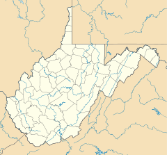

Location: Portions of Main, Elm, Washington, and Winchester Sts., Moorefield, West Virginia Coordinates: 39°3′35″N 78°58′12″W / 39.05972°N 78.97°WCoordinates: 39°3′35″N 78°58′12″W / 39.05972°N 78.97°W Area: 70 acres (28 ha) Built: 1777 Architectural style: Greek Revival, Queen Anne, Italianate Governing body: Local MPS: South Branch Valley MRA NRHP Reference#: 86000774[1] Added to NRHP: January 15, 1986 Moorefield Historic District is a national historic district located at Moorefield, Hardy County, West Virginia. The district encompasses 171 contributing buildings. It consists of a mix of commercial, residential and civic structures, ranging in age from the mid 18th century to the early 20th century. Predominate residential styles are Greek Revival and Queen Anne. The commercia1 buildings are Italianate style. Notable buildings include the Hardy County Court House (1914), City Hall, and Emmanuel Episcopal Church (1879). Located in the district are the separately listed Old Stone Tavern, Thomas Maslin House, and Old Hardy County Courthouse.[2]
It was listed on the National Register of Historic Places in 1986.[1]
References
- ^ a b "National Register Information System". National Register of Historic Places. National Park Service. 2010-07-09. http://nrhp.focus.nps.gov/natreg/docs/All_Data.html.
- ^ Paula Stoner Reed (September 1984). "National Register of Historic Places Inventory Nomination Form: Moorefield Historic District". State of West Virginia, West Virginia Division of Culture and History, Historic Preservation. http://www.wvculture.org/shpo/nr/pdf/hardy/86000774.pdf. Retrieved 2011-08-05.
U.S. National Register of Historic Places in West Virginia Lists by county Barbour • Berkeley • Boone • Braxton • Brooke • Cabell • Calhoun • Clay • Doddridge • Fayette • Gilmer • Grant • Greenbrier • Hampshire • Hancock • Hardy • Harrison • Jackson • Jefferson • Kanawha • Lewis • Lincoln • Logan • Marion • Marshall • Mason • McDowell • Mercer • Mineral • Mingo • Monongalia • Monroe • Morgan • Nicholas • Ohio • Pendleton • Pleasants • Pocahontas • Preston • Putnam • Raleigh • Randolph • Ritchie • Roane • Summers • Taylor • Tucker • Tyler • Upshur • Wayne • Webster • Wetzel • Wirt • Wood • Wyoming

Other lists Categories:- Historic districts in West Virginia
- Historic districts in Hardy County, West Virginia
- Houses on the National Register of Historic Places in West Virginia
- Commercial buildings on the National Register of Historic Places in West Virginia
- Greek Revival architecture in West Virginia
- Italianate architecture in West Virginia
- Queen Anne architecture in West Virginia
- Buildings and structures in Hardy County, West Virginia
- National Register of Historic Places listings in Hardy County, West Virginia
- West Virginia Registered Historic Place stubs


Wikimedia Foundation. 2010.