- Vlăhița
-
Vlăhița
Szentegyháza— Town — Location of Vlăhiţa Coordinates: 46°21′0″N 25°31′48″E / 46.35°N 25.53°ECoordinates: 46°21′0″N 25°31′48″E / 46.35°N 25.53°E Country  Romania
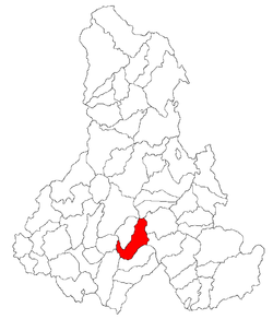
County Harghita County Status Town Government – Mayor Mária-Ella Burus (Democratic Union of Hungarians in Romania) Area – Total 98.48 km2 (38 sq mi) Population (2004) – Total 7,042 Ethnicity – Hungarians 98.3% – Romanians 1.7% Time zone EET (UTC+2) – Summer (DST) EEST (UTC+3) Website http://www.primariavlahita.ro/ro/index.php Vlăhița (Hungarian: Szentegyháza, Hungarian pronunciation: [ˈsɛntɛɟhaːzɒ], until 1899 Szentegyházas-Oláhfalu) is a town in Harghita County, Romania. It lies in the Székely Land, an ethno-cultural region in eastern Transylvania.
The town administers two villages:
- Băile Homorod / Homoródfürdő
- Minele Lueta / Szentkeresztbánya
Its Romanian name is of Slavic origin, meaning "little Vlach", while its Hungarian name means "Church of the Saint".
Contents
History
The town was part of the Székely Land area of the historical Transylvania province. It belonged to Udvarhelyszék until the administrative reform of Transylvania in 1876, when it fell within the Udvarhely County of the Austria-Hungary. After the Treaty of Trianon of 1920, it became part of Romania and fell within Odorhei County during the interwar period. In 1940, the second Vienna Award granted the Northern Transylvania to Hungary and it was held by Hungary until 1944. After Soviet occupation, the Romanian administration returned and the settlement became officially part of Romania in 1947. Between 1952 and 1960, the town fell within the Magyar Autonomous Region, between 1960 and 1968 the Mureș-Magyar Autonomous Region. In 1968, the province was abolished, and since then, the town has been part of Harghita County.
Demographics
The town has a total population of 7,042 of which 6,960 (98.3%) are Székely Hungarians, making it the town with the highest proportion of Hungarians in Romania (2002 census).
Demographic movement according to the censuses:

Location
The town is situated between Odorheiu Secuiesc and Miercurea-Ciuc. Its 860 m altitude makes it the highest town in Harghita County.
Culture
The town is famous for its Children's Orchestra (Filarmonica de copii/Gyermekfilharmónia), in which more than 140 youngsters sing and play instruments.
Twin town
Harghita County, Romania Cities Miercurea-Ciuc (county seat) · Gheorgheni · Italic text Odorheiu Secuiesc · Topliţa

Towns Băile Tuşnad · Bălan · Borsec · Cristuru Secuiesc · Vlăhiţa
Communes Atid · Avrămeşti · Bilbor · Brădeşti · Căpâlniţa · Cârţa · Ciceu · Ciucsângeorgiu · Ciumani · Corbu · Corund · Cozmeni · Dăneşti · Dârjiu · Dealu · Ditrău · Feliceni · Frumoasa · Gălăuţaş · Joseni · Lăzarea · Leliceni · Lueta · Lunca de Jos · Lunca de Sus · Lupeni · Mădăraş · Mărtiniş · Mereşti · Mihăileni · Mugeni · Ocland · Păuleni-Ciuc · Plăieşii de Jos · Porumbeni · Praid · Racu · Remetea · Săcel · Sâncrăieni · Sândominic · Sânmartin · Sânsimion · Sântimbru · Sărmaş · Satu Mare · Secuieni · Siculeni · Şimoneşti · Subcetate · Suseni · Tomeşti · Tulgheş · Tuşnad · Ulieş · Vărşag · Voşlăbeni · Zetea
Categories:- Harghita County geography stubs
- Towns in Romania
- Populated places in Harghita County
- Székely communities
Wikimedia Foundation. 2010.

