- Milecastle 6
-
Coordinates: 54°58′29″N 1°39′11″W / 54.974663°N 1.653079°W
Milecastle 6 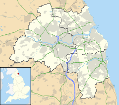
 Milecastle 6
 Milecastle 6 shown within Tyne and Wear
OS grid reference NZ22306450 List of places: UK • England • Tyne and Wear 
This article is part of the series on:
Military of ancient Rome (portal)
753 BC – AD 476Structural history Roman army (unit types and ranks, legions, auxiliaries, generals) Roman navy (fleets, admirals) Campaign history Lists of wars and battles Decorations and punishments Technological history Military engineering (castra, siege engines, arches, roads) Political history Strategy and tactics Infantry tactics Frontiers and fortifications (limes, Hadrian's Wall) Milecastle 6 (Benwell Grove) was a milecastle of the Roman Hadrian's Wall.
Contents
Construction
The exact location of this milecastle is unknown but the wall in this area runs beneath the A186. The area is built over with roads and terraced houses and no milecastle remains are known.[1]
Excavations and investigations
In 1966 J Collingwood Bruce suggested that the site of Milecastle 6 lay beneath the Benwell Grove road in Newcastle.[1]
Associated Turrets
Each milecastle on Hadrian's Wall had two associated turret structures. These turrets were positioned approximately one-third and two-thirds of a Roman mile to the west of the Milecastle, and would probably have been manned by part of the milecastle's garrison. The turrets associated with Milecastle 6 are known as Turret 6A and Turret 6B.
Turret 6A
Turret 6A has never been located from its remains. It has been positioned from the average distance to Turret 6B. This places Turret 6A approximately 90 yards (82 m) east of the eastern rampart of Condercum fort.[2] This places it underneath the houses and road of Westholme Gardens in Benwell.[2]
Location: 54°58′35″N 1°39′45″W / 54.976487°N 1.662437°W
Turret 6B
Turret 6B was discovered by Robert Shafto in 1751, during construction of the Military Road, Shafto stated that it was approximately 4 yards (3.7 m) square.[3] It was positioned at a point 308 yards (282 m) west of the western rampart of Condercum.[2][4] This places it somewhere near to the modern road of Two Ball Lonnen. All surface trace of the turret had been obliterated by modern development by 1968.[4]
Location: 54°58′42″N 1°40′08″W / 54.978391°N 1.668827°W
Monument Records
Monument Monument Number National Monuments Record Number Milecastle 6 25035 NZ 26 SW 6 Turret 6A 25038 NZ 26 SW 7 Turret 6B 25044 NZ 26 SW 9 References
- ^ a b "Milecastle 6". Pastscape. English Heritage. http://pastscape.english-heritage.org.uk/hob.aspx?hob_id=25035. Retrieved 14 May 2010.
- ^ a b c "Turret 6A". Pastscape. English Heritage. http://pastscape.english-heritage.org.uk/hob.aspx?hob_id=25038. Retrieved 14 May 2010.
- ^ Breeze, David J (1934), Handbook to the Roman Wall (14th Revised edition - Nov 2006), Society of Antiquaries of Newcastle upon Tyne, pp. 158, ISBN 0901082651
- ^ a b "Turret 6B". Pastscape. English Heritage. http://pastscape.english-heritage.org.uk/hob.aspx?hob_id=25044. Retrieved 14 May 2010.
Milecastles of Hadrian's Wall Milecastles 0 • 1 • 2 • 3 • 4 • 5 • 6 • 7 • 8 • 9 • 10 • 11 • 12 • 13 • 14 • 15 • 16 • 17 • 18 • 19 • 20 • 21 • 22 • 23 • 24 • 25 • 26 • 27 • 28 • 29 • 30 • 31 • 32 • 33 • 34 • 35 • 36 • 37 • 38 • 39 • 40 • 41 • 42 • 43 • 44 • 45 • 46 • 47 • 48 • 49 • 50 • 50TW • 51 • 52 • 53 • 54 • 55 • 56 • 57 • 58 • 59 • 60 • 61 • 62 • 63 • 64 • 65 • 66 • 67 • 68 • 69 • 70 • 71 • 72 • 73 • 74 • 75 • 76 • 77 • 78 • 79 • 80
Milefortlets MF 1 • MF 2 • MF 3 • MF 4 • MF 5 • MF 6 • MF 7 • MF 8 • MF 9 • MF 10 • MF 11 • MF 12 • MF 13 • MF 14 • MF 15 • MF 16 • MF 17 • MF 18 • MF 19 • MF 20 • MF 21 • MF 22 • MF 23 • MF 24 • MF 25 • MF 26Other structures on Hadrian's Wall Portgate • Chesters Bridge • Knag Burn Gateway • Peel Gap Tower • Willowford Bridge • Pike Hill Signal TowerCategories:- Milecastles of Hadrian's Wall


Wikimedia Foundation. 2010.