- Milecastle 14
-
Coordinates: 55°00′13″N 1°49′59″W / 55.003682°N 1.833018°W
Milecastle 14 
 Milecastle 14
 Milecastle 14 shown within Northumberland
OS grid reference NZ10686768 List of places: UK • England • Northumberland 
This article is part of the series on:
Military of ancient Rome (portal)
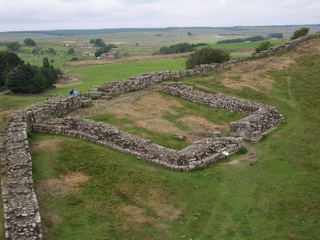
753 BC – AD 476Structural history Roman army (unit types and ranks, legions, auxiliaries, generals) Roman navy (fleets, admirals) Campaign history Lists of wars and battles Decorations and punishments Technological history Military engineering (castra, siege engines, arches, roads) Political history Strategy and tactics Infantry tactics Frontiers and fortifications (limes, Hadrian's Wall) Milecastle 14 (March Burn) was a milecastle of the Roman Hadrian's Wall. Its remains exist as a low (maximum 0.4 metres (1.3 ft) on the west side)[1] platform, south of the B6318 Military Road and about 1 kilometre (0.62 mi) to the west of the road junction at Rudchester Farm.[2]
Contents
Construction
Milecastle 14 was a short-axis milecastle with unknown gateway type (though the dimensions of the north gateway were found to match those of Milecastle 37, and the gateway had been blocked up some time after construction.)[1] Short axis milecastles (Type I) were thought to have been constructed by the Legio II Augusta who were based in Isca Augusta (Caerleon).[3]
The milecastle had dimensions of 18.29 metres (60.0 ft) across, having broad walls.[2]
The remains of an internal building 5.11 metres (16.8 ft) wide, (located on the west side) have been identified.[2]
Excavations and investigations
- 1930 – The earthworks of the Milecastle platform are identified from an aerial photograph.[1]
- 1946 – Stevens investigated the milecastle, identifying the measurements and state of the north gate. Any remaining evidence of the south gate had been ploughed away.[4]
- 1966 – English Heritage Field Investigation. The previous description was confirmed.
- 1989 – English Heritage Field Investigation. No additional information.
Associated turrets
Each milecastle on Hadrian's Wall had two associated turret structures. These turrets were positioned approximately one-third and two-thirds of a Roman mile to the west of the Milecastle, and would probably have been manned by part of the milecastle's garrison. The turrets associated with Milecastle 14 are known as Turret 14A and Turret 14B.
Turret 14A
No visible remains exist of Turret 14A (Eppies Hill), though in 1966, an English Heritage Field Investigation reported a concentration of stone in the field boundary hedge, at NZ 1011 6770, on the highest point of the hill, and proposed that this may be an indication of its site. Horsley reported seeing the turret, but is ambiguous with regard to the location.[5]
Approximate location: 55°00′13″N 1°50′37″W / 55.003741°N 1.843555°W
Turret 14B
No trace has been found of Turret 14B.[6]
Expected location: 55°00′16″N 1°50′56″W / 55.004493°N 1.848977°W
Monument records
Monument Monument Number National Monuments Record Number Milecastle 14 22795 NZ 16 NW 9 Turret 14A 22798 NZ 16 NW 10 Turret 14B 20375 NZ 06 NE 1 References
- ^ a b c "Milecastle 14". Pastscape. English Heritage. http://www.pastscape.org/hob.aspx?hob_id=22795. Retrieved 5 July 2010.
- ^ a b c Breeze, David J (1934), Handbook to the Roman Wall (14th Revised edition – Nov 2006), Society of Antiquaries of Newcastle upon Tyne, pp. 172–173, ISBN 0901082651
- ^ David J Breeze and Brian Dobson (1976). Hadrian's Wall. Allen Lane. pp. 14–15. ISBN 0140271821.
- ^ The Journal of Roman Studies (London: Society for Promotion of Roman Studies) 37: 168. 1947.
- ^ "Turret 14A". Pastscape. English Heritage. http://www.pastscape.org/hob.aspx?hob_id=22798. Retrieved 07 Jul 2010.
- ^ "Turret 14B". Pastscape. English Heritage. http://www.pastscape.org/hob.aspx?hob_id=20375. Retrieved 09 Jul 2010.
Bibliography
- Daniels, Charles (1979), "Review: Fact and Theory on Hadrian's Wall", Britannia 10: 357–364, JSTOR 526069
Milecastles of Hadrian's Wall Milecastles 0 • 1 • 2 • 3 • 4 • 5 • 6 • 7 • 8 • 9 • 10 • 11 • 12 • 13 • 14 • 15 • 16 • 17 • 18 • 19 • 20 • 21 • 22 • 23 • 24 • 25 • 26 • 27 • 28 • 29 • 30 • 31 • 32 • 33 • 34 • 35 • 36 • 37 • 38 • 39 • 40 • 41 • 42 • 43 • 44 • 45 • 46 • 47 • 48 • 49 • 50 • 50TW • 51 • 52 • 53 • 54 • 55 • 56 • 57 • 58 • 59 • 60 • 61 • 62 • 63 • 64 • 65 • 66 • 67 • 68 • 69 • 70 • 71 • 72 • 73 • 74 • 75 • 76 • 77 • 78 • 79 • 80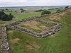
Milefortlets MF 1 • MF 2 • MF 3 • MF 4 • MF 5 • MF 6 • MF 7 • MF 8 • MF 9 • MF 10 • MF 11 • MF 12 • MF 13 • MF 14 • MF 15 • MF 16 • MF 17 • MF 18 • MF 19 • MF 20 • MF 21 • MF 22 • MF 23 • MF 24 • MF 25 • MF 26Other structures on Hadrian's Wall Portgate • Chesters Bridge • Knag Burn Gateway • Peel Gap Tower • Willowford Bridge • Pike Hill Signal TowerCategories:- Milecastles of Hadrian's Wall


Wikimedia Foundation. 2010.