- Milecastle 5
-
Coordinates: 54°58′17″N 1°37′44″W / 54.971402°N 1.628967°W
Milecastle 5
Milecastle 5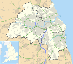
 Milecastle 5
 Milecastle 5 shown within Tyne and Wear
OS grid reference NZ23806410 List of places: UK • England • Tyne and Wear 
This article is part of the series on:
Military of ancient Rome (portal)
753 BC – AD 476Structural history Roman army (unit types and ranks, legions, auxiliaries, generals) Roman navy (fleets, admirals) Campaign history Lists of wars and battles Decorations and punishments Technological history Military engineering (castra, siege engines, arches, roads) Political history Strategy and tactics Infantry tactics Frontiers and fortifications (limes, Hadrian's Wall) Milecastle 5 (Quarry House) was a milecastle of the Roman Hadrian's Wall. No remains exist of the milecastle, though its supposed position is at the junction of the A186 Westgate road and the B1311 Corporation Street.[1] No remains currently exist.[2]
Contents
Construction
Nothing is known of the long/axis or gateways type of Milecastle 5.
Excavations and investigations
“ thought there were visible signs of a castellum just behind the quarry-house ” - 1858 - MacLauchlan agreed the location, stating that:[4]
“ It is probable there was a Mile Castle where the Wall makes a bend at the top of Westgate Road ” - 1968 - English Heritage Field Investigation. It was noted that all traces of the Milecastle had been obliterated by modern development.
Associated Turrets
Each milecastle on Hadrian's Wall had two associated turret structures. These turrets were positioned approximately one-third and two-thirds of a Roman mile to the west of the Milecastle, and would probably have been manned by part of the milecastle's garrison. The turrets associated with Milecastle 5 are known as Turret 5A and Turret 5B.
Turret 5A
The discovery of Milecastle 4 some way from its presumed location has brought into question the presumed sites of all milecastles and turrets in this area. However, the site is included on the National Monuments Record.[5] (Other comments).
Presumed location: 54°58′24″N 1°38′12″W / 54.973223°N 1.636761°WTurret 5B
The discovery of Milecastle 4 some way from its presumed location has brought into question the presumed sites of all milecastles and turrets in this area. However, the site is included on the National Monuments Record.[6] (Other comments).
Presumed location: 54°58′27″N 1°38′40″W / 54.974144°N 1.644564°WMonument Records
Monument Monument Number National Monuments Record Number Milecastle 5 25026 NZ 26 SW 3 Turret 5A 22667 NZ 26 SW 4 Turret 5B 25032 NZ 26 SW 5 References
- ^ Hope Dodds, Madeleine (1930), A History of Northumberland, 13 (first ed.), Andrew Reid, Sons & Co, pp. 498
- ^ Birley, Eric B (1961), Research on Hadrian's Wall, Titus Wilson & Son
- ^ Horsley, John (1732), Britannia Romana or the Roman Antiquities of Britain, Frank Graham (published 1974), pp. 137–8, ISBN 085983090X
- ^ "Milecastle 5". Pastscape. English Heritage. http://www.pastscape.org/hob.aspx?hob_id=25026. Retrieved 26 May 2010.
- ^ "Turret 5A". Pastscape. English Heritage. http://www.pastscape.org/hob.aspx?hob_id=25029. Retrieved 26 May 2010.
- ^ "Turret 5B". Pastscape. English Heritage. http://www.pastscape.org/hob.aspx?hob_id=25032. Retrieved 26 May 2010.
Bibliography
- Daniels, Charles (1979), "Review: Fact and Theory on Hadrian's Wall", Britannia 10: 357–364, JSTOR 526069
Milecastles of Hadrian's Wall Milecastles 0 • 1 • 2 • 3 • 4 • 5 • 6 • 7 • 8 • 9 • 10 • 11 • 12 • 13 • 14 • 15 • 16 • 17 • 18 • 19 • 20 • 21 • 22 • 23 • 24 • 25 • 26 • 27 • 28 • 29 • 30 • 31 • 32 • 33 • 34 • 35 • 36 • 37 • 38 • 39 • 40 • 41 • 42 • 43 • 44 • 45 • 46 • 47 • 48 • 49 • 50 • 50TW • 51 • 52 • 53 • 54 • 55 • 56 • 57 • 58 • 59 • 60 • 61 • 62 • 63 • 64 • 65 • 66 • 67 • 68 • 69 • 70 • 71 • 72 • 73 • 74 • 75 • 76 • 77 • 78 • 79 • 80
Milefortlets MF 1 • MF 2 • MF 3 • MF 4 • MF 5 • MF 6 • MF 7 • MF 8 • MF 9 • MF 10 • MF 11 • MF 12 • MF 13 • MF 14 • MF 15 • MF 16 • MF 17 • MF 18 • MF 19 • MF 20 • MF 21 • MF 22 • MF 23 • MF 24 • MF 25 • MF 26Other structures on Hadrian's Wall Portgate • Chesters Bridge • Knag Burn Gateway • Peel Gap Tower • Willowford Bridge • Pike Hill Signal TowerCategories:- Milecastles of Hadrian's Wall


Wikimedia Foundation. 2010.