- Disston, Oregon
-
Disston — Unincorporated community — Location within the state of Oregon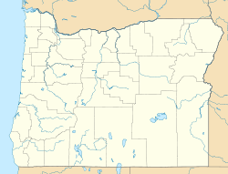
 Disston
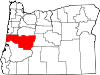
Coordinates: 43°41′53″N 122°46′12″W / 43.69806°N 122.77°WCoordinates: 43°41′53″N 122°46′12″W / 43.69806°N 122.77°W Country United States State Oregon County Lane Time zone Pacific (PST) (UTC-8) – Summer (DST) PDT (UTC-7) ZIP code 97434 Area code(s) 458 and 541 FIPS code GNIS feature ID Disston is an unincorporated community in Lane County, Oregon, United States, southeast of Cottage Grove where Brice Creek and Layng Creek join to form the Row River. It is about a mile west of the Umpqua National Forest.
Disston post office was established in 1906 and ran until 1974.[1] Cranston Jones, the first postmaster, was also one of the founders of the first sawmill in Disston and the name of the town came from the famous Disston saws.
At one time there were two sawmills in Disston, the Wheeler-Osgood Lumber Company and the I. E. James Lumber Company.[2] Both mills closed down in the 1950s.[2]
Disston was a sawmill and logging town and also a supply point for miners heading into the nearby Bohemia mining district.[3] The terminus of the Oregon, Pacific and Eastern Railway logging railroad was also in Disston.[4] Much of the former rail line has now been converted to the Row River National Recreation Trail, although the rail trail doesn't extend into Disston.[4] A hiking trail managed by the United States Forest Service, the Noonday Wagon Road Trail, follows an 1896 wagon road that started in Disston and was used to haul supplies into the mining district.[5]
See also
- Musick Guard Station, a historic Forest Service structure southeast of Disston
References
- ^ McArthur, Lewis A.; Lewis L. McArthur (2003) [1928]. Oregon Geographic Names (7th ed.). Portland, Oregon: Oregon Historical Society Press. p. 291. ISBN 0-87595-277-1.
- ^ a b "The Oregon, Pacific & Eastern Railway". Abandoned Railroads of the Pacific Northwest. http://www.brian894x4.com/OPandErailroad.html. Retrieved March 20, 2009.
- ^ "Disston, Oregon — Milltown". Lane County Historian (Lane County Historical Society) XXV (2). Summer 1980. https://ir.library.oregonstate.edu/dspace/bitstream/1957/10754/1/Vol_25_No_2_Sum_1980.pdf. Retrieved March 20, 2009.
- ^ a b Row River Trail
- ^ "#1405 Noonday Wagon Road Trail". United States Forest Service. http://www.fs.fed.us/r6/umpqua/recreation/hiking/cottage-grove-trails/tr-1405-noonday-wagon-rd.shtml. Retrieved March 20, 2009.
External links
- Historic images of two covered bridges near Disston from the Salem Public Library
- Historic image of students at Disston School from the University of Oregon Library
Municipalities and communities of Lane County, Oregon Cities Coburg | Cottage Grove | Creswell | Dunes City | Eugene | Florence | Junction City | Lowell | Oakridge | Springfield | Veneta | Westfir
Unincorporated
communitiesAlvadore | Belknap Springs | Blachly | Blue River | Brickerville | Cheshire | Cloverdale | Crow | Culp Creek | Cushman | Deadwood | Deerhorn | Dexter | Disston | Dorena | Elmira | Fall Creek | Finn Rock | Franklin | Gillespie Corners | Glenada | Glenwood | Goldson | Goshen | Greenleaf | Heceta Beach | Horton | Indiola | Jasper | Lancaster | Latham | Leaburg | Linslaw | London Springs | Lorane | Low Pass | Mabel | Mapleton | Marcola | McCredie Springs | McKenzie Bridge | Minerva | Mohawk | Nimrod | North Beach | Noti | Pleasant Hill | Rainbow | Riverview | Saginaw | Searose Beach | Siltcoos | Swisshome | Tide | Tiernan | Triangle Lake | Vaughn | Vida | Walden | Walker | Walterville | Walton | Wendling | Westlake
Ghost towns Categories:- Unincorporated communities in Lane County, Oregon
- Lane County, Oregon geography stubs


Wikimedia Foundation. 2010.