- Westfir, Oregon
Infobox Settlement
official_name = Westfir, Oregon
settlement_type =City
nickname =
motto =
imagesize =
image_caption =
image_
imagesize =
image_caption =
image_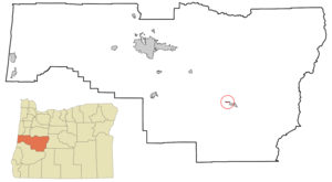
mapsize = 250px
map_caption = Location inOregon
mapsize1 =
map_caption1 =
subdivision_type = Country
subdivision_name =United States
subdivision_type1 = State
subdivision_name1 =Oregon
subdivision_type2 = County
subdivision_name2 = Lane
government_type =
leader_title =Mayor
leader_name =
established_title = Incorporated
established_date =1979
area_magnitude =
area_total_sq_mi = 0.3
area_total_km2 = 0.9
area_land_sq_mi = 0.3
area_land_km2 = 0.9
area_water_sq_mi = 0.0
area_water_km2 = 0.0
area_urban_sq_mi =
area_urban_km2 =
area_metro_sq_mi =
area_metro_km2 =
population_as_of =2000
population_note =
population_total = 276
population_metro =
population_urban =
population_density_km2 = 304.5
population_density_sq_mi = 789.9
timezone = Pacific
utc_offset = -8
timezone_DST = Pacific
utc_offset_DST = -7
latd = 43 |latm = 45 |lats = 24 |latNS = N
longd = 122 |longm = 30 |longs = 17 |longEW = W
elevation_m = 327.7
elevation_ft = 1075
website =
postal_code_type =ZIP code
postal_code = 97492
area_code = 541
blank_name = FIPS code
blank_info = 41-79950GR|2
blank1_name = GNIS feature ID
blank1_info = 1152152GR|3
footnotes =Westfir is a city in Lane County,
Oregon ,United States . The population was 276 at the 2000 census.Westfir was established in 1923 as a
company town by the Western Lumber Company.Geography
Westfir is located at coor dms|43|45|24|N|122|30|17|W|city (43.756694, -122.504785)GR|1.
According to the
United States Census Bureau , the city has a total area of 0.3square mile s (0.9km² ), of which, 0.3 square miles (0.9 km²) of it is land and 2.86% is water.Demographics
As of the
census GR|2 of 2000, there were 276 people, 100 households, and 74 families residing in the city. Thepopulation density was 789.9 people per square mile (304.5/km²). There were 106 housing units at an average density of 303.4/sq mi (116.9/km²). The racial makeup of the city was 99.28% White and 0.72% Native American. Hispanic or Latino of any race were 1.09% of the population.There were 100 households out of which 37.0% had children under the age of 18 living with them, 66.0% were married couples living together, 5.0% had a female householder with no husband present, and 26.0% were non-families. 21.0% of all households were made up of individuals and 6.0% had someone living alone who was 65 years of age or older. The average household size was 2.76 and the average family size was 3.22.
In the city the population was spread out with 30.1% under the age of 18, 4.7% from 18 to 24, 27.5% from 25 to 44, 24.3% from 45 to 64, and 13.4% who were 65 years of age or older. The median age was 38 years. For every 100 females there were 120.8 males. For every 100 females age 18 and over, there were 119.3 males.
The median income for a household in the city was $32,031, and the median income for a family was $31,875. Males had a median income of $27,500 versus $24,375 for females. The
per capita income for the city was $11,324. About 8.9% of families and 12.2% of the population were below thepoverty line , including 15.5% of those under the age of eighteen and 7.4% of those sixty five or over.References
External links
* [http://www.oakridgechamber.com/westfir.asp Oakridge-Westfir Chamber of Commerce page on Westfir]
Wikimedia Foundation. 2010.