- 1995–96 Australian region cyclone season
-
1995–96 Australian region cyclone season 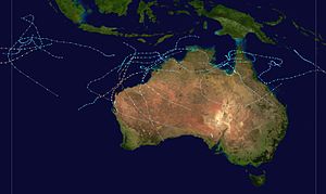
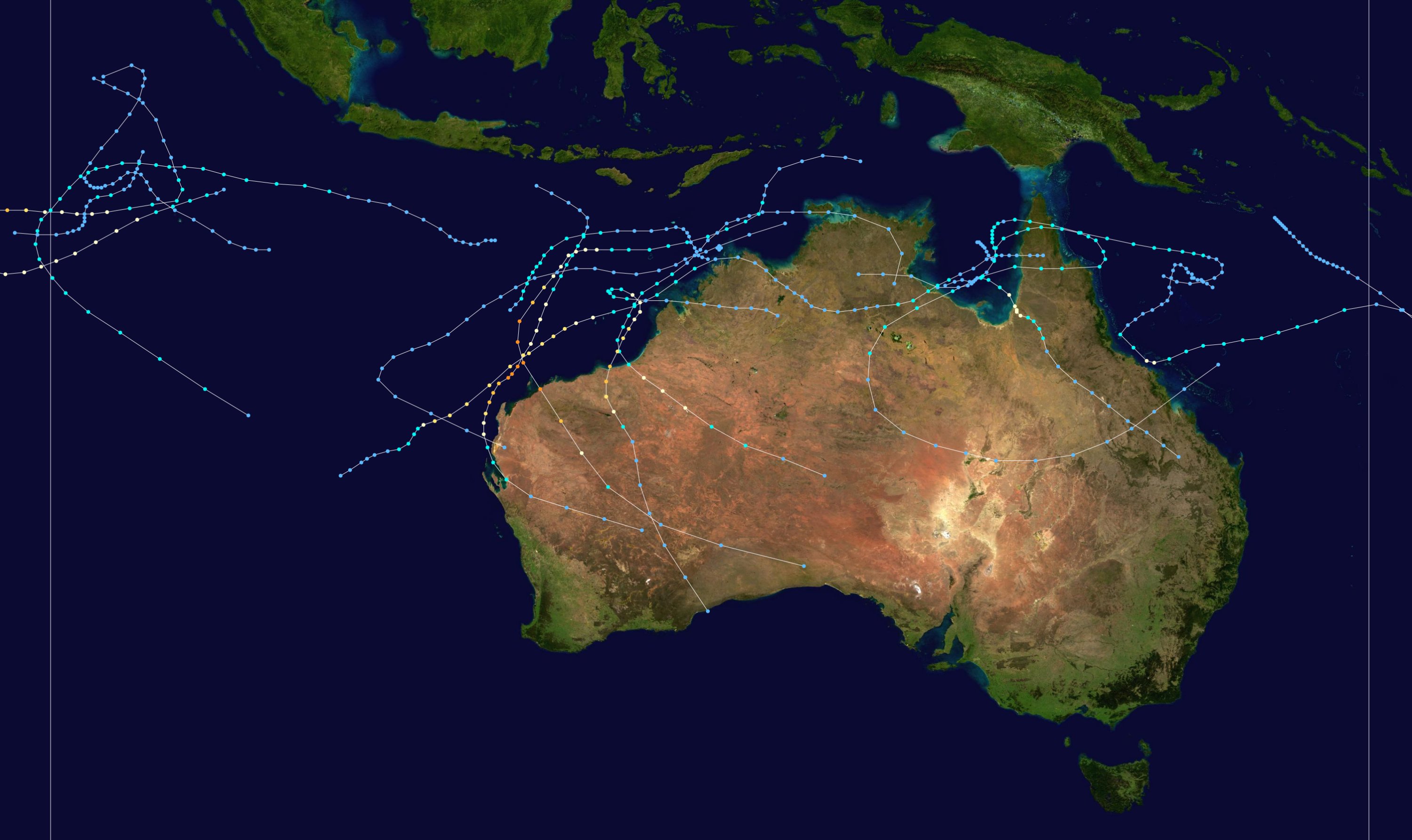
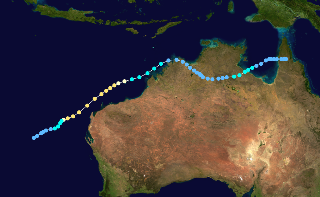
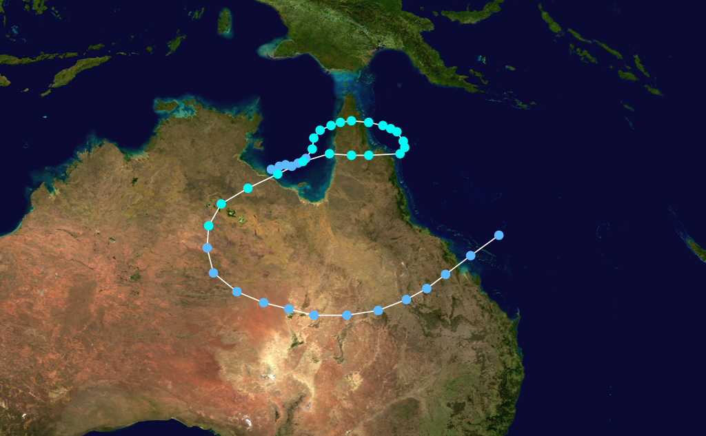
Season summary mapFirst storm formed: 16 November 1995 Last storm dissipated: 12 April 1996 Strongest storm: Olivia – 925 hPa (mbar), 195 km/h (120 mph) (10-minute sustained) Tropical lows: 19 Tropical cyclones: 14 official, 1 unofficial Severe tropical cyclones: 9 Total fatalities: 1 direct Total damage: $58.5 million (1996 USD) Australian region cyclone seasons
1993–94, 1994–95, 1995–96, 1996–97, 1997–98Related articles: - 1995–96 South-West Indian Ocean cyclone season
- 1995–96 South Pacific cyclone season
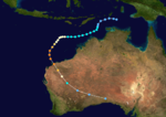
1995-1996 Australian region cyclone season was an active Australian cyclone season, with Western Australia experiencing a record number of landfalling intense storms in the Pilbara region. The season produced a total of 19 tropical cyclones, of which 14 developed into named storms and 9 reached severe tropical cyclone status. The strongest of the season was Severe Tropical Cyclone Olivia, which also produced the highest recorded wind gust on record of 408 km/h (253 mph). Though several systems impacted land, the general sparsity of population centres in Australia limits the scale of damage. One person was confirmed to have been killed and cumulative losses were estimated at A$77 million (US$58.5 million).
Storms
Severe Tropical Cyclone Daryl-Agnielle
Category 3 severe tropical cyclone (Australian scale) Category 1 tropical cyclone (SSHS) 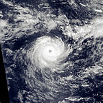

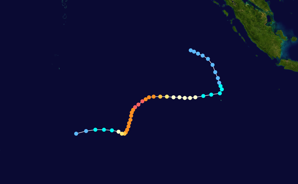
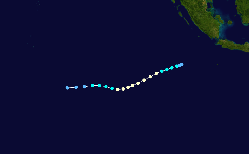
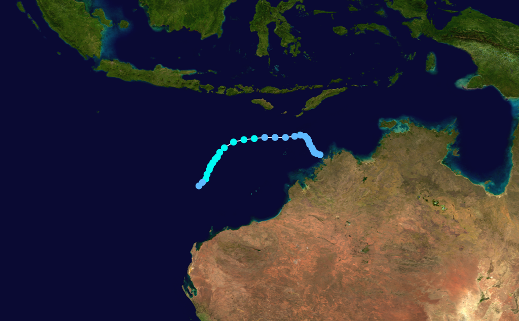
Duration 16 November – 19 November (Crossed 90°E) Intensity 130 km/h (80 mph) (10-min), 965 mbar (hPa) The first storm of the year and most intense across the Southern Hemisphere during the 1995–96 seasons, Cyclone Daryl was first identified several hundred kilometres west of Sumatra on 16 November. Initially tracking south-eastward, the system gradually attained gale-force winds as it neared the Cocos Islands late on 17 November. Squally conditions and heavy rain impacted the islands but no damage took place. Low wind shear allowed for further strengthening; a mid-level ridge south of the system forced Daryl to turn towards the west. Early on 19 November, the storm intensified into a severe tropical cyclone and attained winds of 130 km/h (80 mph) before crossing 90°E and entering the Mauritius area of responsibility. Upon crossing this border, Daryl was assigned a second name, Agnielle, by Mauritius. Over the following days, the system further deepened, peaking in strength as a Category 5 on the Australian intensity scale with 205 km/h (125 mph) and a barometric pressure of 915 hPa (mbar; 27.02 inHg). Steady weakening took place due to markedly stronger wind shear. Cyclone Daryl-Agnielle was last noted as a weak low pressure center on 25 November over the open waters of the southern Indian Ocean.[1]
Tropical Cyclone Emma
Category 1 tropical cyclone (Australian scale) Tropical storm (SSHS) 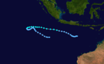
Duration 1 December – 16 December Intensity 75 km/h (45 mph) (10-min), 990 mbar (hPa) Emma stayed well off the Australian coast in the Indian Ocean. It spent most of its duration as a tropical low.
Severe Tropical Cyclone Frank
Category 4 severe tropical cyclone (Australian scale) Category 4 tropical cyclone (SSHS) 
Duration 6 December – 13 December Intensity 165 km/h (105 mph) (10-min), 950 mbar (hPa) It formed on 6 December 1995, and was the first cyclone to form in northwest coast of Australia during the 95/96 season. Cyclone Frank brought heavy winds and rains to the Pilbara coast. Frank was one of four cyclones to strike in that area. [1]
Severe Tropical Cyclone Gertie
Category 3 severe tropical cyclone (Australian scale) Category 1 tropical cyclone (SSHS) 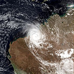

Duration 17 December – 24 December Intensity 130 km/h (80 mph) (10-min), 965 mbar (hPa) A tropical low formed in the Timor Sea on 16 December and tracked westsouthwest as it deepened slowly. The low crossed into the WA region on 17 December and was named Gertie on the afternoon of the 18th. The cyclone then moved towards the southsouthwest during the 19th but slowed to be almost stationary during the late afternoon and evening of that day. Gertie then began to move south, then southeastwards, crossing the coast near Mandora Station on 20 December. Gertie then passed to the northeast of Telfer producing near gale force winds and heavy rain before dissipating on the 21st. The storm did only minor damage.[2]
Severe Tropical Cyclone Barry
Category 3 severe tropical cyclone (Australian scale) Category 1 tropical cyclone (SSHS) 
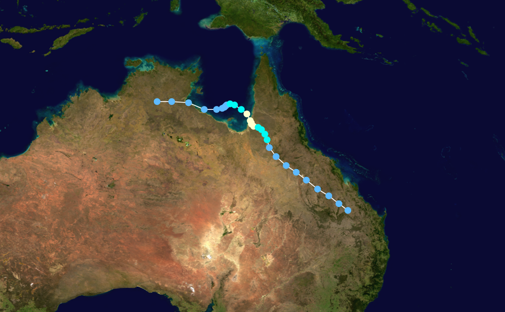
Duration 3 January – 10 January Intensity 155 km/h (100 mph) (10-min), 950 mbar (hPa) Barry formed in the Gulf of Carpentaria on 4 January, reaching a maximum intensity of Category 3 (Australian scale) before crossing the coast between Karumba and Kowanyama two days later. Heavy rains caused severe flooding across the southern Cape York Peninsula, however there were no deaths reported.
Severe Tropical Cyclone Hubert-Coryna
Category 3 severe tropical cyclone (Australian scale) Category 1 tropical cyclone (SSHS) 
Duration 6 January – 9 January (Crossed 90°E) Intensity 150 km/h (90 mph) (10-min), 955 mbar (hPa) Hubert stayed well off the Australian coast in the Indian Ocean from 8 to 12 January 1996.
Severe Tropical Cyclone Celeste
Category 3 severe tropical cyclone (Australian scale) Category 1 tropical cyclone (SSHS) 
Duration 26 January – 29 January Intensity 140 km/h (85 mph) (10-min), 965 mbar (hPa) Tropical Cyclone Celeste formed on 26 January and rapidly intensified into a Category 3 (Australian scale) system. The cyclone moved away from the coast after dumping heavy rain on the Central Coast. One man drowned in floodwaters near Bowen.
Severe Tropical Cyclone Jacob
Category 3 severe tropical cyclone (Australian scale) Category 2 tropical cyclone (SSHS) 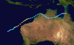
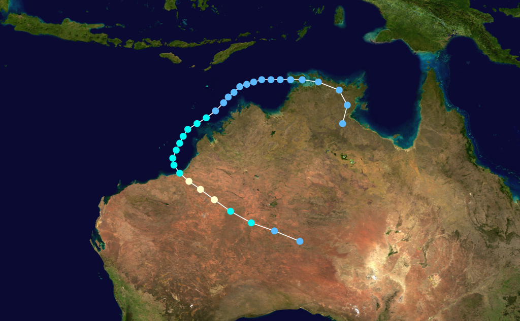
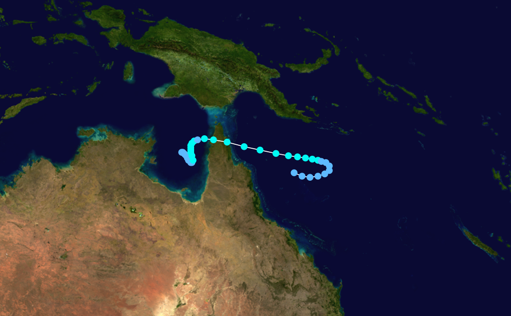
Duration 27 January – 8 February Intensity 155 km/h (100 mph) (10-min), 955 mbar (hPa) TC Jacob formed on 1 February 1996 from a monsoonal low that moved across the Northern Territory and the Kimberley region of Western Australia before tracking over the Bonaparte Gulf. It closely followed the Western Australian coast and developed cyclone characteristics near Adele Island. Jacob continued to intensify and moved westsouthwestwards, roughly parallel to the Pilbara coast. At peak intensity Jacob was a Category 3 storm with wind gusts near the centre estimated to be 200 kilometres per hour. The Kimberley and Pilbara coastal areas received heavy rains as the cyclone passed offshore. Only minor damage occurred and there were no deaths. [3]
Tropical Cyclone Isobel
Category 1 tropical cyclone (Australian scale) Tropical storm (SSHS) 
Duration 27 January – 1 February Intensity 65 km/h (40 mph) (10-min), 995 mbar (hPa) Isobel only lasted from 27 January 1996 to 1 February in the Timor Sea and did not pass close to any land.
Tropical Storm 12P
Tropical storm (SSHS) 
Duration 5 February – 10 February Intensity 65 km/h (40 mph) (1-min), 997 mbar (hPa) A weak storm formed near the edge of the Bureau's area of responsibility in early February. Only the JTWC classified it as a tropical cyclone, reporting peak winds of 65 km/h (40 mph).
Early February Tropical Low
Tropical low (Australian scale) Duration 8 February – 11 February Intensity 55 km/h (35 mph) (10-min), 997 mbar (hPa) Queen Elizabeth II Tropical Low
Tropical low (Australian scale) Duration 14 February – 17 February Intensity 55 km/h (35 mph) (10-min), 996 mbar (hPa) Tropical Cyclone Dennis
Category 1 tropical cyclone (Australian scale) Tropical storm (SSHS) 
Duration 15 February – 18 February Intensity 75 km/h (45 mph) (10-min), 990 mbar (hPa) - Dennis, 13 to 18 February 1996, around Cape York, Queensland
Severe Tropical Cyclone Kirsty
Category 4 severe tropical cyclone (Australian scale) Category 3 tropical cyclone (SSHS) 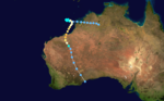
Duration 7 March – 14 March Intensity 175 km/h (110 mph) (10-min), 935 mbar (hPa) A strong cyclone, Kirsty crossed the coast at Pardoo Station near Port Hedland on 12 March 1996. The cyclone did considerable damage to tourist cabins and other structures. [4]
Tropical Cyclone Ethel
Category 2 tropical cyclone (Australian scale) Tropical storm (SSHS) 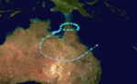
Duration 8 March – 13 March Intensity 100 km/h (65 mph) (10-min), 982 mbar (hPa) - Ethel, 9 to 13 March 1996, Gulf of Carpentaria, Queensland and Pacific Ocean
Severe flooding triggered by Cyclone Ethel resulted in A$75 million (US$57 million).[2]
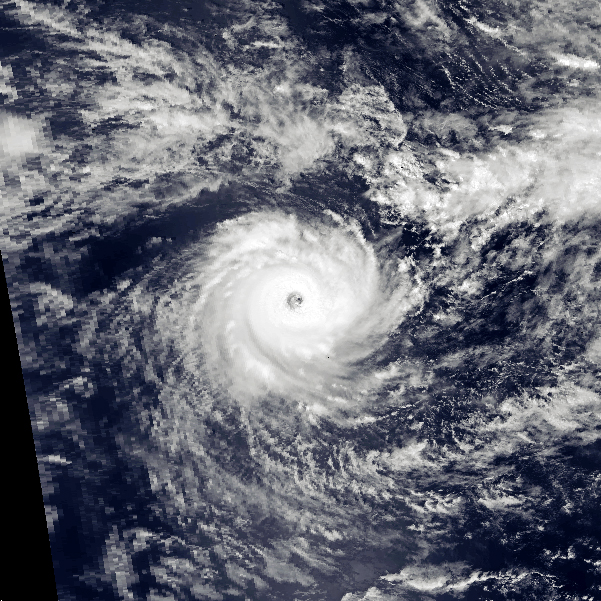
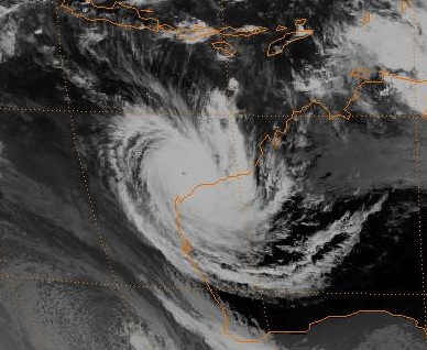
Severe Tropical Cyclone Olivia
Category 4 severe tropical cyclone (Australian scale) Category 4 tropical cyclone (SSHS) 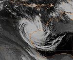
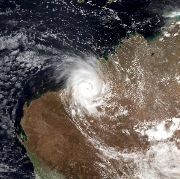
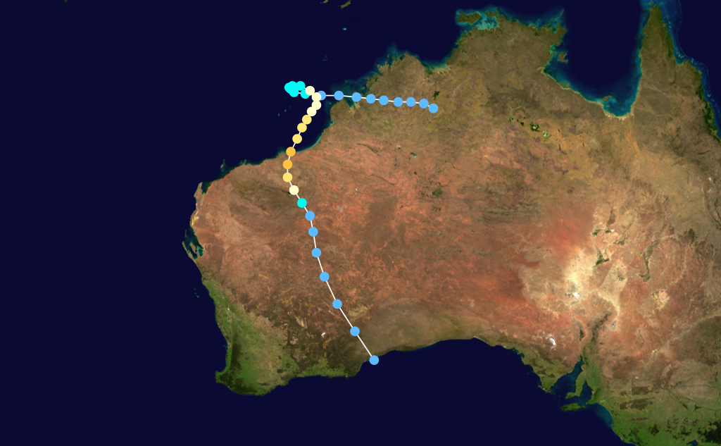
Duration 6 April – 12 April Intensity 195 km/h (120 mph) (10-min), 925 mbar (hPa) Main article: Severe Tropical Cyclone OliviaLasting from 5 April 1996 to 12 April, Olivia reached Category 4 and destroyed 55 houses (plus 27 damaged) at the mining town of Pannawonica. Several buildings also suffered roof damage at neighbouring Mount Tom Price. There were only 10 minor injuries. A gust of 267 km/h was recorded at Varanus Island which is the equal highest recorded wind gust in Australia. [5] [6] More recently, a review conducted by WMO confirmed a reported gust of 408 km/h on Barrow Island on 10 April 1996, at the peak of the storm, making it the highest gust ever recorded on earth during a non-tornadic storm. [7]
Tropical Depression 27S
Tropical depression (SSHS) Duration 12 April – 19 April Intensity 55 km/h (35 mph) (1-min), 1000 mbar (hPa) Tropical Cyclone Jenna
Category 2 tropical cyclone (Australian scale) Tropical storm (SSHS) 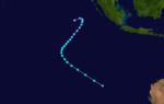
Duration 30 April – 6 May Intensity 95 km/h (60 mph) (10-min), 984 mbar (hPa) Brisbane Tropical Low
Tropical low (Australian scale) Duration 30 April – 5 May Intensity 55 km/h (35 mph) (10-min), 997 mbar (hPa) Storm names
Tropical cyclones are assigned names by the Australian Bureau of Meteorology or Papua New Guinea. Tropical cyclones are named if they are non-frontal low pressure systems of synoptic scale developing over warm waters, or if Dvorak intensity analysis indicate the presence of gale force or stronger winds near the centre. Therefore, tropical systems with gales in one or more quadrants, but not near the centre, are not named.[3] All names assigned in the Australian region are selected sequentially. Only the names used during this cyclone season are listed below. The complete list of names for each basin are found in the World Meteorological Organization's official lists.[4]
Each Australian Tropical Cyclone Warning Centre (Perth, Darwin, and Brisbane) maintained a list of names arranged alphabetically and alternating male and female. Tropical cyclones that develop in the South-East Indian Ocean are assigned names by the Tropical Cyclone Warning Centre in Perth. This region includes the areas east of 90°E, south of the Equator, and west of 125°E. Tropical cyclones that develop south of the Equator between 125°E and 141°E are assigned names by the Tropical Cyclone Warning Centre in Darwin, Northern Territory. This area includes most of the cyclones that form in the Arafura Sea and Western Gulf of Carpentaria. Tropical cyclones in the Coral Sea and Eastern Gulf of Carpentaria between 141°E and 160°E and south of 10°S are assigned names by the Tropical Cyclone Warning Centre in Brisbane, Queensland.[4]
Storms that enter the region that were named by the Mauritius meteorological service or the Fiji Meteorological Service retain their original names. However, those that move from the Australian region into the South-West Indian Ocean (west of 90°E) are renamed by Météo-France. Additionally, the Tropical Cyclone Warning Centre in Port Moresby, Papua New Guinea reserves the right to name cyclones that develop in the Solomon Sea and Gulf of Papua, north of 10°S between 141°E and 160°E. Names are selected randomly from their list and retired once they are used.[5]
Perth
- Daryl - Emma - Frank - Gertie - Hubert - Isobel - Jacob - Kristy
Darwin
- Barry - Olivia
Brisbane
- Celeste - Dennis - Ethel
Additionally, one storm, Jenna, was named the Mauritius meteorological service.[6]
Retirement
At the end of the season, the Bureau of Meteorology retired seven of the thirteen names used during the season. The names were Frank, Gertie, Kristy, Barry, Celeste, Ethel and Olivia.[7]
See also
- List of Southern Hemisphere tropical cyclone seasons
- Atlantic hurricane seasons: 1995, 1996
- Pacific hurricane seasons: 1995, 1998
- Pacific typhoon seasons: 1995, 1996
- North Indian Ocean cyclone seasons: 1995, 1996
References
- ^ "Severe Tropical Cyclone Daryl" (PDF). Bureau of Meteorology. 2011. http://www.bom.gov.au/cyclone/history/pdf/daryl95.pdf. Retrieved 15 February 2011.
- ^ http://www.disasters.ema.gov.au/Browse%20Details/DisasterEventDetails.aspx?DisasterEventID=612
- ^ "Tropical Cyclones: Frequently Asked Questions". Bureau of Meteorology. http://www.bom.gov.au/cyclone/faq/. Retrieved 15 February 2011.
- ^ a b "Tropical Cyclone Operational Plan for the South Pacific and South-East Indian Ocean" (DOC). World Meteorological Organization. 1999. http://www.wmo.ch/pages/prog/www/Peng/tcp/documents/doc/Op-pln99.doc. Retrieved 15 February 2011.
- ^ "Tropical Cyclone Operational Plan for the South Pacific and South-East Indian Ocean" (PDF). World Meteorological Organization. 2006. http://www.wmo.int/pages/prog/www/tcp/documents/TCP-24-OP-PLN-2006-edition-english.pdf. Retrieved 15 February 2011.
- ^ "Tropical Cyclone Jenna". Bureau of Meteorology. 2011. http://www.bom.gov.au/cyclone/history/jenna.shtml. Retrieved 15 February 2011.
- ^ "Retired Australian Region and Papua New Guinea Cyclone Names". Bureau of Meteorology. 2010.


Wikimedia Foundation. 2010.