- Coyote Creek Bridge
-
Coyote Creek Bridge
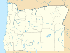

Nearest city: Crow Coordinates: 43°58′12″N 123°19′08″W / 43.97°N 123.31889°WCoordinates: 43°58′12″N 123°19′08″W / 43.97°N 123.31889°W Built: 1922 Governing body: Lane County NRHP Reference#: 79002084 Added to NRHP: November 29, 1979 The Coyote Creek Bridge[1], located near Crow, Oregon, is listed on the National Register of Historic Places.[2]
See also
References
- ^ "Coyote Creek Bridge". Geographic Names Information System, U.S. Geological Survey. November 1, 1991. http://geonames.usgs.gov/pls/gnispublic/f?p=gnispq:3:::NO::P3_FID:1135751. Retrieved 2011-10-20.
- ^ "Oregon National Register List" (PDF). Oregon Parks and Recreation Department. June 6, 2011. p. 20. http://www.oregon.gov/OPRD/HCD/NATREG/docs/oregon_nr_list.pdf. Retrieved July 17, 2011.
U.S. National Register of Historic Places in Oregon Lists by county Baker • Benton • Clackamas • Clatsop • Columbia • Coos • Crook • Curry • Deschutes • Douglas • Gilliam • Grant • Harney • Hood River • Jackson • Jefferson • Josephine • Klamath • Lake • Lane • Lincoln • Linn • Malheur • Marion • Morrow • Multnomah: Portland North • Multnomah: Portland Northeast • Multnomah: Portland Northwest • Multnomah: Portland Southeast • Multnomah: Portland Southwest • Multnomah: Other • Polk • Sherman • Tillamook • Umatilla • Union • Wallowa • Wasco • Washington • Wheeler • Yamhill
Other lists Keeper of the Register • History of the National Register of Historic Places • Property types • Historic district • Contributing property Categories:- National Register of Historic Places in Eugene, Oregon
- Bridges on the National Register of Historic Places in Oregon
- Bridges in Lane County, Oregon
- Road bridges in Oregon


Wikimedia Foundation. 2010.