- List of county routes in Rockland County, New York (76–118A)
-
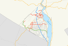 Map of all routes in Rockland County from 76–118A
The following is a list of county routes in Rockland County, New York from Routes 76 to 118A. Most of the routes act as primary roads in the less developed areas and also serve to interconnect the various villages and hamlets of the county. All routes are maintained by the Rockland County highway department. Across the county, routes are numbered such that odd-numbered routes are north–south and increase in number from east to west, while even-numbered routes are east–west and increase from south to north.
There are 25 routes in this segment, the lowest being Route 76 and the highest being Route 118A. The farthest north route is Route 118 in Tomkins Cove, while the farthest south is Route 89 in Airmont. The farthest west is Route 97 in Ramapo and the farthest east is Route 76 in New City. The longest route is Route 80, stretching for 10.4 miles (16.7 km) while the shortest route is Route 98A at a short, .07 of a mile.
Rockland (NY) County Routes (76–118A) CR 76 • CR 80 • CR 80A • CR 81 • CR 83 • CR 84 • CR 85 • CR 86 • CR 89 • CR 90 • CR 93 • CR 94 • CR 95 • CR 97 • CR 98 • CR 98A • CR 100 • CR 106 • CR 108 • CR 109 • CR 110 • CR 112 • CR 118 • CR 118A Other lists: CRs 1–38 • CRs 41–75 Route 76

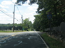
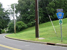
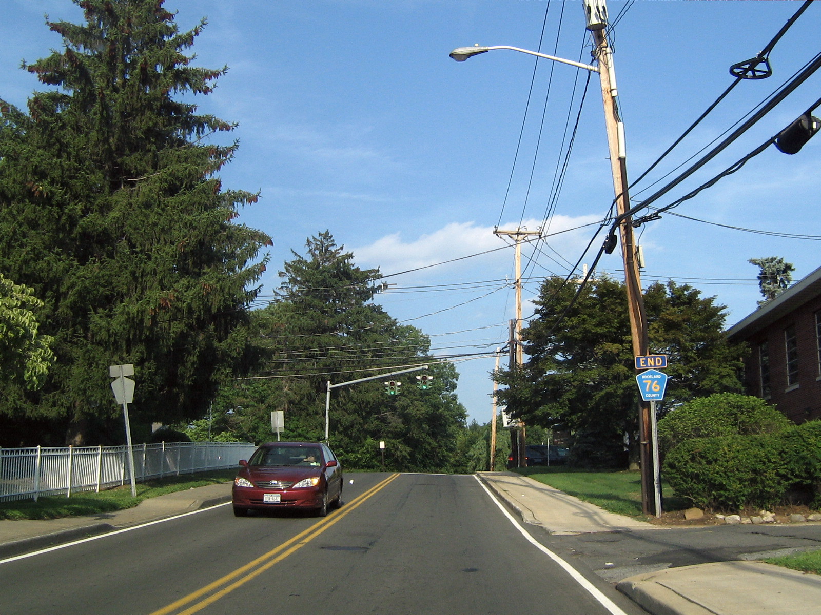
 CR 76's eastern terminus at Main St, close to NY 304 just to the right of this intersection.
County Route 76 is a 0.5 miles (0.80 km) west–east county route in the central part of Rockland County, New York.
Route 76 begins at CR 33, and ends at Main Street in downtown New City.[1] CR 76 runs exclusively in New City. CR 76 allows drivers to cut from Little Tor Road down into the central part of New City. CR 76 is book ended by churches at both of its termini. Park Evangelical Free Church is located at CR 33, and St. Paul's Lutheran Church is located on Main Street. CR 76 passes New City Park early in its route, which includes a private, man-made lake for local residents to swim in. CR 76 comes close to Main Street's southern terminus at NY 304 just south of the downtown business district of New City. CR 76 is one of the shortest Rockland County routes, but unlike the other short ones, it is a highly traveled route.
County Location Mile Destinations Notes Rockland New City 0.0  CR 33 (Little Tor Road)
0.5 Main Street 1.000 mi = 1.609 km; 1.000 km = 0.621 mi Route 80
 Main article: County Route 80 (Rockland County, New York)
County Route 80 is the longest west–east county route in Rockland County at 10.4 miles (16.7 km) miles, and ranks third overall to CR 33 (13.3 miles) and CR 23 (11.0 miles). CR 80 runs through Montebello, Wesley Hills, New Hempstead, New City, and Congers.
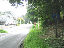
Route 80A

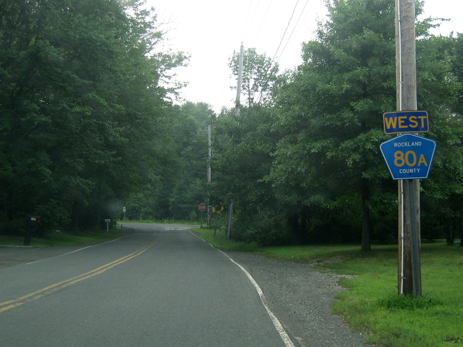
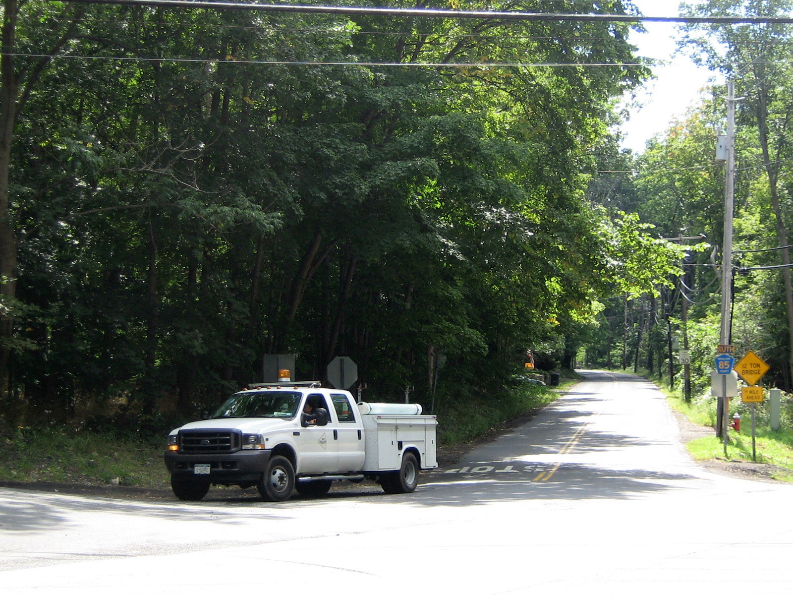
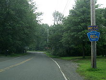 The entire run CR 80A is shown here. The picture is taken from CR 85 northbound, and CR 80 junction signs are seen by the stop sign in the background.
County Route 80A is a 0.07 miles (0.11 km) west–east county route in the western part of Rockland County, New York.
Route 80A begins at CR 80, and ends at CR 85.[2] CR 80A is located exclusively in Montebello. CR 80A is a spur that allows drivers from CR 80 or CR 85 to switch roads without driving directly to the CR 80/CR 85 intersection. The western end of the route is at the driveway of Yeshivas Ohr Reuven, a private Jewish high school.
County Location Mile Destinations Notes Rockland Montebello 0.0  CR 80 (Grandview Avenue)
0.1  CR 85 (Spook Rock Road)
1.000 mi = 1.609 km; 1.000 km = 0.621 mi Route 81

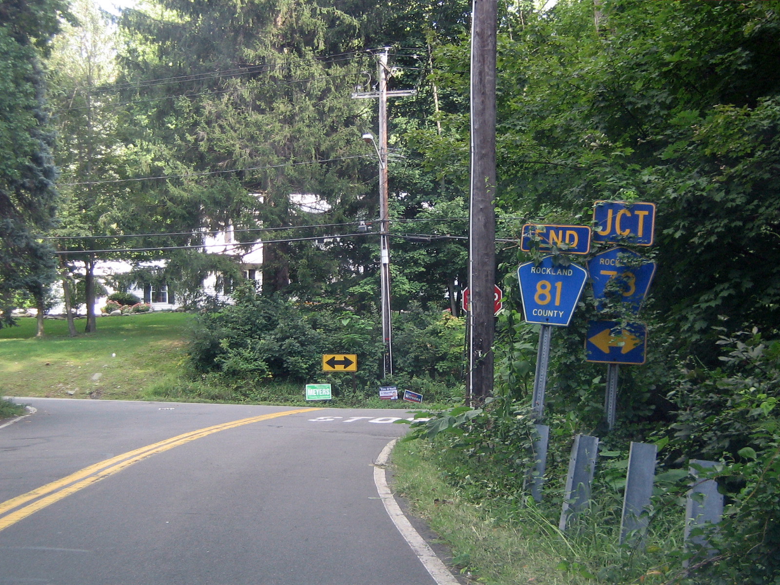
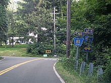 CR 81's southern terminus at CR 73 near CR 73's end at the NY/NJ border.
County Route 81 is a 6.3 miles (10.1 km) south–north route in the western part of Rockland County, New York.
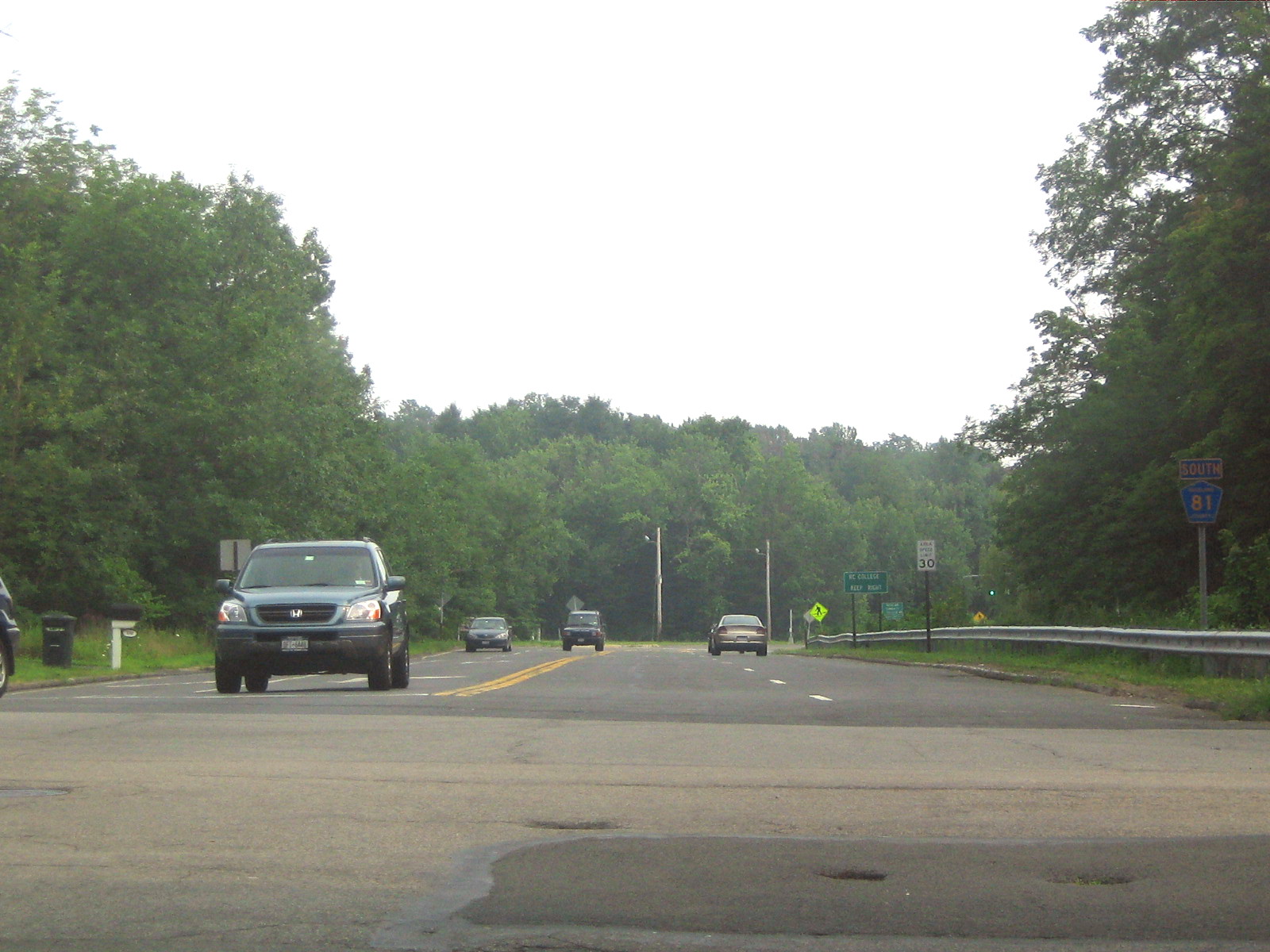
Route 81 begins close to the New Jersey border at CR 73 in Monsey, and ends at US 202, near Harriman State Park, in Wesley Hills.[3][4] CR 81 runs through Monsey, Airmont, Viola, and Wesley Hills.[4] Instead of making a straight path toward a southern terminus at the New Jersey border, CR 81 curves east ending at CR 73.[3] This is to keep CR 81 from being routed into Ascension Cemetery, which is located just north of the New York/New Jersey border along CR 73. CR 81 is routed through mostly residential areas except when it intersects NY 59, and passes Rockland Community College. CR 81 briefly becomes a four-lane road when it passes the college before its intersection with CR 74. After CR 81 passes the college, it goes back to being routed through residential areas. CR 81 runs parallel to CR 85 throughout most of its route. Both are about 6 miles (9.7 km) in length, with CR 81 being the longest Rockland County Route that is entirely located west of the Palisades Interstate Parkway.
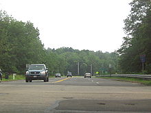 CR 81 southbound as it passes Rockland Community College (in this picture off to the right).
County Location Mile Destinations Notes Rockland Monsey 0.0  CR 73 (East Saddle River Road)
Airmont 2.0  NY 59
NY 59Tallman 2.6  CR 64 (Highview Road)
Viola 3.8  CR 74 (Viola Road)
Wesley Hills 4.7 CR 80 (Grandview Avenue)5.7  CR 84 (Lime Kiln Road)
6.3  US 202 (Willow Grove Road)
1.000 mi = 1.609 km; 1.000 km = 0.621 mi Route 83

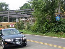
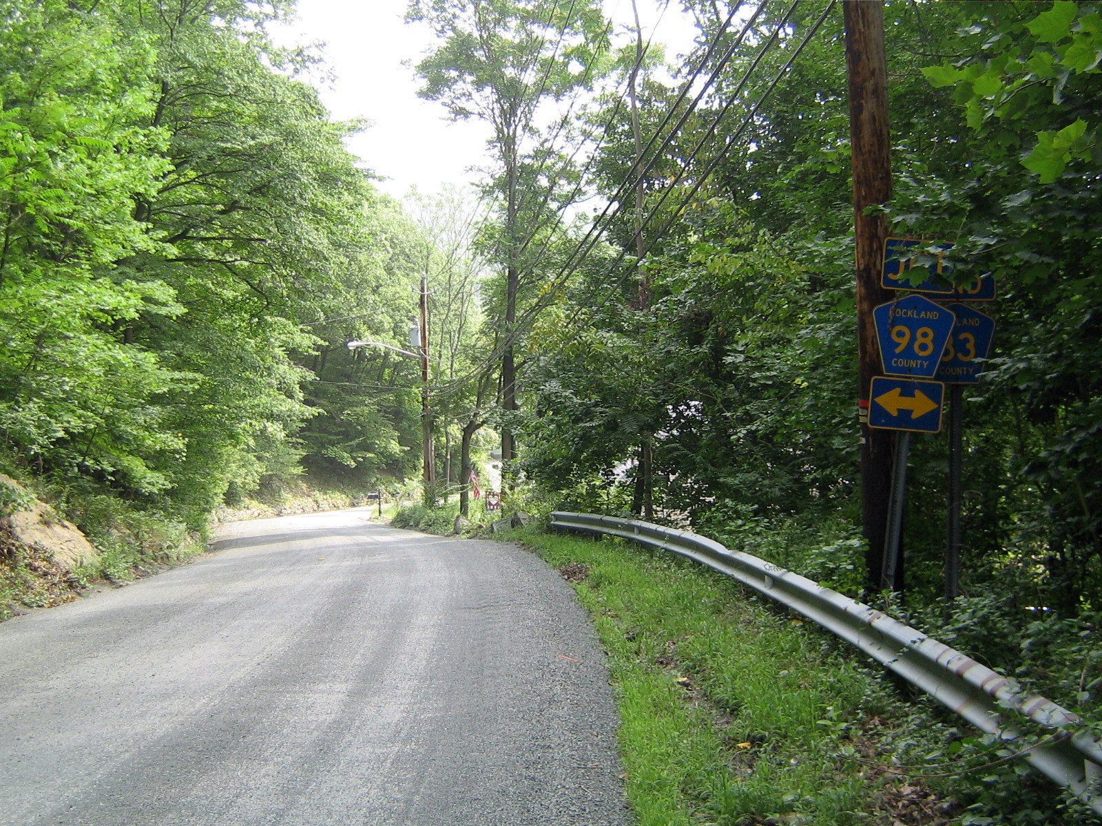
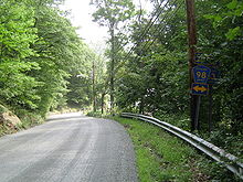 CR 83's southern terminus at CR 98, which is located near CR 75 and exit 14 of the Palisades Parkway.
County Route 83 is a 0.8 miles (1.3 km) south–north county route in the northern part of Rockland County, New York.
Route 83 begins at CR 98, and ends at CR 106.[5] CR 83 runs exclusively through rural Stony Point. CR 83 begins and ends near different entrances to Harriman State Park along Gate Hill Road. CR 83 runs parallel to the Palisades Interstate Parkway between Exits 14 and 15. CR 83's southern terminus is close to CR 75's northern terminus at Call Hollow Road.
County Location Mile Destinations Notes Rockland Stony Point 0.0  CR 98 (Gate Hill Road)
0.8  CR 106 (Gate Hill Road)
1.000 mi = 1.609 km; 1.000 km = 0.621 mi Route 84

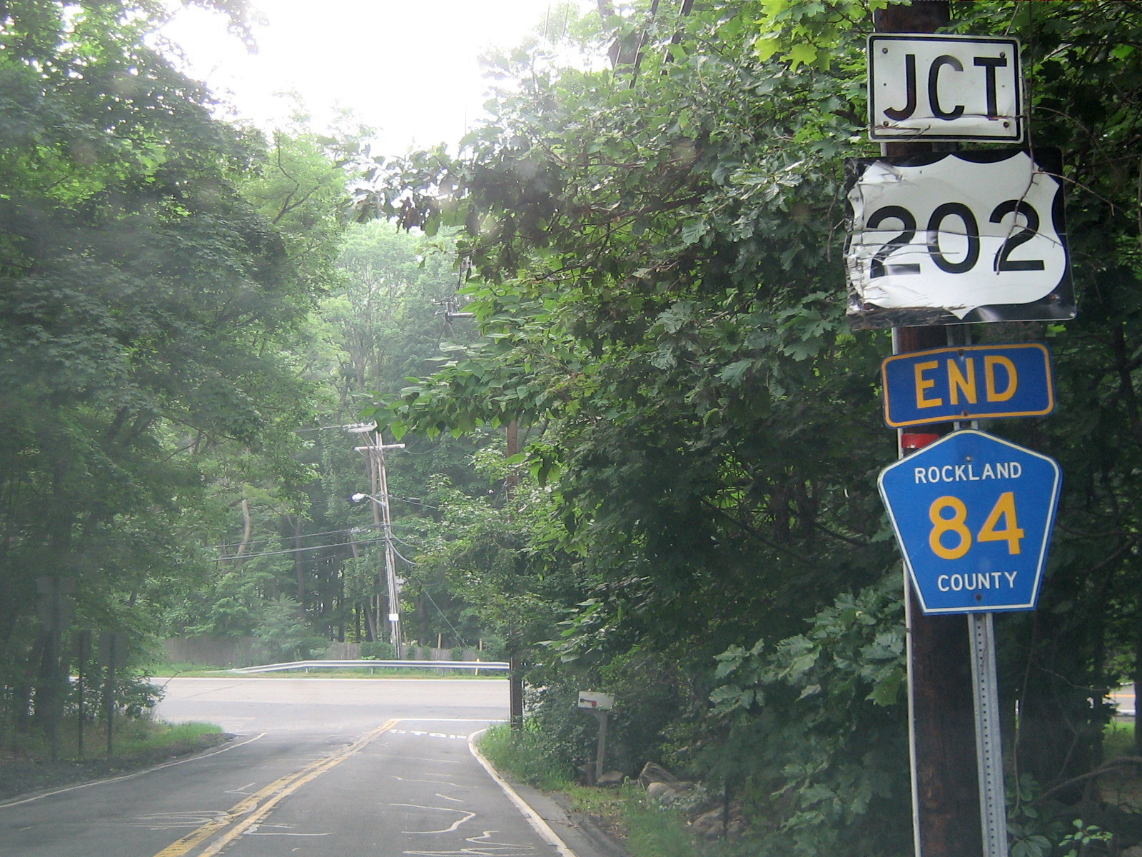
 CR 84 reaches its end at U.S. Route 202. Drivers can elect to go on US 202, or take a sharp left unto to CR 85 which also ends at this location.
County Route 84 is a 1.3 miles (2.1 km) west–east county route in the western part of Rockland County, New York.
Route 84 beings at US 202, and ends at NY 306. CR 84 runs exclusively in Wesley Hills.[3] CR 84 is an alternate route to CR 80, as it runs parallel with it for its entire run. CR 84's western terminus is near Harriman State Park just beyond US 202. CR 84's western terminus is also the northern terminus of CR 85.[3] CR 84's eastern terminus is less than a mile from CR 86 off of NY 306. CR 84 mainly runs through residential areas, and provides a link to Willow Tree Town Park in Wesley Hills.
County Location Mile Destinations Notes Rockland Wesley Hills 0.0 US 2020.0 CR 85 (Spook Rock Road)0.7  CR 81 (Forshay Road)
1.3  NY 306
1.000 mi = 1.609 km; 1.000 km = 0.621 mi Route 85

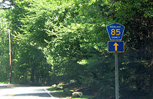 The first northbound CR 85 reassurance sign shown just north of the NY/NJ border in Airmont.
County Route 85 is a 5.8 miles (9.3 km) south–north county route in the western part of Rockland County, New York.
Route 85 begins at the New Jersey border in Airmont and Upper Saddle River, New Jersey, and ends at US 202 in Wesley Hills, near Harriman State Park.[3] CR 85 runs through Airmont, Montebello, and Wesley Hills. CR 85 runs parallel with CR 81 for its entire run. CR 85 passes Spook Rock Golf Course and a couple county parks and pools during its route. CR 85 ends at the New York/New Jersey border, but Cherry Lane continues for another half mile before ending in Upper Saddle River.[3] At its northern terminus, CR 85 shares a terminus with CR 84 at US 202. On US 202, there are no CR 85 junction signs, only CR 84, which begins at the same location as CR 85.
 CR 85 begins here at US 202 at its co-terminus with CR 84, and proceeds south into Montebello.
County Location Mile Destinations Notes Rockland Airmont 2.0 NY 59Tallman 2.6 CR 64 (North Airmont Road / Highview Road)Montebello 3.8 CR 74CR 85 overlaps CR 74 for 0.1 miles (0.2 km) 4.6  CR 80A (Grandview Avenue Extension)
4.8 CR 80 (Grandview Avenue)Wesley Hills 5.8 CR 84 (Lime Kiln Road)5.8 US 202Co-terminus with CR 84 1.000 mi = 1.609 km; 1.000 km = 0.621 mi Route 86

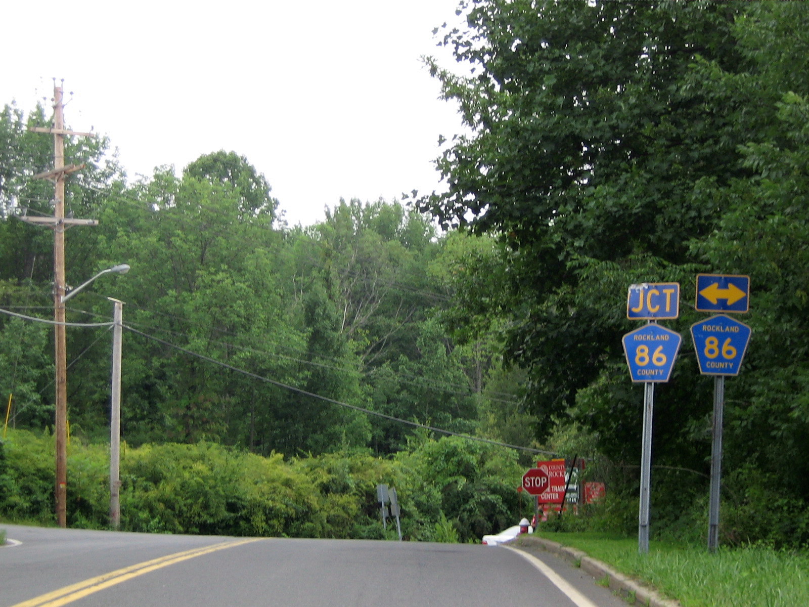
 One of a few signage oddities in Rockland County at CR 49's southern terminus at CR 86.
County Route 86 is a 1.8 miles (2.9 km) west–east county route in the central part of Rockland County, New York.
Route 86 begins at NY 306 in Pomona, and ends at NY 45 in New Hempstead.[3] CR 86 runs exclusively though Pomona, although comes close to Wesley Hills at its western terminus, and close to New Hempstead at its eastern terminus. CR 86's western terminus is about a quarter-mile north of CR 84's eastern terminus along NY 306. CR 86's eastern terminus is about a tenth of a mile south of NY 45's intersection with the Palisades Interstate Parkway (Exit 12).[3] CR 86 is an alternate route to (CR 80), as it runs parallel with it for its entire run. CR 86 runs along the south border of Minisceongo Golf Club and Mount Ivy County Park for a brief period during its run. CR 86 also passes Pomona Middle School along its route. CR86 also provides access to Provident Bank Park, home of the Rockland Boulders of the Can-Am League, near the end of its route.
County Location Mile Destinations Notes Rockland Pomona 0.0 NY 3060.7  CR 67 (McNamara Road)
1.7  CR 49 (Firemen's Memorial Drive)
1.8  NY 45
NY 451.000 mi = 1.609 km; 1.000 km = 0.621 mi Route 89

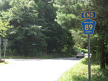 CR 89's southern terminus at the NY/NJ border. Two miles from here is an intersection with NJ 17.
County Route 89 is a 1.8 miles (2.9 km) south–north county route in the western part of Rockland County, New York.
Route 89 begins at the New Jersey border in Airmont and Mahwah, New Jersey, and ends just 0.2 miles (0.32 km) north of the New York State Thruway.[4] CR 89 runs exclusively in Airmont. CR 89 begins after the New Jersey border in residential areas.[4] However, the last half-mile CR 89 intersects NY 59 and the New York State Thruway (I-87/I-287). CR 89 is the only Rockland County Route that has a full intersection with the New York State Thruway (exit 14B). CR 89 provides links to Airmont Lutheran Cemetery, Airmont Town Park, and Fred Rello Fields Town Park. South of CR 89's southern terminus at the New York/NJ border, Airmont Avenue continues to its eventual end at NJ 17.[4]
County Location Mile Destinations Notes Rockland Airmont 1.3 NY 591.6 

 I-87 / I-287 / Thruway
Exit 14B (I-87 / I-287 / Thruway) 1.8 CR 64 (Montebello Road / North Airmont Road)1.000 mi = 1.609 km; 1.000 km = 0.621 mi Route 90

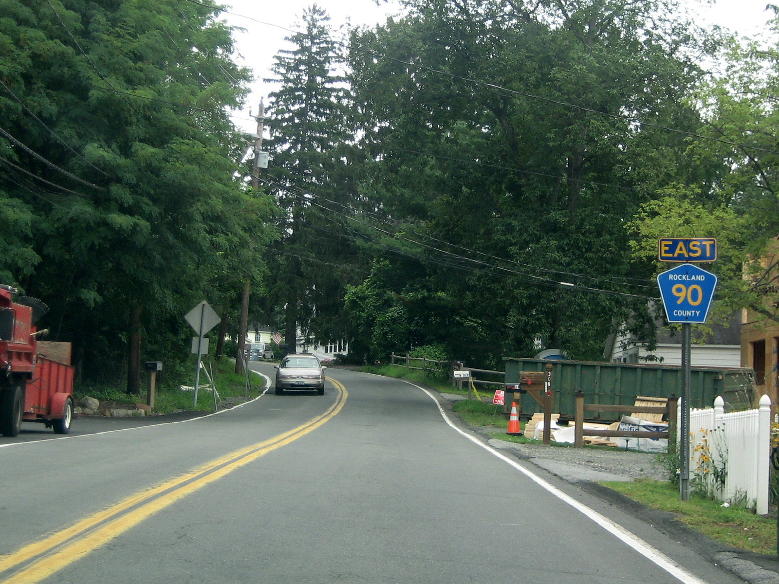
 CR 90 begins here at its co-terminus with CR 29 in north New City, and proceeds east to U.S. 9W
County Route 90 is a 0.8 miles (1.3 km) west–east county route in the eastern part of Rockland County, New York.
Route 90 begins at CR 29 in New City, and ends at US 9W just into the village of Haverstraw.[6] CR 90 runs through the northern parts of New City, and crosses the Haverstraw line just before its eastern terminus. CR 90 runs along the southern border of Hi-Tor State Park. CR 29 marks the western terminus of CR 90, but the road continues as South Mountain Road which continues all the way to NY 45 in Pomona. CR 90's western terminus is also CR 29's northern terminus. At CR 90's eastern terminus at US 9W, the driver has a beautiful view of the Hudson River and Westchester County.
CR 90 is part of the original routing of NY 304.
County Location Mile Destinations Notes Rockland New City 0.0  CR 29 (Haverstraw Road)
0.2  CR 23 (Ridge Road)
Haverstraw 0.8  US 9W
US 9W1.000 mi = 1.609 km; 1.000 km = 0.621 mi Route 93

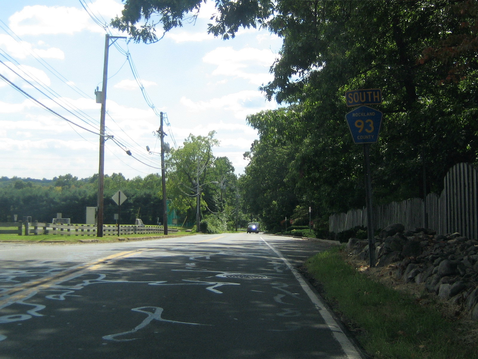
 CR 93 begins here at CR 64 in Montebello, and proceeds south toward its southern terminus at NY 59 in Suffern.
County Route 93 is a 0.8 miles (1.3 km) south–north county route in the western part of Rockland County, New York.
Route 93 begins at NY 59 in Suffern, and ends at CR 64 in Montebello.[7] CR 93 runs in Suffern and Montebello. CR 93 crosses the New York State Thruway (I-287), but does not intersect the highway. CR 93's southern terminus is near Good Samaritan Hospital, on NY 59, in Suffern. CR 93's northern terminus is at Suffern Middle School, and it shares a terminus with CR 64 at this location.[7] CR 93 is mainly a cut-through route from downtown Suffern to more residential areas in Montebello. The route provides a link to a Novartis pharmaceutical plant.
County Location Mile Destinations Notes Rockland Suffern 0.0 NY 59Montebello 0.8 CR 64 (Montebello Road)1.000 mi = 1.609 km; 1.000 km = 0.621 mi Route 94

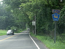 CR 94 begins here, in Thiells, at CR 98 just east of exit 14 of the Palisades Parkway.
County Route 94 is a 3.5 miles (5.6 km) west–east county route in the eastern part of Rockland County, New York.
Route 94 begins at CR 98 in Thiells, and ends at CR 108 in West Haverstraw.[6][8] CR 94 runs through Thiells, Garnerville, and West Haverstraw. CR 94 has a key junction with US 9W/US 202 in West Haverstraw. CR 94 begins just east of CR 98's intersection with the Palisades Interstate Parkway (exit 14) and Harriman State Park. CR 94 provides access to Patriot Hills Golf Course and Phillip J Rotella Golf Course in Thiells. CR 94 formally ended at CR 33 in Garnerville, but recently was extended beyond US 9W/US 202 down toward the Hudson River and Haverstraw Bay County Park. CR 94's western terminus is just across the street from the Stony Point village line.[6]
County Location Mile Destinations Notes Rockland Thiells 0.0 CR 98 (Willow Grove Road)0.8  CR 47 (Thiells – Mount Ivy Road / Hammond Road)
CR 94 overlaps CR 47 for 0.1 miles (0.2 km) Garnerville 2.2 CR 33 (Central Highway)West Haverstraw 2.9 US 9W / US 2023.5  CR 108 (Beach Road)
1.000 mi = 1.609 km; 1.000 km = 0.621 mi Route 95

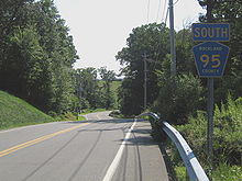 CR 95 begins at this pretty location, and is a scenic route throughout its run. Well, except when it passes some of Rockland County's waste management areas.
County Route 95 is a 1.9 miles (3.1 km) south–north county route in the western part of Rockland County, New York.
Route 95 begins at NY 59 in Hillburn, and ends at a dead end in Sloatsburg.[9] CR 95 goes through Hillburn and Sloatsburg. CR 95 travels along the southwestern border of Harriman State Park. CR 95 parallels NY 59 for the first part of the route, and once it passes Flat Rock Park it goes off on its own. CR 95 then passes Torne Valley Sports Complex during its course. CR 95's final stages is home to several of Rockland County's waste management areas. CR 95's southern terminus is close to US 202 in Suffern, and NY 59's western terminus at NY 17 which is at Exit 15A of the New York State Thruway (I-87) in Hillburn.
County Location Mile Destinations Notes Rockland Hillburn 0.0 NY 591.000 mi = 1.609 km; 1.000 km = 0.621 mi Route 97

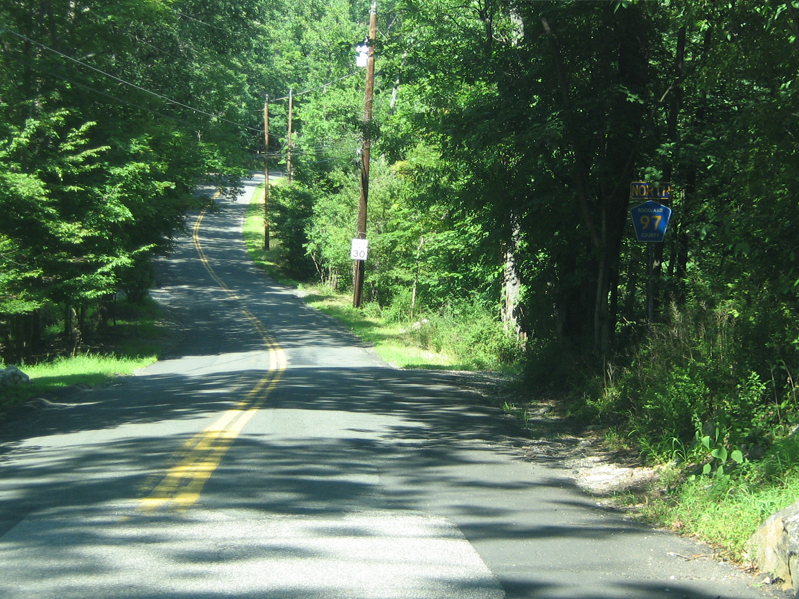
 CR 97 begins here at the start of the yellow lane lines after leaving the village of Sloatsburg.
County Route 97 is a 1.0 mile (1.6 km) south–north county route in the western part of Rockland County, New York.
Route 97 begins at the Sloatsburg village line, and ends at a dead end in Harriman State Park.[5] CR 97 does not enter the village limits of any town in Rockland County, therefore it is designated in the Town of Ramapo. After CR 97's southern terminus, the road continues as Johnstown Road, which continues for another half-mile before ending at Seven Lakes Drive.[5] CR 97 is the most hidden Rockland County Route as there are no indictations that it exists. Johnstown Road is a small, narrow road that appears to be nothing more than a dead end. However, it quickly changes to a two-lane road, and CR 97 begins. CR 97 runs along the southern border of Dater Mountain Nature County Park for most of its route. At the northern terminus of CR 97, there are two hiking trails that lead into Harriman State Park. CR 97 does not intersect any major routes along its run.
Stony Brook Drive, now Johnsontown Road, begins at Seven Lakes Drive, just after the Thruway underpass.[10] It was once a main park drive that went all the way to Lake Sebago and Little Long Pond. From the 1920s to 1962, maps recognized this street as Stony Brook Drive. The name, after 1962, was changed to Johnsontown Road, named after the old village. The road is now just a 1.6-mile (2.6 km) road that ends at a cul-de-sac.[10]
Route 98

 CR 98 here in downtown Stony Point, proceeding west to Harriman State Park.
County Route 98 is a 4.1 miles (6.6 km) west–east county route in the northern part of Rockland County, New York.
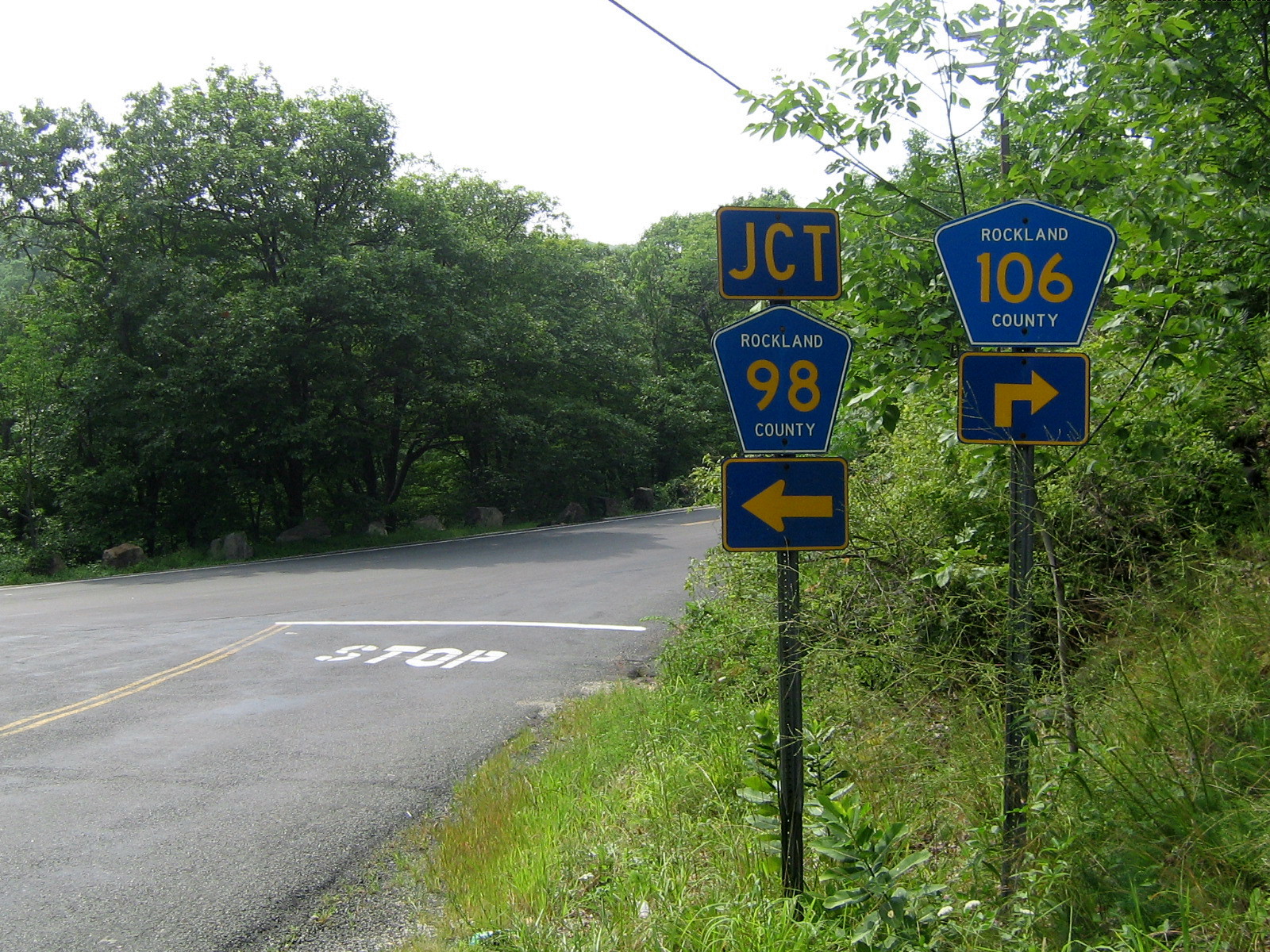
Route 98 begins at CR 106, near Harriman State Park, and ends at US 9W/US 202.[5] CR 98 runs through the Rockland County town of Stony Point, and as well the village limits of Thiells and Stony Point. CR 98 has a junction with the Palisades Interstate Parkway (at Exit 14). CR 98 is an alternate route for CR 106 as it has a very similar path heading into Stony Point. CR 98's western terminus is very close to the CR 106 entrance into Harriman State Park, near Lake Welch, and even borders a piece of the state park that extends out from the rest of the park to the Palisades Interstate Parkway. CR 98 passes Patriot Hill Golf Course and Stony Point Town Park along its route.[5]
CR 98 has one suffixed route, CR 98A. It is located in the town of Stony Point. (see below)[5]
 CR 98 begins here at CR 106 just east of Harriman State Park.
County Location Mile Destinations Notes Rockland Stony Point 0.0 CR 106 (Old Gate Hill Road / Gate Hill Road)0.1  CR 98A (Old Gate Hill Road)
0.8  CR 83 (Blanchard Road)
1.0  CR 75 (Call Hollow Road)
1.5  Palisades Parkway
Exit 14 (Palisades Parkway) Thiells 1.8  CR 94 (Letchworth Village Road)
2.5 CR 47 (Hammond Road / Thiells Road)CR 98 overlaps CR 47 for 0.2 miles (0.3 km) Stony Point 3.6 CR 33 (Central Highway)4.1 US 9W / US 202 (South Liberty Drive)1.000 mi = 1.609 km; 1.000 km = 0.621 mi Route 98A

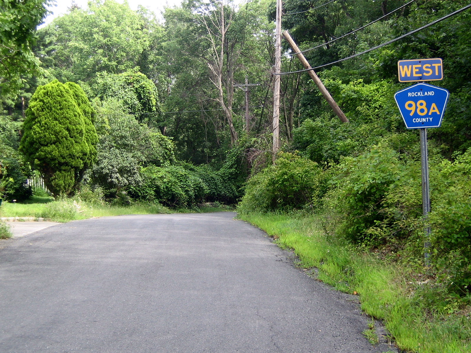
 CR 98A begins here at CR 106. CR 98A is actually heading east despite west signage.
County Route 98A is a 0.1 miles (0.16 km) west–east county route in the northern part of Rockland County, New York.
Route 98A begins at CR 106, and ends at CR 98.[5] CR 98A is located in Stony Point. CR 98A allows drivers to cut from CR 98 to CR 106 or vice versa without going to their intersection. CR 98A is located just before CR 98's western terminus at CR 106 near Harriman State Park. CR 98A is not all that far from Lake Welch and Seven Lakes Drive.[5]
County Location Mile Destinations Notes Rockland Stony Point 0.0 CR 106 (Gate Hill Road)0.1 CR 98 (Gate Hill Road)1.000 mi = 1.609 km; 1.000 km = 0.621 mi Route 100

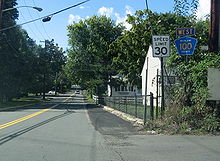 CR 100 begins here at U.S. 9W/202 in Stony Point, and proceeds west through residential neighborhoods before ending at CR 47.
County Route 100 is a 1.2 miles (1.9 km) west–east county route in the northern part of Rockland County, New York.
Route 100 begins at CR 47, and ends at US 9W/US 202.[5] CR 100 runs exclusively in Stony Point. CR 100 runs parallel to CR 106 and CR 98 for its entire run. CR 100 runs mainly through residential neighborhoods, but its eastern terminus is at US 9W/US 202 in downtown Stony Point. CR 100 provides a link for Stony Point Town Park in western Stony Point. To the east of CR 100's eastern terminus is Cedar Pond Brook, which filters into the Hudson River.[5]
County Location Mile Destinations Notes Rockland Stony Point 0.0 CR 47 (Thiells Road)0.5 CR 33 (Central Highway)1.2 US 9W / US 2021.000 mi = 1.609 km; 1.000 km = 0.621 mi Route 106
 Main article: County Route 106 (Rockland County, New York)See also: New York State Route 210
County Route 106 is a continuation of Orange County Route 106 at 7.8 miles (12.6 km). The route was formerly State Route 210 and stretches from the border to Stony Point.
Route 108

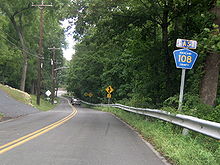
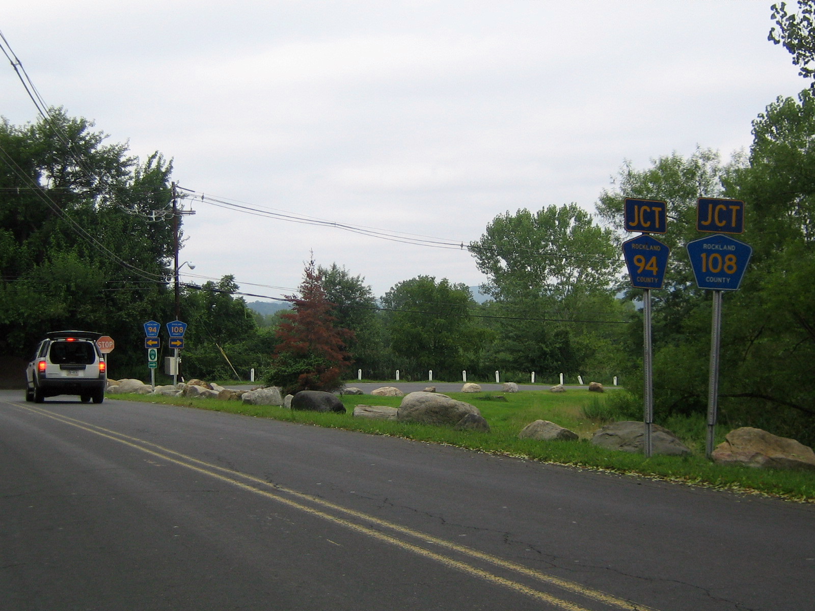
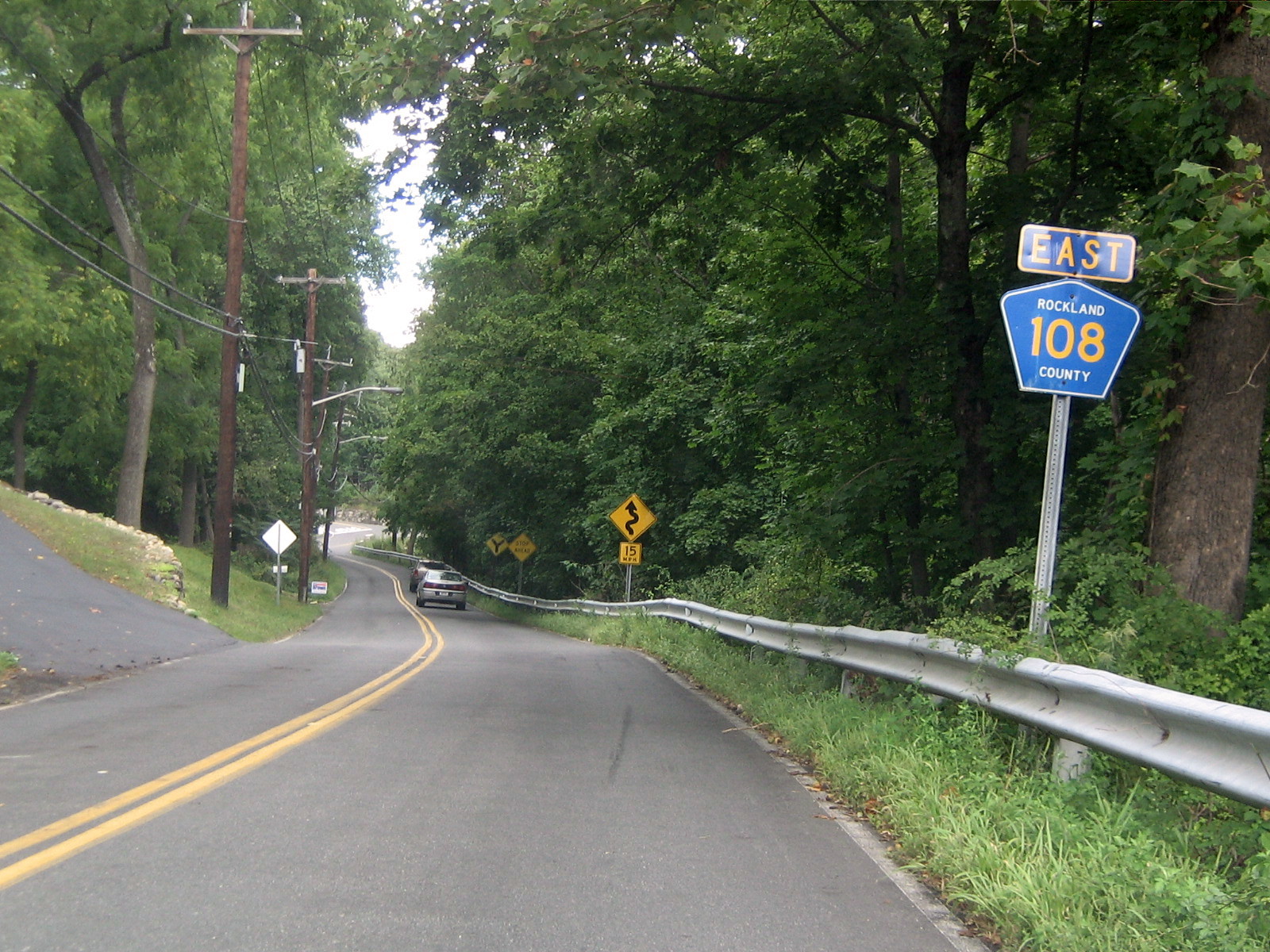
 The view of CR 108 & CR 94's co-eastern termini from Tanneyanns Lane in West Haverstraw.
County Route 108 is a 4.2 miles (6.8 km) west–east county route in the eastern part of Rockland County, New York.
Route 108 begins at CR 106 in Stony Point, and ends at CR 94 in West Haverstraw.[5][6] CR 108 runs through Stony Point and West Haverstraw. CR 108 runs parallel to CR 106 until its junction with US 9W/US 202, but as it hits the Hudson River it turns south and runs along the shore.[5][6] CR 108 actually heads west for less than a quarter of a mile before ending at CR 94. In fact, due to the bizarre routing, CR 108's eastern terminus is CR 94's eastern terminus as well. CR 108 passes the Stony Point Marina and Haverstraw Bay County Park along the Hudson River. From the shore, drivers can see Indian Point Energy Center, and on clear days, and from certain elevations, the Bear Mountain Bridge.
CR 108 is part of the original routing of NY 210.[11]
 CR 108 begins here at CR 106, and proceeds west toward US 9W/202 and the Hudson River.
County Location Mile Destinations Notes Rockland Stony Point 0.0 CR 106 (Central Drive)0.2  CR 112 (Wayne Avenue)
0.6 CR 47 (Reservoir Road)1.4 US 9W / US 2022.1  CR 110 (Beach Road)
West Haverstraw 3.7  CR 109 (Gagan Road)
4.2 CR 94 (Railroad Avenue)1.000 mi = 1.609 km; 1.000 km = 0.621 mi Route 109

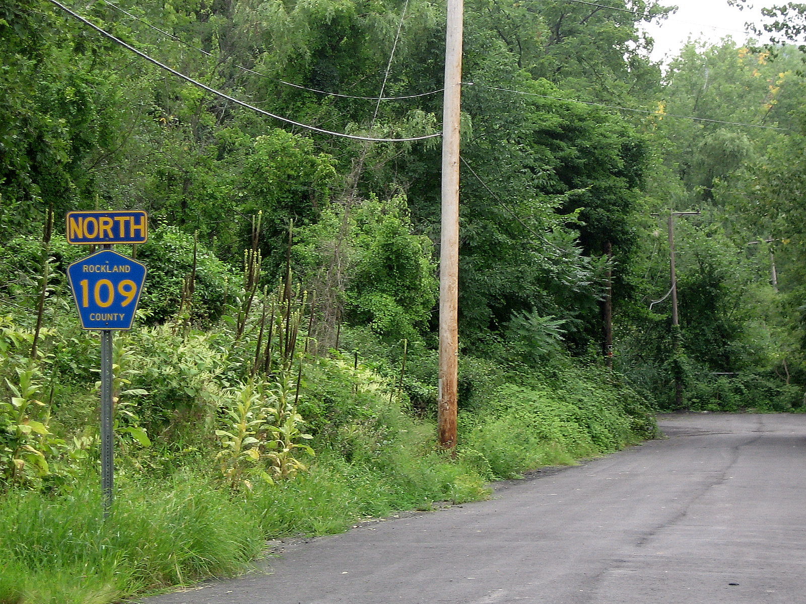
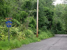 CR 109's southern terminus at the dead end ahead despite the erroneous north marking above 109.
County Route 109 is a 0.2 miles (0.32 km) south–north county route in the eastern part of Rockland County, New York.
Route 109 begins at a dead end near Haverstraw Bay County Park, and ends at CR 108.[6] CR 109 runs exclusively in West Haverstraw.[6] The only reassurance signs along the route face the wrong way, and some maps, including Google Maps, actually show CR 109 heading into the park. This should all be straightened out when construction in Haverstraw Bay County Park is completed.[12]
County Location Mile Destinations Notes Rockland West Haverstraw 0.2 CR 108 (Beach Road)1.000 mi = 1.609 km; 1.000 km = 0.621 mi Route 110

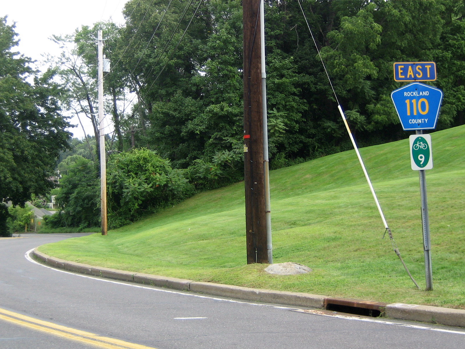
 CR 110 begins here at U.S. 9W/U.S. 202, and heads east to the Hudson River.
County Route 110 is a 0.8 miles (1.3 km) west–east county route in the northern part of Rockland County, New York. It is also multiplexed with part of New York State Bicycle Route 9.[13]
Route 110 begins at US 9W/US 202, and ends at CR 108.[6] CR 110 runs exclusively in Stony Point. Along with CR 108, CR 110 runs along the Hudson River for an extended length of time.[6] CR 110 is Tompkins Avenue and the northern portion of Beach Road that runs along the Hudson River, and CR 108 provides the southern portion. CR 110 provides the driver with an excellent view of the Hudson River, Westchester County, and Indian Point Energy Center. CR 110 comes close to the Stony Point Marina, which is located along CR 108. A little farther north when CR 110 turns west is the historic Battle of Stony Point battlefield, which was fought at during the Revolutionary War.
County Location Mile Destinations Notes Rockland Stony Point 0.0 US 9W / US 202 (North Liberty Drive)0.8 CR 108 (East Main Street / Grassy Point Road)1.000 mi = 1.609 km; 1.000 km = 0.621 mi Route 112
County Route 112
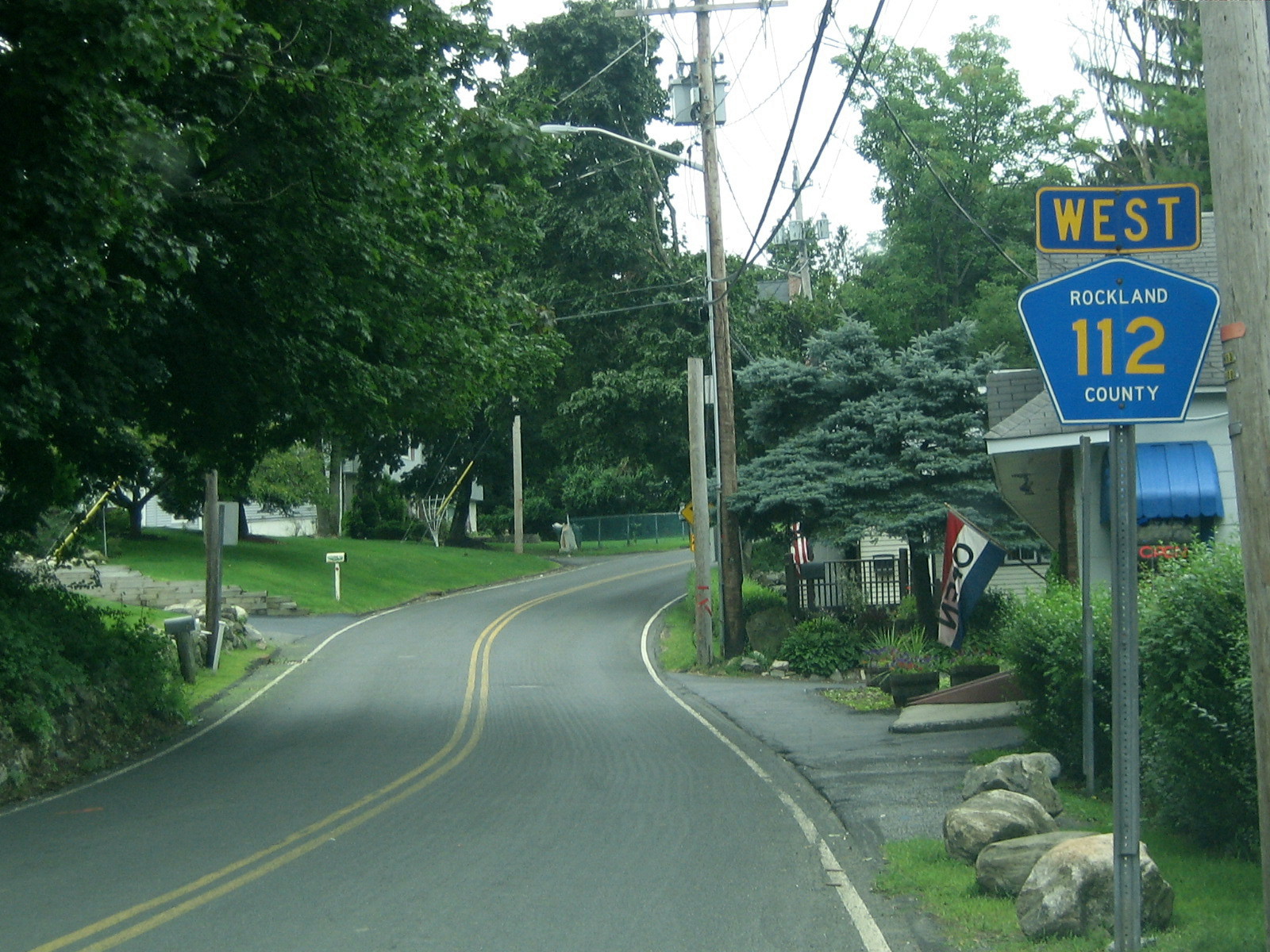
Location: Stony Point Length: 2.47 mi[14] (3.98 km)  CR 112 begins here at U.S. Route 9W, and heads west providing a shortcut to CR 106 and exit 15 of the Palisades Interstate Parkway
County Route 112 is a 1.3 miles (2.1 km) west–east county route in the northern part of Rockland County, New York.
Route 112 begins at CR 108, and ends at US 9W/US 202.[5] CR 112 runs exclusively through Stony Point. CR 112 runs through mainly residential areas. CR 112's western terminus is less than a tenth of a mile from CR 65's southern terminus. In fact, CR 112, CR 65, and CR 108 all end within a quarter-mile from each other. CR 112 begins in a northern direction, but near Lake Boyce it turns due east toward its eastern terminus at US 9W/US 202. CR 112's eastern terminus comes very close to CR 53's southern terminus.[5]
The entire route is in Stony Point, Rockland County.Mile Destinations Notes 0.0 CR 108 (Old Route 210 / West Main Street)0.05  CR 65 (Bulsontown Road)
1.3 US 9W / US 202 (North Liberty Drive)1.000 mi = 1.609 km; 1.000 km = 0.621 mi Route 118
 CR 118's eastern terminus here at U.S. 9W/202
County Route 118
Location: Bulsontown – Tomkins Cove Length: 2.47 mi[15] (3.98 km) County Route 118 is a 2.47-mile (3.98 km) west–east route in northern Rockland County, New York.
Route 118 begins at CR 65 and former CR 69 in Bulsontown, and ends at US 9W/US 202, in Tomkins Cove, near the Hudson River.[5] CR 118 runs through Bulsontown and Tomkins Cove. CR 118's western terminus is also the northern terminus of CR 65. In fact, this location used to be a tri-terminus with CR 118, CR 65, and former CR 69. CR 118 runs along the southern border of Bear Mountain State Park, and passes Bullova Lake and is a link to Tomkins Lake.[5]
CR 118 also passes a disjointed piece of Harriman State Park along its route.[5] In fact, this piece of Harriman State Park is a couple of miles away from the main part of the state park. CR 118 is the highest labeled Rockland County route in any direction, and is the northern most Rockland County route.[5]
The entire route is in Rockland County.Location Mile[15] Destinations Notes Bulsontown 0.00 CR 65 (Bulsontown Road)Northern terminus of CR 65 Tomkins Cove 1.5  CR 53 (Buckberg Road)
Northern terminus of CR 53 2.3  CR 118A (Gays Hill Road)
Southern terminus of CR 118A 2.47 US 9W / US 202 (North Liberty Drive)1.000 mi = 1.609 km; 1.000 km = 0.621 mi Route 118A
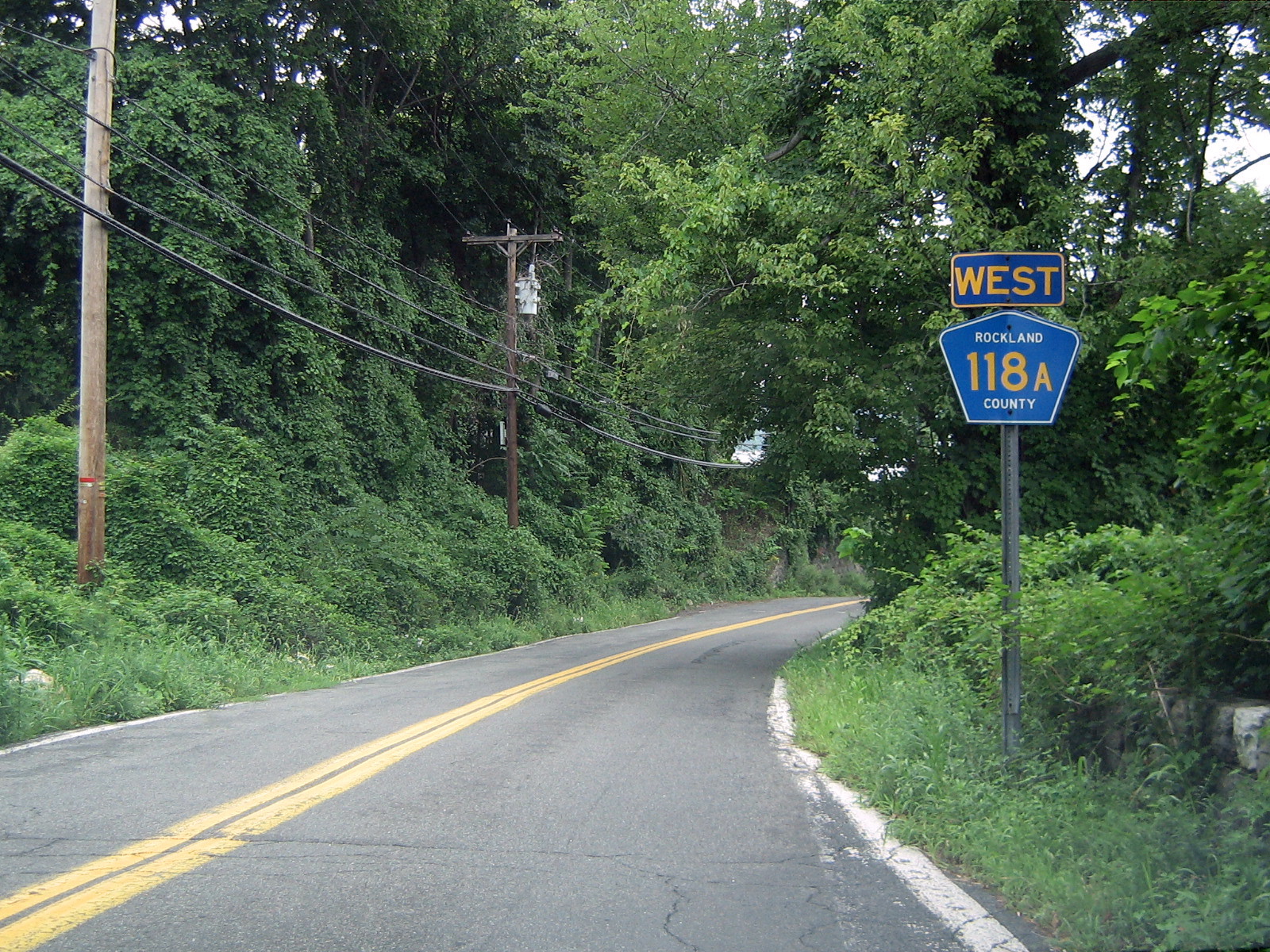
 CR 118A eastbound (despite wrong signage) runs down Gays Hill Road ending just beyond range of this photo.
County Route 118A
Location: Tomkins Cove Length: 0.11 mi[16] (0.18 km) County Route 118A is a 0.11-mile (0.18 km) west–east county highway in the most northeastern region of Rockland County. Route 118A begins at CR 118, and ends at US 9W/US 202.[5] CR 118A is located in Tomkins Cove. CR 118A is a spur that allows drivers from US 9W/US 202 or CR 118 from having to travel to their intersection. While CR 118A is north of CR 118 it is not the northernmost Rockland County Route because CR 118 travels further north during its route.[5]
CR 118A provides the driver a great view of the Hudson River and Indian Point Energy Center across the river in Westchester County. CR 118A leads into West Shore Road beyond its eastern terminus at US 9W/US 202. West Shore Road runs right along the Hudson River before ending back at US 9W/US 202 a mile or so north. The New York State Department of Transportation's traffic counts document actually lists CR 118A as Mott Farm Road, which is parent route CR 118's street name.[17]
County Route 118A begins at an intersection with County Route 118 in Tomkins Cove. The route heads northward along Gays Hill Road, passing a short patch of woodlands. A short distance later, Route 118A comes upon its only intersection, a local driveway. The route makes a short bend, passing another patch of trees in both directions and terminating at an intersection with U.S. Route 9W and U.S. Route 202 in Tomkins Cove.[16]
Location Mile Destinations Notes Tomkins Cove 0.00  CR 118 (Mott Farm Road)
0.11 US 9W / US 202 (North Liberty Drive)1.000 mi = 1.609 km; 1.000 km = 0.621 mi See also
- List of county routes in Rockland County, New York
- List of county routes in Rockland County, New York (1–38)
- List of county routes in Rockland County, New York (41–75)
- County routes in New York
References
- ^ Google Maps. Overview Map of Rockland CR 76 (Map). http://maps.google.com/maps?f=d&hl=en&geocode=8673994528629841,41.136262,-73.991375%3B1789302571348486257,41.136569,-74.000258&saddr=41.136068,-73.991096&daddr=Collyer+Ave%2FCR-76+%4041.136590,+-74.000250&mrcr=0&mrsp=0&sz=16&mra=dme&sll=41.136132,-73.995495&sspn=0.007208,0.014591&ie=UTF8&ll=41.136132,-73.995495&spn=0.028831,0.058365&z=14&om=1. Retrieved September 24, 2007.
- ^ Google Maps. Overview Map of Rockland CR 80A (Map). http://maps.google.com/maps?f=d&hl=en&geocode=1803275821503260599,41.148405,-74.100208%3B2517664476591460868,41.147969,-74.099146&saddr=CR-80%2FGrandview+Ave+%4041.148430,+-74.100250&daddr=41.14788,-74.099114&mrcr=0&mrsp=1&sz=17&mra=dme&sll=41.148107,-74.099007&sspn=0.003603,0.007296&ie=UTF8&z=17&om=1. Retrieved September 24, 2007.
- ^ a b c d e f g h Rockland County, New York (PDF). Legislative District map #4 - Wesley Hills Regional area (Map). http://www.co.rockland.ny.us/Legislature/Hmaps/LD_04.pdf. Retrieved February 17, 2008.
- ^ a b c d e Rockland County, New York (PDF). Legislative District map #12 - Monsey Regional area (Map). http://www.co.rockland.ny.us/Legislature/Hmaps/LD_12.pdf. Retrieved February 17, 2008.
- ^ a b c d e f g h i j k l m n o p q r s t Rockland County, New York (PDF). Legislative District map #1 - Stony Point Regional area (Map). http://www.co.rockland.ny.us/Legislature/Hmaps/LD_01.pdf. Retrieved February 17, 2008.
- ^ a b c d e f g h i Rockland County, New York (PDF). Legislative District map #3 - Haverstraw Regional area (Map). http://www.co.rockland.ny.us/Legislature/Hmaps/LD_03.pdf. Retrieved February 17, 2008.
- ^ a b Rockland County, New York (PDF). Legislative District map #6 - Montebello Regional area (Map). http://www.co.rockland.ny.us/Legislature/Hmaps/LD_06.pdf. Retrieved February 17, 2008.
- ^ Rockland County, New York (PDF). Legislative District map #2 - West Haverstraw Regional area (Map). http://www.co.rockland.ny.us/Legislature/Hmaps/LD_02.pdf. Retrieved February 17, 2008.
- ^ Google Maps. Overview Map of Rockland CR 95 (Map). http://maps.google.com/maps?f=d&hl=en&geocode=17326969998414441388,41.129409,-74.164753%3B3145382540404397952,41.150579,-74.154743&saddr=41.128456,-74.163208&daddr=Torne+Valley+Rd+%4041.150540,+-74.154710&mrcr=0&mrsp=0&sz=16&mra=dme&sll=41.13151,-74.160461&sspn=0.007208,0.014591&ie=UTF8&om=0&ll=41.14014,-74.156084&spn=0.057141,0.11673&z=13. Retrieved September 24, 2007.
- ^ a b Myles, William J. (1999). Harriman Trails, A Guide and History. New York, New York: The New York-New Jersey Trail Conference.
- ^ Anderson, Steve. "Rockland County Routes 101–118". NYCRoads. http://www.nycroads.com/roads/rockland_101-118/. Retrieved March 18, 2010.
- ^ Google Maps. Overview Map of Rockland CR 109 (Map). http://maps.google.com/maps?f=q&hl=en&geocode=&q=CR+109,+Rockland,+New+York,+United+States&sll=41.236124,-73.980389&sspn=0.057574,0.11673&ie=UTF8&ll=41.21319,-73.968458&spn=0.007199,0.014591&z=16&iwloc=addr&om=1. Retrieved September 24, 2007.
- ^ New York State Bicycle Route 9 Map (Haverstraw)
- ^ Yahoo Maps (2009). Overview map of Rockland County Route 112 (Map). Cartography by NAVTEQ Incorporated. http://maps.yahoo.com/#mvt=h&lat=41.26098&lon=-73.976601&zoom=17&q1=41.25852%2C-74.013444&q2=41.265601%2C-73.999861&q3=41.258568%2C-73.982953. Retrieved March 26, 2009.
- ^ a b Yahoo Maps (2009). Overview map of Rockland County Route 118 (Map). Cartography by NAVTEQ Incorporated. http://maps.yahoo.com/#mvt=h&lat=41.26098&lon=-73.976601&zoom=17&q1=41.25852%2C-74.013444&q2=41.265601%2C-73.999861&q3=41.258568%2C-73.982953. Retrieved March 26, 2009.
- ^ a b Yahoo Maps (2009). Overview map of Rockland County Route 118A (Map). Cartography by NAVTEQ Incorporated. http://maps.yahoo.com/#mvt=h&lat=41.261722&lon=-73.980447&zoom=19&q1=41.260846%2C-73.98153&q2=41.262161%2C-73.980682. Retrieved March 27, 2009.
- ^ "Rockland County traffic counts" (PDF). New York State Department of Transportation. 2003. https://www.nysdot.gov/divisions/engineering/technical-services/hds-respository/rocklandtvbk.pdf. Retrieved April 8, 2010.
External links
Categories:- County routes in Rockland County, New York


Wikimedia Foundation. 2010.