- Climate of the British Isles
-

The British Isles are an archipelago off the north-west of Europe, consisting of the islands of Great Britain and Ireland along with smaller surrounding ones. Its position allows dry continental air from Eurasia to meet wetter air from the Atlantic Ocean, which causes the weather to be highly variable, often changing many times during the day. It is defined as a temperate oceanic climate, or Cfb on the Köppen climate classification system. It is significantly warmer than other regions on the same latitude, due to the warmth provided by the Gulf Stream. Temperatures do not often switch between great extremes, with warm summers and mild winters.
Contents
Temperature
The British Isles undergo very small temperature variations. This is due to its proximity to the Atlantic, which acts as a temperature buffer, warming the Isles in winter and cooling them in summer. Coastal areas tend to be more temperature than inland areas, as the influence of the ocean is less acute. Valleys can be especially cold, as cool air collects in them during the winter. July is usually the warmest month, with the highest temperatures being found closest to Continental Europe, in south-east England. Temperatures usually do not reach freezing points, especially in coastal areas.
Sunshine and cloud

The sunniest times are the months of May and June, whereas December has the least sunshine. The clearest skies in the British Isles occur over the south of England, due to the winds from the continent. Equally, mountainous areas, especially in the North-west receive barely any sunshine, sometimes less than 1000 hours a year. In winter on north-south valleys there are sometimes only a few hours of sunshine in a day.
Radiation fog may develop over inland areas of Great Britain and can persist for hours or even days in the winter and can pose a major hazard for drivers and aircraft. Fog is more common inland and on higher altitudes; mainly during winter and during the morning at times of high pressure.
On occasions blocking anticyclones (high pressure systems) may move over the British Isles, which can persist for weeks or even months. The subsided, dry air often results in clear skies and few clouds, bringing frosty nights in winter and hot days in the summer, when some coastal areas can achieve almost maximum possible sunshine for periods of weeks.
Precipitation
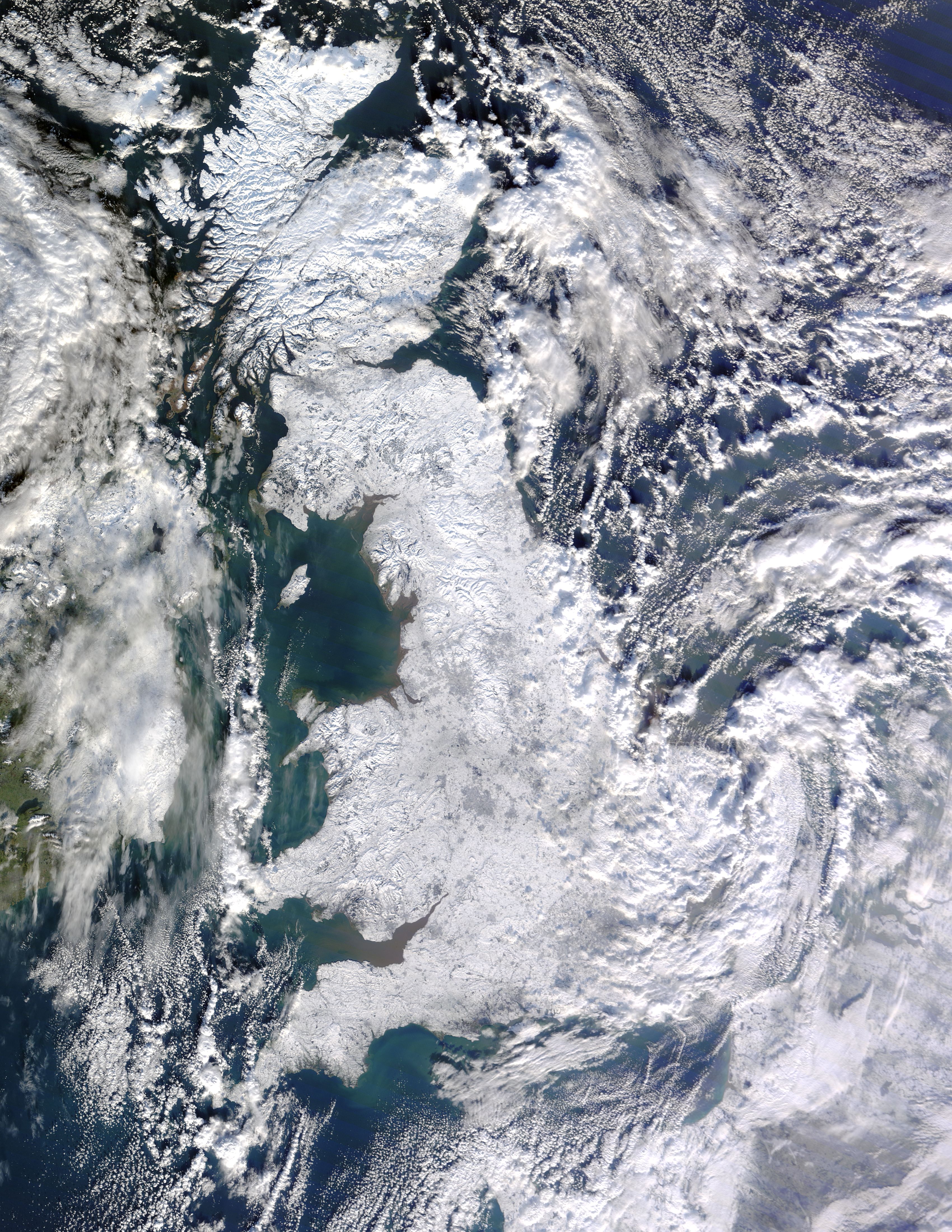
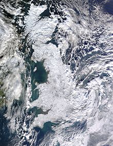 Great Britain in the winter of 2009-2010
Rainfall varies across the Isles, with a general trend to more rain as you go west and in higher elevations. December and January are usually the wettest months. The mountain ranges are the wettest areas in the Isles.[1] These are some of the wettest locations in Europe.[2][3] Most rainfall comes from North Atlantic depressions occur throughout the year and are particularly frequent and intense in the autumn and winter. They can on occasions bring prolonged periods of heavy rain, and flooding is quite common.
Snow can occur during winter months, but is rare. Hail, although uncommon, can happen any time throughout the year.
Winds
The prevailing winds over the British Isles are from the south-west, and winds are strongest on coasts that face the Atlantic. Generally, the coast tends to be windier than inland areas; and the west tends to be windier than the east.
Gales — which are defined as winds with speeds of 51 to 101 km/h (32 to 63 mph)— are strongly associated with the passage of deep depressions across the area. The Hebrides experience on average 35 days of gale a year (a day where there are gale force winds). Areas of high elevation tend to have higher wind speeds than low elevations.
Severe weather
The British Isles do not experience extreme weather regularly. There have been several occasions where extreme weather events have occurred. In the winter of 1982, for a few days parts of central and southern England experienced temperatures lower than central Europe and Moscow. In contrast, the summers of 1975 and 1976 experienced temperatures as high as 35 °C (95 °F). It was so dry the country suffered drought and water shortages.[4] Extended periods of extreme weather, such as the drought of 1975–1976 and the very cold winters of 1946–1947, 1962–1963, 1978–79, 1981–1982 and 2009–2010, are often caused by blocking anti-cyclones which can persist several days or even weeks. In winter they can bring long periods of cold dry weather and in summer long periods of hot dry weather.
Cyclones
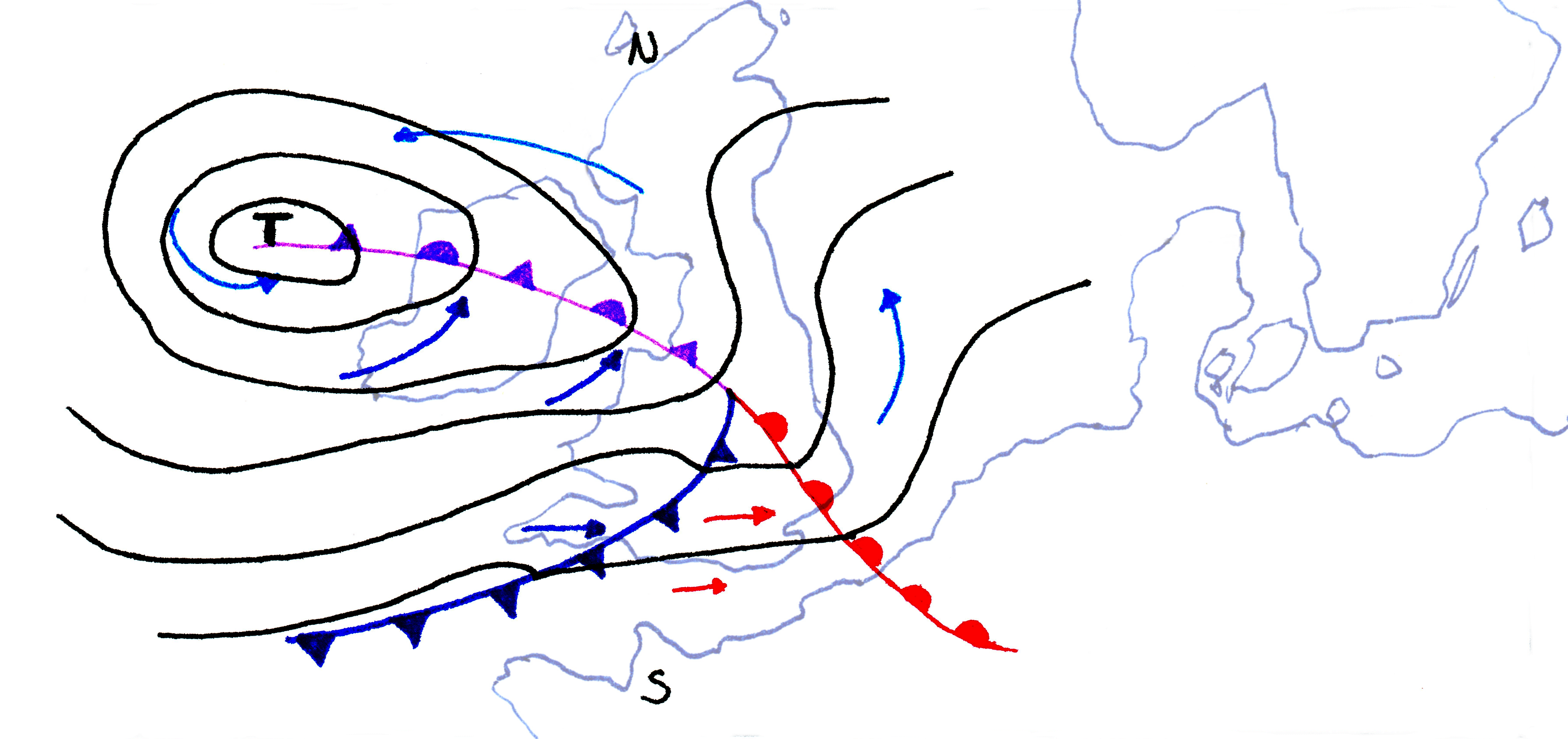
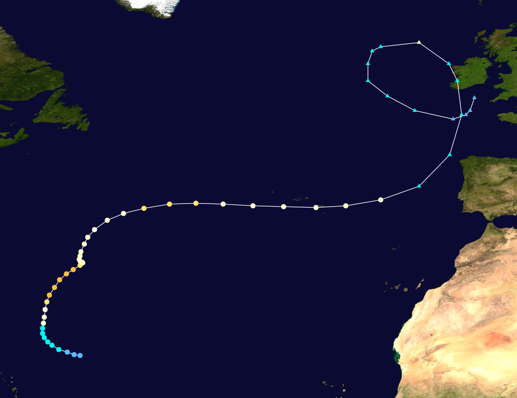
 Hurricane Gordon's path
Tropical cyclones themselves do not affect the British Isles due to the cold temperature of the surrounding Ocean. Any Tropical cyclone that comes near the Isles has said to have undergone a process called extratropical transition. The Isles do experience these extratropical cyclones, The Great Storm of 1987 was a very deep depression which formed in the Bay of Biscay, which also contained the remnants of Hurricane Floyd.[5] Hurricane Lili of 1996 and Hurricane Gordon of 2006 both were strong extratropical cyclones with tropical storm-force winds, which caused transport closures, power-cuts and flooding.
Flash floods
There have also been occurrences of severe flash floods caused by intense rainfall. The most severe was the Lynmouth disaster of 1952 in which 34 people died and 38 houses and buildings were completely destroyed. In the summer of 2004, a severe flash flood devastated the village of Boscastle in Cornwall. However, the worst floods occurred in the North Sea flood of 1953. A powerful storm from the Atlantic moved around Scotland and down the east coast of England. As it moved south it produced a storm surge which was magnified as the North Sea became narrower further south. By the time the storm affected south-east England and the Netherlands, the surge had reached the height of 3.6 metres (12 ft). Over 300 people were killed by the floods in eastern England.
Thunderstorms
Thunderstorms are most common in the south-east, and least common in the north-west.[6] Occasionally, thunderstorms can be severe and produce large hailstones as seen in Ottery St Mary, Devon in October 2008, where drifts reached 1.8 metres (5 ft 11 in).[7]
Climate change
Estimates produced by the Met Office predict average annual temperature to increase by 2°C (4°F) and the warmest summer day to increase by 3°C (6°F) by the 2050s. Average winter rainfall is also likely to increase and most areas will see a slight decrease in annual rainfall.[8]
Recent events
Recently the British Isles have undergone some record breaking events. In 2004-2006, a partial drought caused fires to break out throughout the south of Great Britain, and water restrictions were introduced in some areas. The drought problems were solved due to the unusually wet period between October 2006 and July 2007, which had higher than average rainfall.
The year 2006 was an unusually warm one. Although the year started off cool, from April the weather stayed warmer than average. July was the hottest month on record for the Isles and most of Europe[9],
History
The last glacial period in the British Isles ended about 10,000 years ago. During this period the temperature was so low that much of the surrounding ocean froze and an ice sheet extended across most of the Isles.
The cold period from the 16th century to the mid-19th century is known as the Little Ice Age.
The temperature records in England are continuous back to the mid 17th century. The Central England temperature (CET) record is the oldest in the world, and is a compound source of cross-correlated records from several locations in central England.
See also
References
- ^ "Rainfall Amount (mm) Annual Average". Met Office. http://www.metoffice.gov.uk/climate/uk/averages/19712000/rr/17.gif. Retrieved 2008-04-13.
- ^ Clark, Ross (2006-10-28). "The wetter, the better". The Independent. http://www.telegraph.co.uk/property/3354276/The-wetter-the-better.html. Retrieved 2009-09-02.
- ^ Philip, Catherine (2005-07-28). "40 die as one year's rain falls in a day". London: The Times. http://www.timesonline.co.uk/tol/news/world/article548749.ece. Retrieved 2009-09-02.
- ^ "The 1976 Drought averages". British Broadcasting Corporation. http://www.bbc.co.uk/weather/features/understanding/1976_drought.shtml. Retrieved 2006-08-01.
- ^ "Hurricanes". The BBC. http://www.bbc.co.uk/weather/features/understanding/hurricane_cycle.shtml. Retrieved 2009-04-14.
- ^ "Days of Thunder Annual Average". Met Office. http://www.metoffice.gov.uk/climate/uk/averages/19712000/dt/17.gif. Retrieved 2007-08-14.
- ^ "Hailstorm sparks 'absolute chaos'". BBC News. 2008-10-30. http://news.bbc.co.uk/1/hi/england/devon/7699112.stm. Retrieved 2009-10-30.
- ^ "UKCP Map". The Met Office. http://www.metoffice.gov.uk/climatechange/guide/ukcp/map/. Retrieved 9 December 2009.
- ^ McKie, Robin (October 15, 2006). "Official: this summer is the longest, hottest ever". The Observer. http://observer.guardian.co.uk/uk_news/story/0,,1922913,00.html. Retrieved 2006-11-05.
Categories:
Wikimedia Foundation. 2010.