- Unorganized Kenora District
-
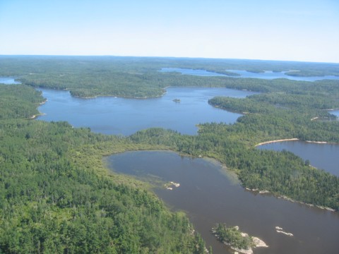
Unorganized Kenora — Unorganized — Scenery near Minaki

 Unorg. Kenora
Coordinates: 53°00′N 89°00′W / 53°N 89°WCoordinates: 53°00′N 89°00′W / 53°N 89°W Country  Canada
Province  Ontario
District Kenora Settled Government – Federal riding Kenora, Timmins—James Bay – Prov. riding Kenora—Rainy River, Timmins—James Bay Area[1] – Land 400,652.34 km2 (154,692.7 sq mi) Population (2006)[1] – Total 7,041 – Density 0.0/km2 (0/sq mi) Time zones EST (UTC-5) CST (UTC-6) – Summer (DST) EDT (UTC-4) CDT (UTC-5) Postal Code FSA P Area code(s) 705, 807 Unorganized Kenora is an unorganized area in northwestern Ontario, Canada, in Kenora District. Comprising 98.39 percent of the district's land area, yet only 10.93 percent of its population, it is essentially the remainder of the district's territory after all incorporated cities, municipalities, townships, Indian reserves, and Indian settlements have been excluded.
Local services boards
- Greater Oxdrift
- Melgund
- Minaki
- Redditt
- Round Lake
- Wabigoon
Demographics
Canada census – Kenora, Unorganized Community Profile 2006 2001 Population:
Land area:
Population density:
Median age:
Total private dwellings:
Mean household income:7041 (-7.7% from 2001)
400,652.34 km2 (154,692.73 sq mi)
0.0 /km2 (0 /sq mi)
44.3 (males: 44.9, females: 43.8)
7603
$43,4997631 (-4.4% from 1996)
401,003.37 km2 (154,828.27 sq mi)
0.0 /km2 (0 /sq mi)
40.4 (males: 41.2, females: 39.8)
8826
$52,368Population trend:[4]
- Population in 2006: 7,041
- Population in 2001: 7,631
- Population in 1996: 10,269 (or 7,981 when adjusted to 2001 boundaries)
- Population in 1991: 9,723
References
- ^ a b "Kenora, Unorganized community profile". 2006 Census data. Statistics Canada. http://www12.statcan.gc.ca/census-recensement/2006/dp-pd/prof/92-591/details/page.cfm?Lang=E&Geo1=CSD&Code1=3560090&Geo2=PR&Code2=35&Data=Count&SearchText=Kenora&SearchType=Begins&SearchPR=01&B1=All&Custom=. Retrieved 2011-06-28.
- ^ "2006 Community Profiles". Statistics Canada. Government of Canada. 2009-02-24. http://www12.statcan.ca/census-recensement/2006/dp-pd/prof/92-591/index.cfm?Lang=E. Retrieved 2011-06-28.
- ^ "2001 Community Profiles". Statistics Canada. Government of Canada. 2007-02-01. http://www12.statcan.ca/english/profil01/CP01/Index.cfm?Lang=E. Retrieved 2011-06-28.
- ^ Statistics Canada: 1996, 2001, 2006 census

Division No. 23, Manitoba Hudson Bay Division No. 22, Manitoba
Division No. 19, Manitoba
Division No. 1, Manitoba
James Bay  Kenora, Unorganized (surrounds most other CSD's
in Kenora District. See Kenora District for a full list)

Angle Twp. (USA) Lake of the Woods, Sioux Narrows-Nestor Falls, Unorg. Rainy River, Unorg. Thunder Bay Unorg. North Cochrane Cities 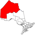
Towns Red Lake • Sioux LookoutTownships Indian reserves Attawapiskat 91A • Bearskin Lake • Cat Lake 63C • Deer Lake • Eagle Lake 27 • English River 21 • Fort Albany 67 (part) • Fort Hope 64 • Fort Severn 89 • Kasabonika Lake • Keewaywin • Kenora 38B • Kingfisher Lake 1 • Kitchenuhmaykoosib Aaki 84 • Lac Seul 28 • Lake of the Woods 31G • Lake of the Woods 37 • Marten Falls 65 • Muskrat Dam Lake • Neskantaga • North Spirit Lake • Northwest Angle 33B • Osnaburgh 63B • Pikangikum 14 • Poplar Hill • Rat Portage 38A • Sabaskong Bay 35C and 35D • Sachigo Lake 1 and 2 • Sandy Lake 88 • Shoal Lake 39A (part) • Shoal Lake 40 (part) • Shoal Lake 34B2 • The Dalles 38C • Wabaseemoong • Wabauskang 21 • Wabigoon Lake 27 • Wapekeka 1 and 2 • Wawakapewin • Weagamow Lake 87 • Whitefish Bay 32A • Whitefish Bay 33A • Whitefish Bay 34A • Wunnumin 1 and 2Indian settlements Unorganized areas Unorganized KenoraSee also: Communities in Kenora District • Census divisions of OntarioCategories:- Kenora District, Ontario
- Unorganized areas in Ontario
- Northern Ontario geography stubs


Wikimedia Foundation. 2010.