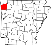
- Cincinnati, Arkansas
-
Cincinnati, Arkansas — Unincorporated community — Cincinnati's position in Arkansas. Coordinates: 36°02′14″N 94°30′40″W / 36.03722°N 94.51111°WCoordinates: 36°02′14″N 94°30′40″W / 36.03722°N 94.51111°W Country  United States
State  Arkansas
County Washington Elevation 321 m (1,053 ft) Time zone Central (CST) (UTC-6) - Summer (DST) CDT (UTC-5) Zip code 72769 Area code(s) 479 GNIS feature ID 47789 U.S. Geological Survey Geographic Names Information System: Cincinnati, Arkansas Cincinnati is an unincorporated community in Washington County, Arkansas, United States. Cincinnati receives mail delivery from Summers (ZIP code 72769). The population of the Summers ZCTA was 942[1] at the 2000 census. It is part of the Fayetteville–Springdale–Rogers, AR-MO Metropolitan Statistical Area.
Contents
Geography
Cincinnati is in the Ozarks on the southern edge of the Springfield Plateau near the Boston Mountains. Cincinnati is on
 Arkansas Highway 59 about 5 miles (8.0 km) north of
  U.S. Route 62 and 2 miles (3.2 km) east of the Oklahoma border.
History
In the early years before 1857, Cincinnati was first known as Buzzard Roost, then Silvia. This early settlement was such a thriving center of commerce that people came from Fayetteville for supplies. [2]
2010 New Year's Eve Tornado Kills Four
"The year 2010 ended with an awful roar, followed by an even worse silence." Three of Cincinnati's inhabitants died during the storm. Another died four days later from injuries sustained in the tornado. [3]
References
- ^ U.S. Census Bureau Fact Finder Fact Sheet for Zip Code Tabulation Area 72769
- ^ [|Poole, Arlen Dee (A D)]. "Cincinnati". Historic Washington County. http://www.historicwashingtoncounty.org/cincinnati.html. Retrieved 2011-01-18.
- ^ Seyler, Randal (Jan 5, 2011), "Tornado Kills Four", Washington County Enterprise-Leader: 1
Municipalities and communities of Washington County, Arkansas County seat: Fayetteville Cities Elkins | Elm Springs‡ | Farmington | Fayetteville | Greenland | Johnson | Lincoln | Prairie Grove | Springdale‡ | Tontitown | West Fork | Winslow
Town Townships Boston | Brush Creek | Cane Hill | Center | Cove Creek | Crawford | Durham | Dutch Mills | Elkins | Elm Springs | Farmington | Fayetteville | Goshen | Greenland | Harmon | Illinois | Johnson | Lee's Creek | Lincoln | Litteral | Marrs Hill | Morrow | Prairie | Prairie Grove | Reed | Rhea's Mill | Richland | Springdale | Starr Hill | Tontitown | Valley | Vineyard | Wedington | West Fork | White River | Winslow | Wyman
Unincorporated
communitiesAppleby | Arnett | Baldwin | Banyard | Beav-O-Rama | Black Oak | Blackburn | Blue Springs Village | Brentwood | Canehill | Cincinnati | Clyde | Durham | Dutch Mills | Evansville | Fayette Junction | Floss | Gulley | Habberton | Harmon | Harris | Hazel Velley | Hicks | Hogeye | Hubbard | Mayfield | McNair | Morrow | Mount Olive | Oak Grove | Odell | Onda | Pilgrim's Rest | Pitkin Corner | Rhea | Rochelle Riviera | Savoy | Shady Grove | Skylight | Sonora | Spring Valley | Starks | Steele | Strain | Strickler | Sulphur City | Summers | Sunset | Suttle | Tolu | Tuttle | Viney Grove | Walnut Grove | War Eagle Cove | Wedington | Wedington Woods | Wheeler | White Rock | Woolsey | Wyman | Wyola
Ghost towns Barbara | Blewford | Carter | Cross Roads | Jabur | McGuire | Porter's Store | Rickert | Rucker's Grove | Sexton | Summit | Sydenham
Footnotes ‡This populated place also has portions in an adjacent county or counties
Categories:- Populated places in Washington County, Arkansas
- Unincorporated communities in Arkansas
Wikimedia Foundation. 2010.


