- St Faith's Church, Little Witchingham
-
St Faith's Church, Little Witchingham 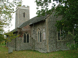
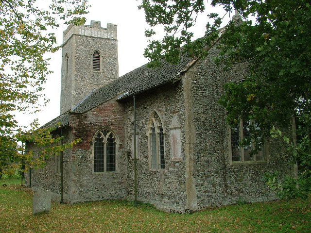
St Faith's Church, Little Witchingham,
from the southeastLocation in Norfolk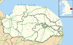
 St Faith's Church, Little Witchingham
Coordinates: 52°44′18″N 1°07′56″E / 52.7383°N 1.1323°E OS grid reference TG 115 203 Location Little Witchingham, Norfolk Country England Denomination Anglican Website Churches Conservation Trust History Dedication Saint Faith Architecture Functional status Redundant Heritage designation Grade II* Designated 22 July 1983 Architectural type Church Style Gothic Groundbreaking 12th century Specifications Materials Flint with stone and brick dressings St Faith's Church, Little Witchingham, is a redundant Anglican church in the village of Little Witchingham in Norfolk, England. It has been designated by English Heritage as a Grade II* listed building,[1] and is under the care of the Churches Conservation Trust.[2] It stands in a relatively isolated position in country lanes, about 9 miles (14 km) northeast of Norwich and 3 miles (5 km) south of Reepham.[2][3] It is notable for its sequence of medieval wall paintings.[2]
Contents
History
St Faith's has its origins in the 12th century, although most of its fabric is from the 14th century. The tower was added in the 15th century.[1][2] In the 1930s the church had fallen into disuse and it became a ruin. In 1967 Eve Baker climbed through a window and rediscovered the existence of medieval wall paintings.[4] These were renovated and the church was repaired by the Norfolk Churches Trust and the Council for the Care of Churches. It is now vested in the Churches Conservation Trust. As of 2011 the church is kept locked because many of its floor tiles were stolen in 2008, but a key can be obtained nearby.[4]
Architecture
The church is constructed in flint rubble with stone and brick dressings. Its plan consists of a nave with a south aisle, a chancel and a west tower. The tower is without buttresses, and its battlemented parapet is decorated with a freize and flushwork panels. Along the south side of the aisle and chancel, and in the east end of the aisle, are two-light windows. The east window has three lights. In the north wall is a blocked doorway. The south wall of the chancel contains a fragment of a stone preaching cross, carved with an image of the Crucifixion. Inside the church the south arcade is carried on octagonal piers and the arches are decorated with zigzag patterns. The roof of the nave and chancel dates from the 18th century.[1]
Wall paintings
The wall paintings date from the middle of the 14th century, and have suffered varying degrees of damage. The roundels in the arcades depict the Four Evangelists. Along the top of the south wall of the church is a painting depicting the apostles around the risen Christ. Below this is a sequence of paintings showing events in the Passion of Christ. Under these is decoration with vines and scrolling. The paintings elsewhere are not as clear. One shows parts of Saint George killing the Dragon, another is thought to have contained Saint Christopher, and another possibly is of The Three Living and the Three Dead.[5]
See also
- List of churches preserved by the Churches Conservation Trust in the East of England
References
- ^ a b c "Church of St Faith, Little Witchingham", The National Heritage List for England (English Heritage), 2011, http://list.english-heritage.org.uk/resultsingle.aspx?uid=1342803, retrieved 18 May 2011
- ^ a b c d St Faith's Church, Little Witchingham, Norfolk, Churches Conservation Trust, http://www.visitchurches.org.uk/Ourchurches/Completelistofchurches/St-Faiths-Church-Little-Witchingham-Norfolk/, retrieved 25 March 2011
- ^ Little Witchingham, Streetmap, http://streetmap.co.uk/grid/611430_320269_120, retrieved 21 February 2011
- ^ a b Little Witchingham St Faith, Little Witchingham, Church of England, http://www.achurchnearyou.com/little-witchingham-little-witchingham-st-faith-church/, retrieved 21 February 2011
- ^ Knott, Simon (June 2004), St Faith, Little Witchingham, Norfolk Churches, http://www.norfolkchurches.co.uk/littlewitchingham/littlewitchingham.htm, retrieved 21 February 2011
External links
Categories:- Grade II* listed buildings in Norfolk
- Grade II* listed churches
- Church of England churches in Norfolk
- English Gothic architecture
- Churches preserved by the Churches Conservation Trust

Wikimedia Foundation. 2010.