- Halki (Greece)
-
Halki (or Chalki)
Χάλκη
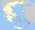
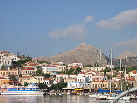
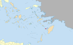
The port of EmporioLocation Coordinates 36°14′N 27°34′E / 36.233°N 27.567°ECoordinates: 36°14′N 27°34′E / 36.233°N 27.567°E Government Country: Greece Region: South Aegean Regional unit: Rhodes Population statistics (as of 2001) Municipality - Population: 313 - Area: 37.04 km2 (14 sq mi) - Density: 8 /km2 (22 /sq mi) Other Time zone: EET/EEST (UTC+2/3) Elevation (min-max): 0 - 601 m (0 - 1972 ft) Postal: 851 10 Telephone: 22460 Auto: ΚΧ, ΡΟ, ΡΚ Website www.halki.gr Halki (Greek: Χάλκη; alternatively Chalce or Chalki) is a Greek island and municipality in the Dodecanese archipelago in the Aegean Sea, some 6 km (4 mi) west of Rhodes. With the area of 28 km2 (11 sq mi), it is the smallest inhabited island of Dodecanese. It is part of the Rhodes peripheral unit.[1] It has permanent population of 330 (increased during the summer months), concentrated in the only village Emborio. The 2001 census showed a population of 313 inhabitants. The community is divided in two parts, Chorio (also spelled Horio) and Emporio (the port).
Contents
History
The island supported a much larger population but following emigration in the mid twentieth century Chorio was almost completely abandoned. A sizable group of the residents moved to Tarpon Springs, Florida, establishing the Greek-American community there that continues to this day. A ruined medieval castle of the Knights of St. John overlooks the old town and the chapel contains some of the original frescoes.
List of Halki rulers:
Roman Empire 27 BC - 395 Byzantine Empire 395 - 7th century Arabs 7th century - 825 Byzantine Empire 825 - 1204 Venice 1204 - Genoa - 1523 Ottoman Empire 1523 - 1912 Italy 1912 - 1948 Greece 1948 Municipality
The Municipality of Chalki includes several uninhabited offshore islands, the largest of which is Alimia to the northeast, and has a total land area of 37.043 km². The island's primary industry is tourism, although fishing is also substantial. There is virtually no natural water supply on the island and rainfall is collected in large cisterns. Drinking water is brought in from Rhodes but there can be shortages during the summer months with the increased population.
References
- ^ Kallikratis law Greece Ministry of Interior (Greek)
External links
 Media related to Halki at Wikimedia Commons
- Official website (Greek), (English)
Articles on the Aegean Sea GeneralCountries Other Cyclades Amorgos · Anafi · Andros · Antimilos · Antiparos · Delos · Despotiko · Donoussa · Folegandros · Gyaros · Ios · Irakleia · Kardiotissa · Kea · Keros · Kimolos · Koufonisia · Kythnos · Milos · Mykonos · Nata · Naxos · Paros · Polyaigos · Rineia · Santorini · Schoinoussa · Serifopoula · Serifos · Sifnos · Sikinos · Syros · Therasia · Tinos · VousDodecanese Agathonisi · Arkoi · Armathia · Alimia · Astakida · Astypalaia · Çatalada · Chalki · Chamili · Farmakonisi · Gaidaros · Gyali · Imia/Kardak · Kalolimnos · Kalymnos · Kandelioussa · Kara Ada · Karpathos · Kasos · Kinaros · Kos · Küçük Tavşan Adası · Leros · Lipsi · Lebynthos · Nimos · Nisyros · Patmos · Pacheia · Platy · Pserimos · Rhodes · Saria · Salih Ada · Symi · Syrna · Telendos · Tilos · ZaforaNorth Aegean Agios Eustratius · Ammouliani · Ayvalık Islands · Büyük Ada · Chios · Chryse · Cunda · Foça Islands · Fournoi Korseon · Icaria · Imbros · Koukonesi · Lemnos · Lesbos · Metalik Ada · Nissiopi · Oinousses · Psara · Samiopoula · Samos · Samothrace · Tenedos · Thasos · ThymainaSaronic Sporades Adelfoi Islets · Agios Georgios Skopelou · Alonnisos · Argos Skiathou · Dasia · Erinia · Gioura · Grammeza · Kyra Panagia · Lekhoussa · Peristera · Piperi · Psathoura · Repio · Rineia Skyrou · Sarakino · Skandili · Skantzoura · Skiathos · Skopelos · Skyropoula · Skyros · Tsougria · ValaxaCretan Afendis Christos · Agia Varvara · Agioi Apostoloi · Agioi Pandes · Agioi Theodoroi · Agios Nikolaos · Anavatis · Arnaouti · Aspros Volakas · Avgo · Crete · Daskaleia · Dia · Diapori · Dionysades · Elasa · Ftena Trachylia · Glaronisi · Gramvousa · Grandes · Kalydon (Spinalonga) · Karavi · Karga · Katergo · Kavallos · Kefali · Kolokythas · Koursaroi · Kyriamadi · Lazaretta · Leon · Mavros · Mavros Volakas · Megatzedes · Mochlos · Nikolos · Palaiosouda · Peristeri · Peristerovrachoi · Petalida · Petalouda · Pontikaki · Pontikonisi · Praso Kissamou · Prosfora · Pseira · Sideros · Souda · Valenti · VryonisiOther Dodecanese Islands The 12 major islands Minor islands Adelfoi Syrnas Islets · Agathonisi · Agioi Theodoroi Halkis · Agreloussa · Alimia · Antitilos · Anydros Patmou · Archangelos · Arefoussa · Arkoi · Armathia · Astakida · Chalavra · Chalki · Chiliomodi Patmou · Chondros · Chteni · Faradonesia · Farmakonisi · Fokionisia · Fragos · Gaidaros · Glaros Kinarou · Gyali · Imia · Kalolimnos · Kalovolos · Kalymnos · Kamilonisi · Kandeloussa · Karavolas Rodou · Kinaros · Koubelonisi · Kouloundros · Kouloura Leipson · Kounoupoi · Koutsomytis · Leipsoi · Levitha · Makronisi Kasou · Makronisi Leipson · Makry Aspronisi Leipson · Makry Halkis · Marmaras · Mavra Levithas · Megalo Aspronisi Leipson · Megalo Glaronisi · Megalo Sofrano · Mesonisi Seirinas · Mikro Glaronisi · Mikro Sofrano · Nimos · Pacheia Nisyrou · Pergoussa · Piganoussa · Pitta · Plati Pserimou · Plati Symis · Pontikousa · Prasonisi · Prasouda · Pserimos · Safonidi · Ro · Saria · Seirina · Sesklio · Strongyli Kastellorizou · Strongyli Kritinias · Telendos · Tragonisi · Zafora
Administrative division of the South Aegean Region Area: 5,286km² • Population: 302,686 (2001) • Capital: ErmoupoliRegional unit of Andros Regional unit of KalymnosRegional unit of KarpathosRegional unit of Kea-KythnosRegional unit of KosRegional unit of MilosRegional unit of MykonosRegional unit of NaxosRegional unit of ParosRegional unit of RhodesRegional unit of SyrosRegional unit of ThiraRegional unit of TinosRegional governor: Ioannis Machairidis • Website: www.pnai.gov.grCategories:
- South Aegean geography stubs
- Dodecanese
- Municipalities of the South Aegean
- Populated places in Rhodes (peripheral unit)
Wikimedia Foundation. 2010.


