- Shurugwi
-
This article is about the town. For the district, see Shurugwi District.
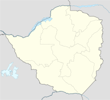
 Location of Shurugwi
Shurugwi, formerly Selukwe, a town and administrative centre in Midlands Province, southern Zimbabwe, located about 350 km south of Harare; population 16,138 (Central Statistical Office, Zimbabwe. Census of Population, 1992. Harare: Government Printer). The town was established in 1899 on Selukwe goldfield, which itself was discovered in the early 1890s not long after the annexation of Rhodesia by the Pioneer Column.
Contents
History
Shurugwi was established in 1899 by the British South Africa Company and Willoughby's Consolidated Company. Its name was derived from a nearby bare oval granite hill that resembled the shape of a pigpen (selukwe) of the local Karanga people.
The district remains an important centre for gold and chrome mining, but is perhaps best known as the home district of the former Rhodesian Prime Minister Ian Douglas Smith who owned a farm near Gwenoro Dam.
Industry and agriculture
The town is the terminus of a branch rail line from Gweru (formerly Gwelo), 22 miles (35 km) to the north. Shurugwi is one of Zimbabwe's largest producers of chrome; other metals also are mined there. Its healthful climate and scenic location attract tourists and retired people. The largest employers are ZIMASCO, UNKI Mine, a subsidiary of Anglo-American through its platinum wing, Angloplats, the government through education, agriculture and health.
Most farmers are peasant farmers who grow maize and other high grain producing crops. Animal husbandry is also practised to some extent.
Natural resources
The town is located on the mineral rich belt, commonly known as the Great Dyke in Zimbabwe, making it one of the most mineral rich towns in the country. Chromite, Gold and Nickel are all mined around Shurugwi. The town is also located on one the most beautiful places in Zimbabwe, Wolfshall Pass, commonly known as Boterekwa due to the winding of the road as it negotiates its way up and between mountains. This is very similar to the pass close to Louis Trichardt in South Africa since both were constructed by an Italian firm, the difference only being there are tunnels in Louis Trichardt. It has been a scene of many road accidents with most of them fatal.The most notable of these accidents occurred in 1976 when a bus load of students from Chrome Secondary School overturned. Only three teachers survived the crash
Facilities
Most of the infrastructure in Shurugwi is very old. There is only one hotel in the town centre - the Grand Hotel which now operates as a bar.
Education
There are a number of schools in Shurugwi including Parkinson High, Chrome High, Shurugwi 2, Batanai High School, Charles Wraith Primary, Railway block primary, Selukwe peak primary, Ironsides primary etc. Most better schools are found in Shurugwi rural area, such as Pakame Mission, one of the oldest schools in the country, a Methodist run mission school which is about 40 km by road on the South towards Zvishavane, very close Guruguru Mountain, a volcanic solid rock mountain in Shurugwi Rural Areas, Tongogara High School, a government operated boarding school 40 km to the East and Hanke Adventist High School, an SDA run school 10 km on the North of Tongogara. All these schools offer up to Advanced Level ("A-Level") education.
There are also some post-independence (post April 18, 1980) schools with basically poor standards of education with pass rates of below 5% on Ordinary Level (O-levels) which is due to quality teachers who normally do not want to teach in rural areas. Rusununguko Secondary School which along the Chivi/Beit Bridge road offers better education though. It is one of the few schools to attain A-Level status in its class.
Shurugwi also has some good rural primary schools such as Vungwi Primary School, Mpumangayi Secondary School and Tumba Primary Schools. Most of the graduates leave Shurugwi after primary/secondary education to pursue further education (usually A' Levels) in other towns as far as Harare. A relative minority ultimately end up studying at the University of Zimbabwe and other post independent universities in Zimbabwe or even at universities abroad. Resultantly, Shurugwi has produced a considerable number of professionals, notably in the fields of Chartered Accountants, Lawyers, Engineers, Medical Doctors etc. There is no tertiary college of any form in Shurugwi and its surrounding areas, with the nearest Technical college available 35 km away in Gweru.
Mhangami Primary School is an Anglican church run school. Originally called St Pius, it was renamed to Mhangami in honour of the local Chief Mhangami. The school was established in 1943 and offers up to grade 7.
Coordinates: 19°40′S 30°00′E / 19.667°S 30°E
Subdivisions of Zimbabwe Provinces Districts Beitbridge · Bikita · Bindura · Binga · Bubi · Buhera · Bulawayo · Bulilimamangwe · Chegutu · Chikomba · Chimanimani · Chipinge · Chiredzi · Chirumhanzu · Chivi · Gokwe North · Gokwe South · Goromonzi · Guruve · Gutu · Gwanda · Gweru · Harare · Hurungwe · Hwange · Hwedza · Insiza · Kadoma · Kariba · Kwekwe · Lupane · Makonde · Makoni · Marondera · Masvingo · Matobo · Mazowe · Mberengwa · Mount Darwin · Mudzi · Mukumbura · Murehwa · Mutare · Mutasa · Mutoko · Muzarabani · Mwenezi · Nkayi · Nyanga · Rushinga · Seke · Shamva · Shurugwi · Tsholotsho · Umguza · Umzingwane · Uzumba-Maramba-Pfungwe · Wedza · Zaka · Zvimba · ZvishavaneWards Largest cities Categories:- Populated places in Zimbabwe
- Midlands (Zimbabwe)
- Populated places established in 1899

Wikimedia Foundation. 2010.