- Mount Victoria (Canada)
-
- This article is for the mountain on the British Columbia-Alberta border in the Canadian Rockies. For the mountain in the Jervis Inlet area of the British Columbia Coast, see Mount Victoria (British Columbia).
Mount Victoria Location in Alberta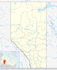
 Mount Victoria
Elevation 3,464 m (11,365 ft) [1] Prominence 553 m (1,814 ft) [2] Location Location Alberta, Canada Range Sir Winston Churchill Range Coordinates 51°22′42″N 116°18′12″W / 51.37833°N 116.30333°WCoordinates: 51°22′42″N 116°18′12″W / 51.37833°N 116.30333°W[2] Topo map NTS 83C/05 Mount Victoria, 3,464 metres (11,365 ft), is a mountain on the border between British Columbia and Alberta in the Canadian Rockies. It is located just northeast of Lake O'Hara in Yoho National Park[3] and is also part of Banff National Park and is on the Continental Divide (which is the definition of the interprovincial boundary in this region).
References
- ^ "Mount Victoria". PeakFinder. http://peakfinder.com/peakfinder.ASP?PeakName=Mount+Victoria. Retrieved 2009-12-12.
- ^ a b "Mount Victoria". Bivouac.com. http://www.bivouac.com/MtnPg.asp?MtnId=1591. Retrieved 2009-12-12.
- ^ "Victoria, Mount". BC Geographical Names. http://apps.gov.bc.ca/pub/bcgnws/names/22482.html.
Categories:- Mountains of Alberta
- Mountains of British Columbia
- Great Divide of North America
- Canadian Rockies
- Borders of Alberta
- Borders of British Columbia
- British Columbia Interior geography stubs

Wikimedia Foundation. 2010.