- Oddingley
-
Coordinates: 52°14′02″N 2°08′02″W / 52.2339°N 2.1339°W
Oddingley 
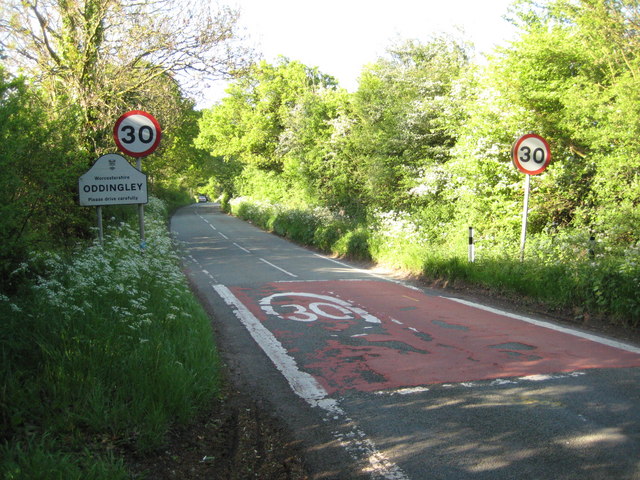
Approaching Oddingley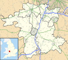
 Oddingley
Oddingley shown within WorcestershirePopulation 197 [1] OS grid reference SO909595 Parish Oddingley District Wychavon Shire county Worcestershire Region West Midlands Country England Sovereign state United Kingdom Post town DROITWICH Postcode district WR9 Dialling code 01905 Police West Mercia Fire Hereford and Worcester Ambulance West Midlands EU Parliament West Midlands UK Parliament Mid Worcestershire List of places: UK • England • Worcestershire Oddingley is a village and civil parish in the English county of Worcestershire, approximately 9 km (5.6 mi) north-east of the county town of Worcester.
Contents
History
 The church of Oddingley seen from the Birmingham-Worcester canal
Toponymy
Oddingley was recorded in 816 as Oddingalea.[2] It was listed in the Domesday Book of 1086 as Oddunclei.[3] The name derives from the Old English for "Woodland clearing of the family or followers of a man called Odda".[2]
19th century
In 1806, Oddingley became known for the unsolved murder of the village parson, Reverend G. Parker. Parker was shot and beaten to death by a man widely suspected to be Richard Hemming, a carpenter from Droitwich.[4] Hemming was never apprehended and it was believed that he had escaped the country. In 1830, a body was found which was later identified to be that of Hemming.[4]
Governance
Oddingley is in the Bowbrook ward of the Worcestershire district of Wychavon. It is part of the constituency of Mid Worcestershire, represented at parliament by Conservative MP Peter Luff.[5] It is part of the West Midlands constituency of the European Parliament.
Geography
Oddingley lies approximately 9 km (5.6 mi) north-east of the county town of Worcester and about 5 km (3.1 mi) south of Droitwich. Nearby villages to Oddingley include Newland, Dunhampstead, Saleway, Sale Green and Tibberton. It is situated close to the Worcester and Birmingham Canal.[6]
Demography
The population of Oddingley, according to the 1801 census, was 110. In the 1991 census, the population of the village was recorded as 165. By 2001, this had grown to 197 with 77 households.[1]
Population of Oddingley[7] Year 1801 1811 1821 1831 1841 1851 1861 1871 1881 1891 Population 110 155 168 157 - - 202 195 193 152 Year 1901 1911 1921 1931 1941 1951 1961 1971 1981 1991 Population 130 110 97 113 - - - - - 165 Year 2001 Population 197 Church
Oddingley's church is dedicated to Saint James the Apostle and lies to the south of the village.[6][8]
References
- ^ a b "2001 Census Worcestershire" (PDF). http://worcestershire.whub.org.uk/home/cs-research-census-populationreport.pdf. Retrieved 2008-06-07.[dead link]
- ^ a b Mills, A. D. (1998). Dictionary of English Place-Names. Oxford University Press. pp. 260. ISBN 0192800744.
- ^ "Oddingley". Domesday Book. The National Archives. 1086. http://www.nationalarchives.gov.uk/documentsonline/details-result.asp?Edoc_Id=7577667&queryType=1&resultcount=1. Retrieved 2008-06-07.
- ^ a b Turberville, T. C. (1852). Worcestershire in the Nineteenth Century: A Complete Digest of Facts. Longman, Brown, Green, and Longmans. pp. 123–129. http://books.google.co.uk/books?id=07sHAAAAQAAJ.
- ^ "UK Parliament - Find your MP". http://findyourmp.parliament.uk/commons/postcode/search/l/WR9+7NF.html. Retrieved 2008-06-07.
- ^ a b A History of the County of Worcester: volume 3. British History Online. 1913. pp. 456–460. http://www.british-history.ac.uk/report.aspx?compid=43153.
- ^ "Online Historical Population Reports". University of Essex. http://www.histpop.org/ohpr/servlet/Search?ResourceType=Census&ResourceType=Legislation&ResourceType=Essays&ResourceType=Registrar+General&ResourceType=TNA&SearchTerms=Oddingley&search=Search&simple=yes&path=Results&treestate=expandnew&active=yes&titlepos=0. Retrieved 2008-06-07.
- ^ Lewis, Samuel (1848). 'Ocle-Livers - Offwell', A Topographical Dictionary of England. British History Online. pp. 469–472. http://www.british-history.ac.uk/report.aspx?compid=51191.
Categories:- Villages in Worcestershire


Wikimedia Foundation. 2010.