- Newland, Worcestershire
-
Coordinates: 52°08′04″N 2°17′59″W / 52.1344°N 2.2997°W
Newland 
Beauchamp Community alms houses, built 1864, Newland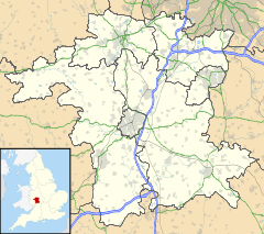
 Newland
Newland shown within WorcestershireOS grid reference SO796485 Parish Newland District Malvern Hills Shire county Worcestershire Region West Midlands Country England Sovereign state United Kingdom Post town MALVERN Postcode district WR13 Police West Mercia Fire Hereford and Worcester Ambulance West Midlands EU Parliament West Midlands UK Parliament West Worcestershire List of places: UK • England • Worcestershire Newland is a village and civil parish on the north-eastern edge of Malvern Link, Worcestershire, England, on the A449 road. A church, the St Leonard Chapelry, in Newland is associated with the Beauchamp Community of retired Church of England priests.[1]
The village lies on the edge of the 6.5 hectare Newland Common, which is protected by the Malvern Hills Conservators and is centred on the traditional English Swan Inn public house.[2] Adjacent to the Swan is a cricket field run as part of Barnards Green Cricket Club. Both the Swan and the cricket field are owned by the Trustees of the Madresfield Estate - a large local landowner. There is no shop or post office in the village.
Alongside the Hereford to Worcester railway line to the north of the village is a former halt, with a signal box and level crossing. This is now a showman site of mobile homes where showpeople live and store their rides, amusements and trade equipment.
References
- ^ St. Leonards, Newland, The Chapel of the Beauchamp Community, Malvern Retrieved 23 October 2010
- ^ Retirement of Swan landlord Retrieved 24 May 2009.
External links
Areas of Malvern, Worcestershire Barnards Green · Cowleigh · Great Malvern · Hall Green · Howsel (Lower) · Howsel (Upper) · Link Top · Little Malvern · Malvern Link · Malvern Wells · Newland · North Malvern · Poolbrook · Pound Bank · Sherrard's Green · West Malvern · Wyche (Lower) · Wyche (Upper)Categories:- Malvern, Worcestershire
- Villages in Worcestershire
- Worcestershire geography stubs


Wikimedia Foundation. 2010.