- Millersylvania State Park
-
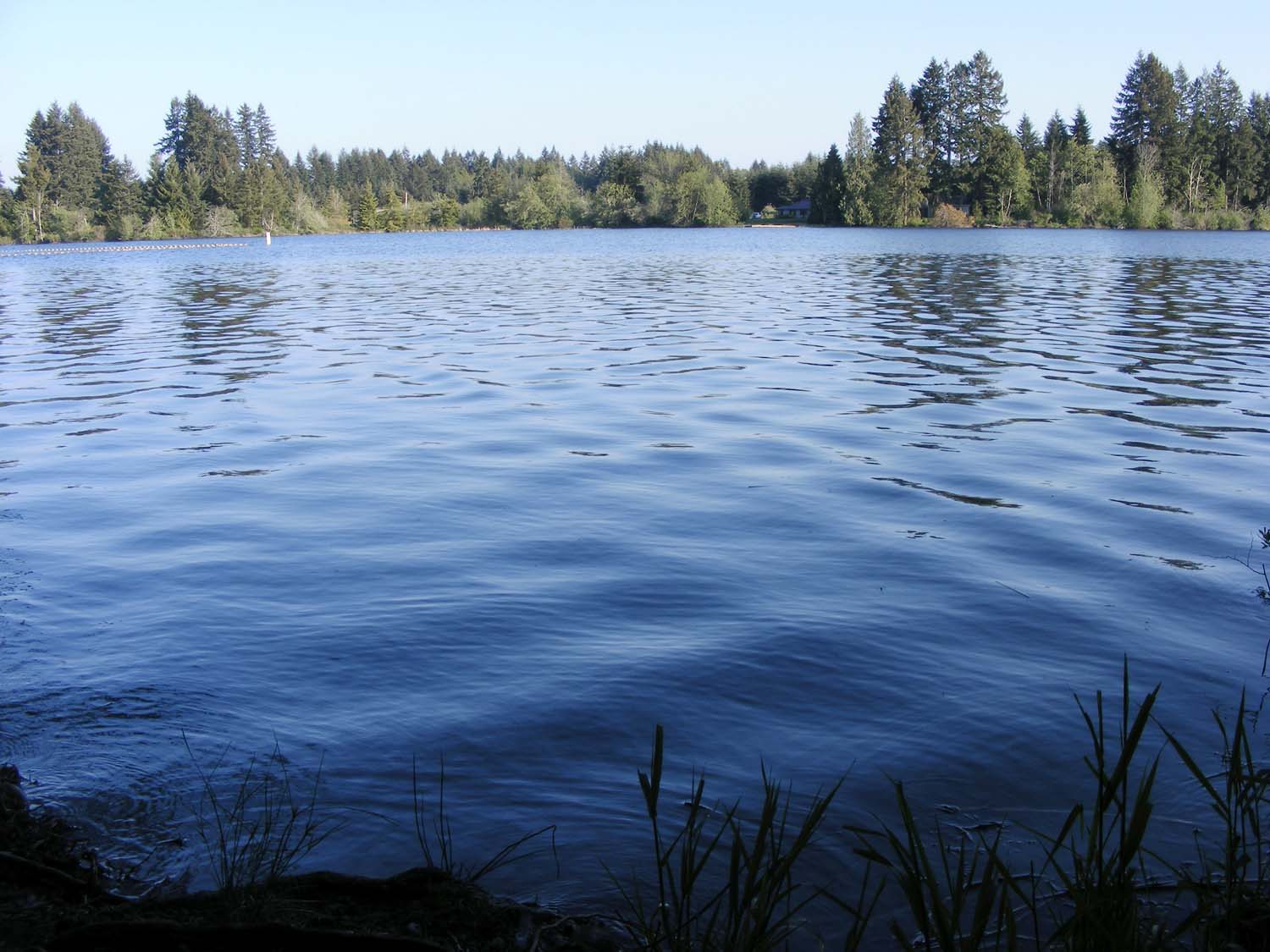
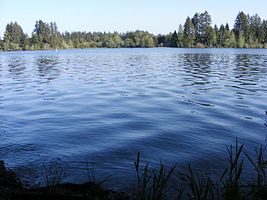 Deep Lake
Millersylvania is an 842 acre (3.4 km²) park 10 miles (16 km) south of Olympia, Washington. The park has 6 miles (9.7 km) of trails (including the 1-mile (1.6 km) fitness trail), old-growth cedar and fir trees, and also features camping and 3,300 feet (1 km) of freshwater shoreline on Deep Lake.
Deep Lake is located in Section 3, Township 16N, Range 2W, Willamette.[1]
According to the survey done by the State Department of Game in 1947, Deep Lake is 17 feet (5.2 m) deep at its deepest part. It covers an area of 66.2 acres (268,000 m2), and has a water volume of 771 acre feet (951,000 m3)[2]. It was once reportedly home to a rare species of freshwater crab as reported in the Miller Family diaries, which went extinct due to overfishing by new settlers coming from the east.[citation needed]
An 1855 survey noted the name as Deep Lake.[3] For a period of time, the lake was called Drake Lake, which was named after the Lyman Darrow Drake Family that settled on the south side of the lake in 1872. The Drake family sold their property in 1908 but the Drake Lake name was still commonly used up until the late 1920s as was evidenced by several US Geological Survey and Metsker Maps dated up to 1929.
History
The first known name of the lake was Deep Lake as noted in a land survey in 1855.[3] For a period of time, the lake went under the name Drake Lake, but was changed back to Deep Lake in 1907.[1] The park was originally called "Miller's Glade" by the Miller family, who once owned the property. The family later changed the name to "Millersylvania," meaning "wooded glade." The park's 842 acres were homesteaded by Squire Lathum in 1855 before being sold to John Miller. Miller's family gave the property to the state in 1921, stipulating that the land must forever be used as a park. Millersylvania's buildings were reconstructed in 1935 almost entirely by hand by the Civilian Conservation Corps. Relics of a narrow-gauge railroad and several skid roads used in the 19th century by the logging industry remain on park grounds. Stumps of trees still carry notch scars where springboards supported brawny loggers.
References
External links
Protected Areas of Washington Federal National ParksNational MonumentsEbey's Landing National Historical Reserve · Fairhaven Historic District · Pioneer Square Historic District · Vancouver National Historic Reserve Historic District
National Recreation AreasNational Wildlife RefugesColumbia · Conboy Lake · Copalis · Dungeness · Flattery Rocks · Franz Lake · Grays Harbor · Julia Butler Hansen Refuge for the Columbian White-Tailed Deer · Lewis and Clark · Little Pend Oreille · McNary · Nisqually · Pierce · Protection Island · Quillayute Needles · Ridgefield · Saddle Mountain · San Juan Islands · Steigerwald Lake · Toppenish · Turnbull · Umatilla · Willapa
National WildernessAlpine Lakes · Boulder River · Brothers · Buckhorn · Clearwater · Colonel Bob · Glacier Peak · Glacier View · Goat Rocks · Henry M. Jackson · Indian Heaven · Juniper Dunes · Lake Chelan-Sawtooth Ridge · Mount Adams · Mount Baker · Mount Rainier · Mount Skokomish · Noisy-Diobsud · Norse Peak · Olympic · Pasayten · Salmo-Priest · San Juan · Stephen Mather · Tatoosh · Trapper Creek · Washington Islands · Wenaha–Tucannon · Wild Sky · William O. Douglas · Wonder Mountain
State Alta Lake · Anderson Lake · Battle Ground Lake · Bay View · Beacon Rock · Belfair · Birch Bay · Blake Island · Blind Island · Bogachiel · Bottle Beach · Bridgeport · Bridle Trails · Brooks Memorial · Cama Beach · Camano Island · Camp Wooten Environmental Learning Center · Cape Disappointment · Centennial Trail · Clark Island · Columbia Hills · Columbia Plateau Trail · Conconully · Crawford · Curlew Lake · Cutts Island · Damon Point · Daroga · Dash Point · Deception Pass · Dosewallips · Doug's Beach · Eagle Island · Fay Bainbridge · Federation Forest · Fields Spring · Flaming Geyser · Fort Casey · Fort Columbia · Fort Ebey · Fort Flagler · Fort Okanogan · Fort Simcoe · Fort Townsend · Fort Ward · Fort Worden · Ginkgo Petrified Forest · Goldendale Observatory · Grayland Beach · Griffin Bay · Griffiths-Priday · Harstine Island · Hope Island (Mason County) · Hope Island (Skagit County) · Ike Kinswa · Illahee · Iron Horse · James Island · Jarrell Cove · Joemma Beach · Jones Island · Joseph Whidbey · Kanaskat-Palmer · Kinney Point · Kitsap Memorial · Kopachuck · Lake Chelan · Lake Easton · Lake Sammamish · Lake Sylvia · Lake Wenatchee · Larrabee · Leadbetter Point · Lewis and Clark · Lewis and Clark Trail · Lime Kiln Point · Lincoln Rock · Manchester · Maryhill · Matia Island · McMicken Island · Millersylvania · Moran · Mount Pilchuck · Mount Spokane · Mystery Bay · Nine Mile Recreation Area · Nolte · Ocean City · Olallie · Olmstead Place · Osoyoos Lake · Pacific Beach · Pacific Pines · Palouse Falls · Paradise Point · Patos Island · Peace Arch · Pearrygin Lake · Penrose Point · Peshastin Pinnacles · Pleasant Harbor · Posey Island · Potholes · Potlatch · Rainbow Falls · Rasar · Reed Island · Riverside · Rockport · Sacajawea · Saint Edward · Saltwater · Scenic Beach · Schafer · Seaquest · Sequim Bay · Shine Tidelands · Skagit Island · Skull Island · South Whidbey · Spencer Spit · Squak Mountain · Squilchuck · Steamboat Rock · Steptoe Battlefield · Steptoe Butte · Stretch Point · Stuart Island · Sucia Island · Sun Lakes · Tolmie · Triton Cove · Turn Island · Twanoh · Twenty-Five Mile Creek · Twin Harbors · Upright Channel · Wallace Falls · Wanapum Recreational Area · Wenatchee Confluence · Westport Light · Yakima Sportsman
Ahtanum · Capitol · Elbe Hills · Green Mountain · Loomis · Loup Loup · Tahoma · Tahuya · Tiger Mountain · Yacolt Burn
Admiralty Inlet · Badger Gulch · Bald Hill · Barker Mountain · Bone River · Camas Meadows · Carlisle Bog · Castle Rock · Charley Creek · Chehalis River Surge Plain · Chopaka Mountain · Clearwater Bogs · Cleveland Shrub Steppe · Columbia Falls · Columbia Hills · Cypress Highlands · Dabob Bay · Dailey Prairie · Davis Canyon · Entiat Slopes · Goose Island · Gunpowder Island · Kahlotus Ridgetop · Kennedy Creek · Kings Lake Bog · Kitsap Forest · Little Pend Oreille River · Marcellus Shrub Steppe · Methow Rapids · Mima Mounds · Monte Cristo · Niawiakum River · North Bay · Oak Patch · Olivine Bridge · Pinecroft · Point Doughty · Riverside Breaks · Rocky Prairie · Sand Island · Schumacher Creek · Selah Cliffs · Skagit Bald Eagle · Skookum Inlet · Snoqualmie Bog · Spring Creek Canyon · Trout Lake · The Two-Steppe · Upper Dry Gulch · Washougal Oaks Natural Area · Whitcomb Flats · Willapa Divide
Cattle Point · Clearwater Corridor · Cypress Island · Devils Lake · Dishman Hills · Elk River · Ellsworth Creek · Granite Lakes · Hat Island · Hendrickson Canyon · Klickitat Canyon · Lake Louise · Loomis · Lummi Island · Merrill Lake · Morning Star · Mount Si · Rattlesnake Mountain Scenic Area · Shipwreck Point · South Nemah · South Nolan · Stavis · Table Mountain · Tahoma Forest · Teal Slough · Washougal Oaks Natural Area · West Tiger Mountain · White Salmon Oak · Woodard Bay
Other Former state parksLyons Ferry Park · Mukilteo Lighthouse Park · Wenberg County Park
Blanchard Forest · Cascadia Marine Trail · The Enchantments · Goose Island · Sehome Hill Arboretum · Withrow Moraine · Yellow Island
Coordinates: 46°54′39.2″N 122°54′45.5″W / 46.910889°N 122.912639°W
Categories:- Washington (state) state parks
- National Register of Historic Places in Olympia, Washington
- Civilian Conservation Corps in Washington (state)
- Parks in Thurston County, Washington
Wikimedia Foundation. 2010.