- Miseryfjellet
-
Miseryfjellet 
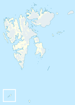
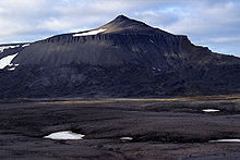
Elevation 536 m (1,759 ft) Prominence 536 m (1,759 ft) Location Bear Island, Barents Sea, Norway Coordinates 74°26′N 19°10′E / 74.433°N 19.167°ECoordinates: 74°26′N 19°10′E / 74.433°N 19.167°E Miseryfjellet, at 536 metres (1,759 ft), is the tallest peak on Bear Island (Bjørnøya), a Norwegian island in the Barents Sea. Miseryfjellet is on the eastern side of Bear Island and contains three distinct component peaks.[1] The name Bear Island is derived from the seasonal presence of polar bears, Ursus maritimus, whose population in the Barents Sea region is a genetically distinct sub-population of this species.[2]
References
- Bear Island: Description (1999)
- C. Michael Hogan (2008) Polar Bear: Ursus maritimus, globalTwitcher.com, ed. Nicklas Stromberg
Line notes
- ^ Bear Island, 1999
- ^ C. Michael Hogan (2008) Polar Bear: Ursus maritimus, globalTwitcher.com, ed. Nicklas Stromberg
Categories:- Mountains of Svalbard
- Svalbard geography stubs
Wikimedia Foundation. 2010.


