- Klickitat River
Geobox | River
name = Klickitat River
category = River
image_size = 300
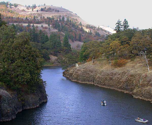
image_caption = The Klickitat River ouside Lyle, Washington
etymology =
country = United States
country_
state = Washington
district_type = County
district = Klickitat County
district1 = Yakima County
source =
source_location = Cascade Range
source_region = Yakima County
source_state = Washington
source_elevation_imperial = 5227
source_elevation_note = Source elevation derived fromGoogle Earth search using GNIS source coordinates.]
source_length_imperial =
source_lat_d = 46
source_lat_m = 29
source_lat_s = 13
source_lat_NS = N
source_long_d = 121
source_long_m = 25
source_long_s = 16
source_long_EW = W
source_coordinates_note = GNIS|1521728|Klickitat River]
mouth_name = Columbia River
mouth_location = Lyle
mouth_district =
mouth_region =
mouth_state = Washington
mouth_country =
mouth_note =
mouth_lat_d = 45
mouth_lat_m = 41
mouth_lat_s = 47
mouth_lat_NS = N
mouth_long_d = 121
mouth_long_m = 17
mouth_long_s = 29
mouth_long_EW = W
mouth_coordinates_note =
mouth_elevation_imperial = 80
mouth_elevation_note = Mouth elevation derived fromGoogle Earth search using GNIS mouth coordinates.]
length_imperial = 75
length_round = 0
watershed_imperial = 1350
watershed_note = [http://www.nwcouncil.org/fw/subbasinplanning/klickitat/plan/EntirePlan.pdf Klickitat Subbasin Plan] , Northwest Power and Conservation Council]
discharge_location = Lyle, at mouth
discharge_round = 0
discharge_imperial = 1572
discharge_note = [http://pubs.usgs.gov/wdr/2005/wdr-wa-05-1/ Water Resources Data-Washington Water Year 2005] , USGS]
discharge_min_imperial = 360
discharge_max_imperial = 40000
map_size =
map_caption =
map1 =
map1_size =
map1_caption =
map1_locator =
commons = The Klickitat River is a tributary of theColumbia River , approximately convert|75|mi|km long, in south-centralWashington in theUnited States . It drains a ruggedplateau area on the eastern side of theCascade Range northeast ofPortland, Oregon . In 1986, 10 miles of the river were designated Wild and Scenic from the confluence with Wheeler Creek, near the town of Pitt, to the confluence with the Columbia River. [ [http://www.rivers.gov/wsr-klickitat.html Wild and Scenic Klickitat River] - National Wild and Scenic Rivers System]Course
The Klickitat River rises in the high Cascades near
Tieton Peak , in northwestern Yakima County, in a remote corner of theYakama Indian Reservation . It flows southeast, then generally south across theLincoln Plateau . It enters northern Klickitat County, andmeander s south through steep canyons. It enters the Columbia from the north at Lyle, approximately convert|10|mi|km|0 north-northwest ofThe Dalles, Oregon . State Route 142 follows the lower convert|15|mi|km of the river. The river is bridged by State Route 14 at its mouth.Recreation
The
Klickitat Trail follows the river on an abandoned railroad grade from near Goldendale, Washington to theColumbia River just west of The Dalles, Oregon, nearly 30 miles.ee also
*
List of Washington rivers
*Tributaries of the Columbia River
*List of National Wild and Scenic Rivers References
External links
* [http://www.rivers.gov/wsr-klickitat.html Wild and Scenic Klickitat River] - National Wild and Scenic Rivers System

Wikimedia Foundation. 2010.